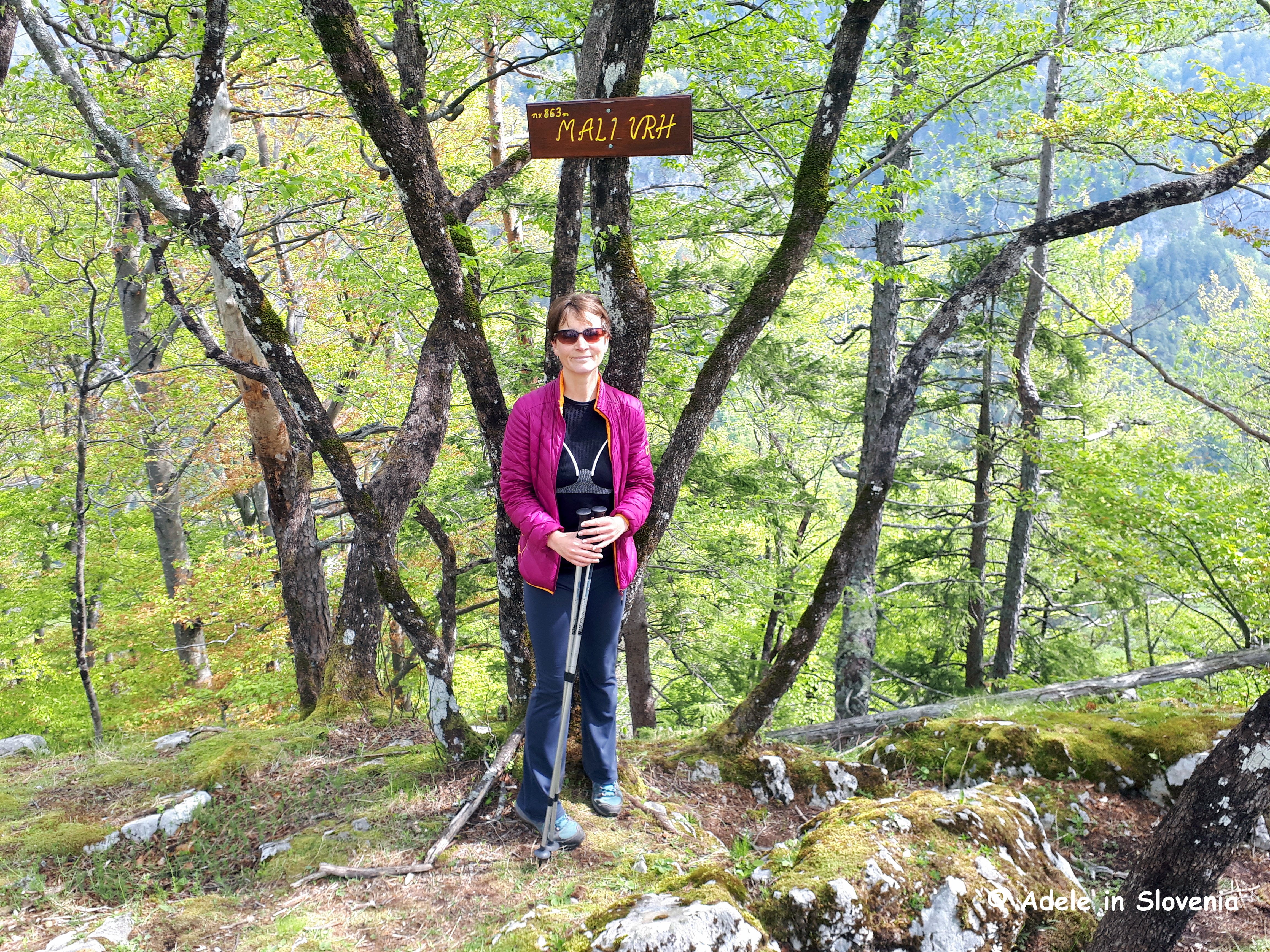
When choosing what to blog about, sometimes a look at my blog statistics can help to provide inspiration. So, having seen that there has been significant interest in the blog I wrote last year about Tito’s Village (Titova vas), I thought I would write another blog on the theme, though this time describing an alternative, more interesting/challenging, way of reaching it; a hike along the ridge from Mali vrh and onward to Tito’s Village.
Mali vrh can be reached by taking the aptly-named Sunny Path (Sonča pot) from Žirovnica to St. Lawrence’s church (sv. Lovrenc). You can join the path and reach the church from several places. I like to park in Žirovnica then take the path that leads towards the steps that go up towards the distinctive water surge tank. Don’t go up the steps but just to the right the path, though not marked, is easily visible as it traverses the grassy meadows above the villages of Žirovnica.

Follow the path towards the church and, just a hundred metres or so before reaching the church, you will see a sign pointing upwards to the left marked Brin vrh.
If you want to visit the church, do so first, then return to the sign and head up the steep path to reach Mali vrh. At the top there is a small rest area…

…complete with a visitors book…

and, somewhat bizarrely, a broom! I’m guessing it must be to brush the snow off the benches in winter!

From Mali vrh continue along the ridge before descending to a saddle where you can either descend steeply down to the Završnica reservoir and recreational park (this makes a great circular route if you walk back past the reservoir and continue on the path back to the water surge tank), or you continue towards Tito’s village, or even further!

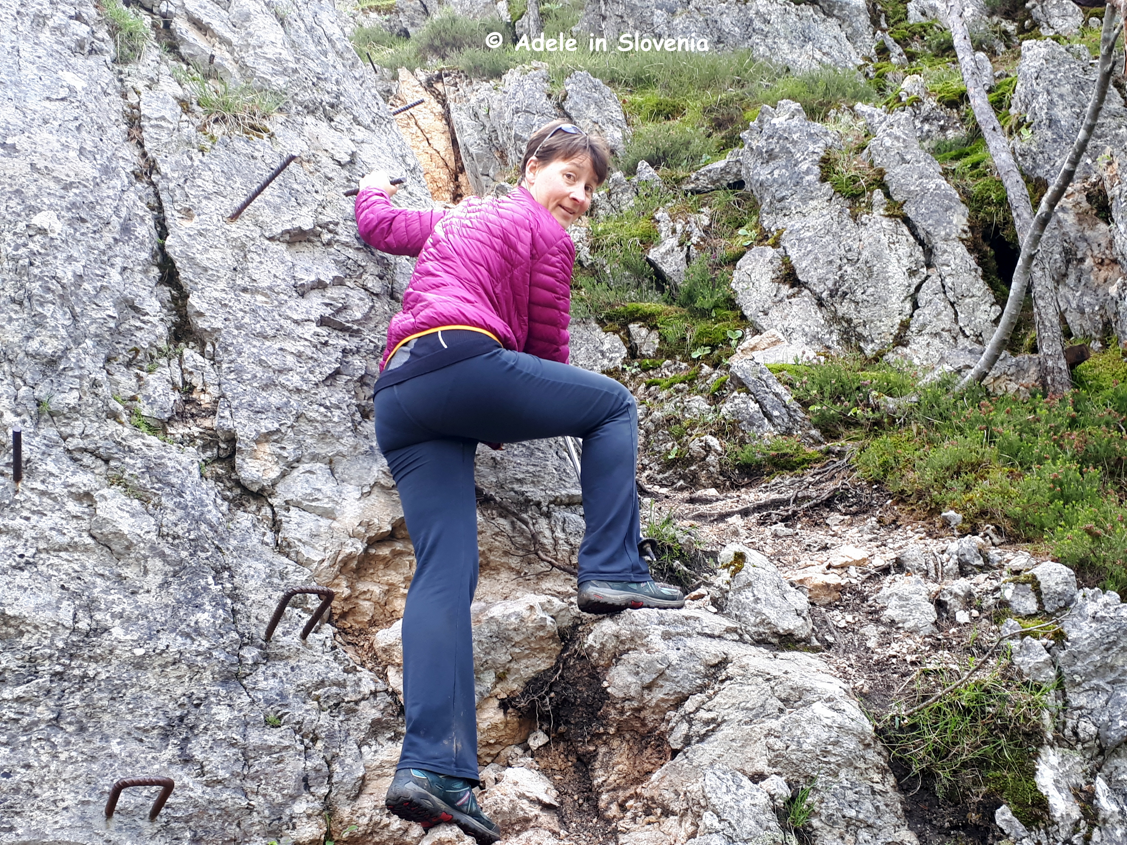
In a couple of places there are iron pegs and rungs, but there’s nothing too scary – fortunately – and it adds to the adventure!

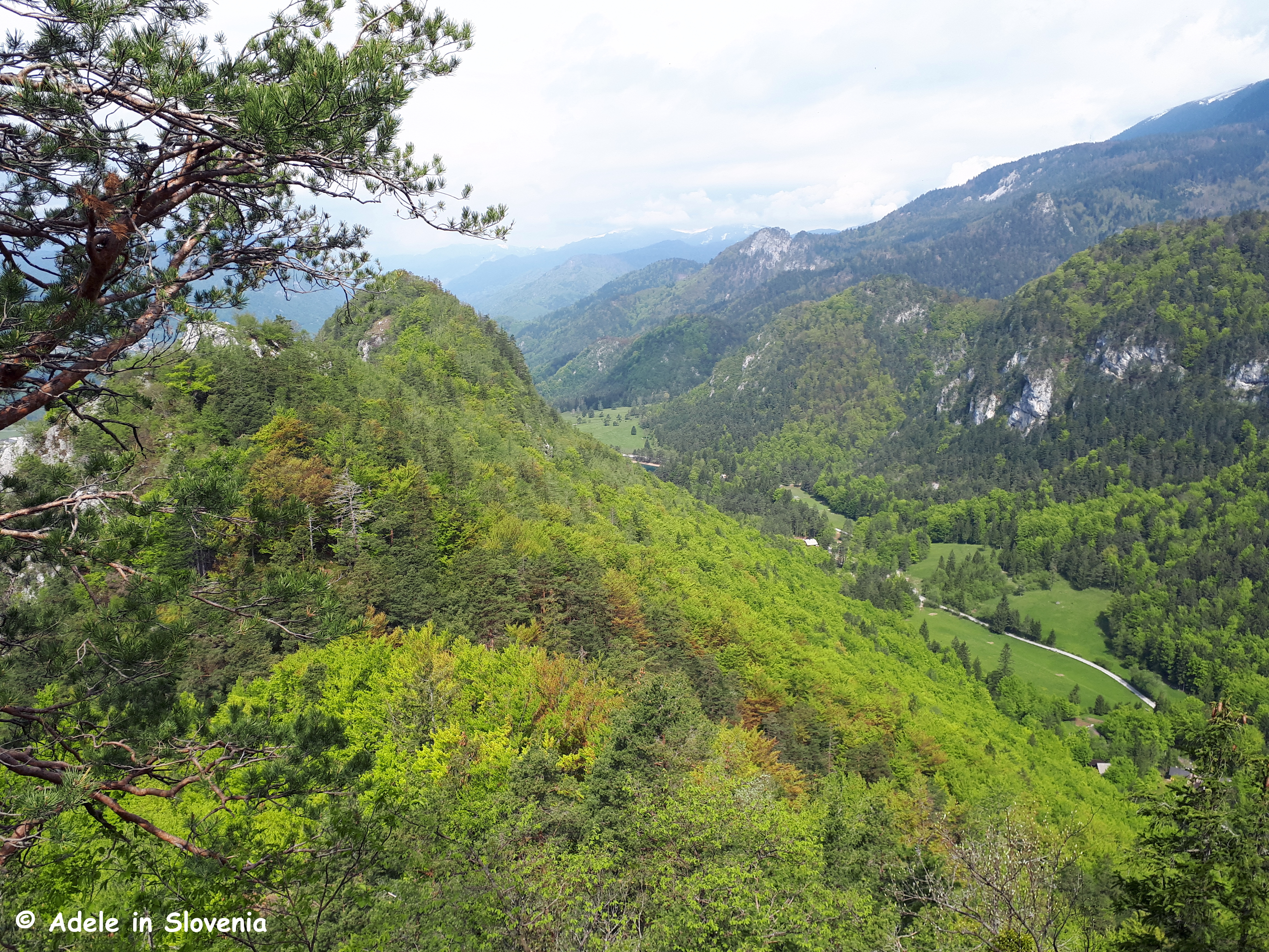
The path is very well marked throughout, and there are a couple of strategically placed benches where you can take a breather and soak up the views of the surrounding villages and countryside, as well as Lake Bled and the Julian Alps on one side…
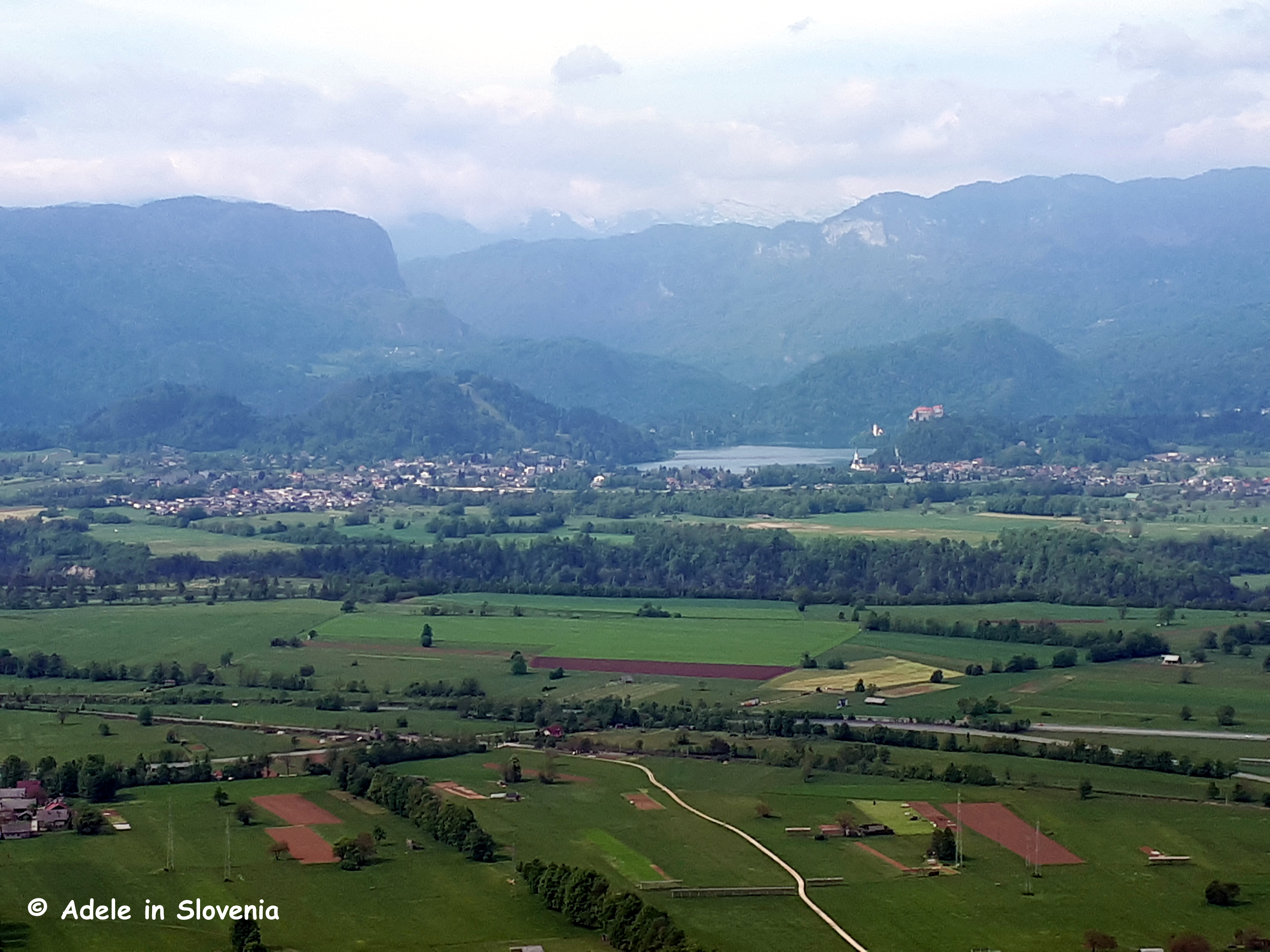
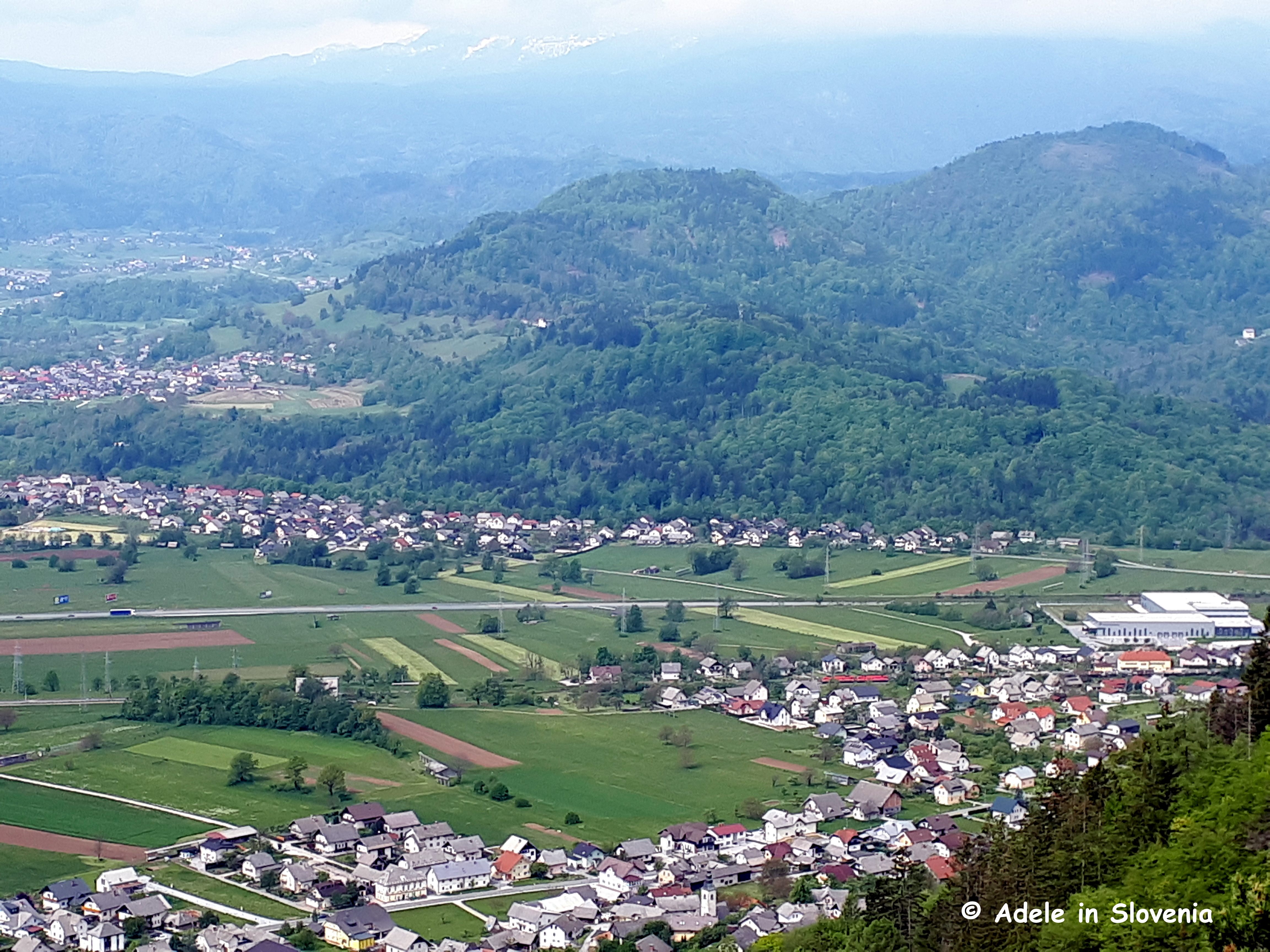
…while on the other you can see the lush Završnica valley beneath Mt. Stol – the highest peak in the Karavanke mountain range.
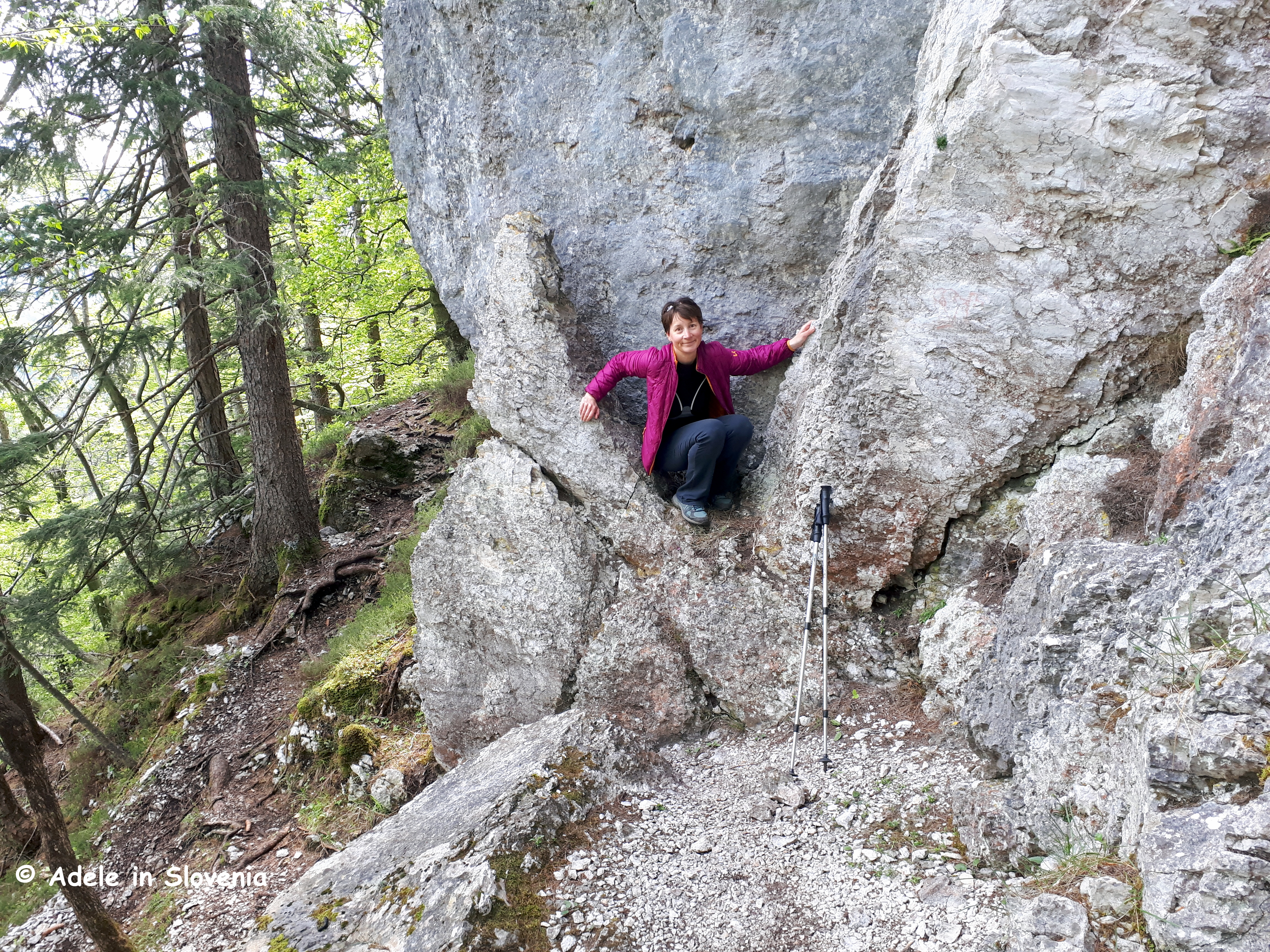
The path continues it way along the ridge, with a few nooks and crannies to explore along the way!
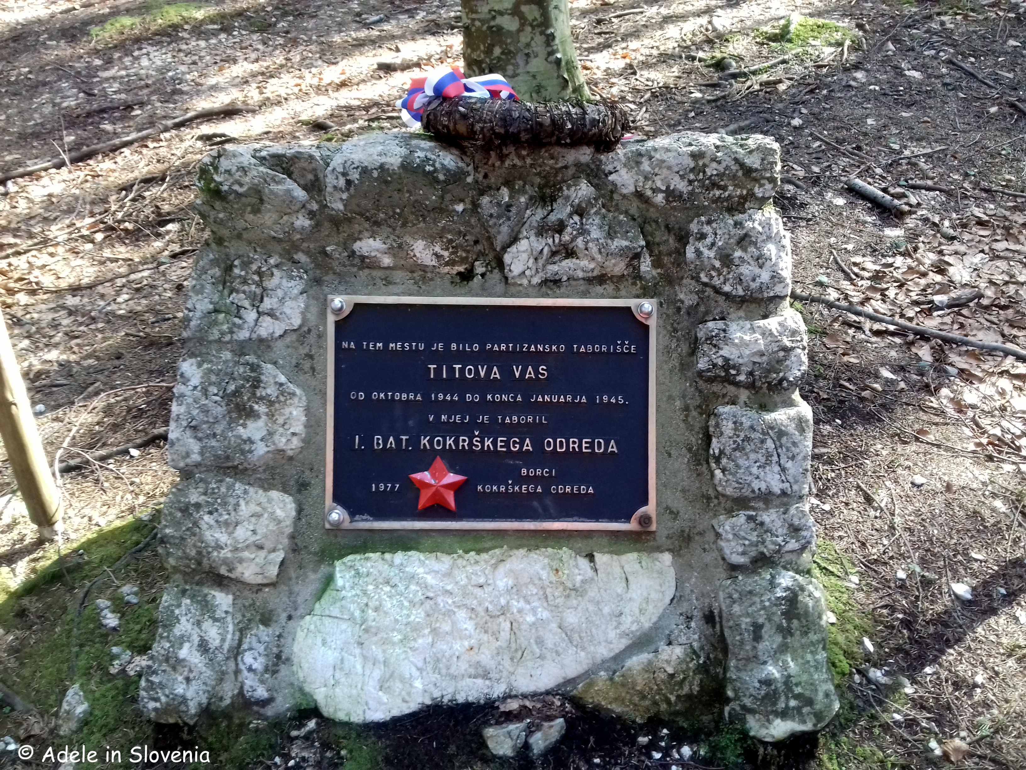
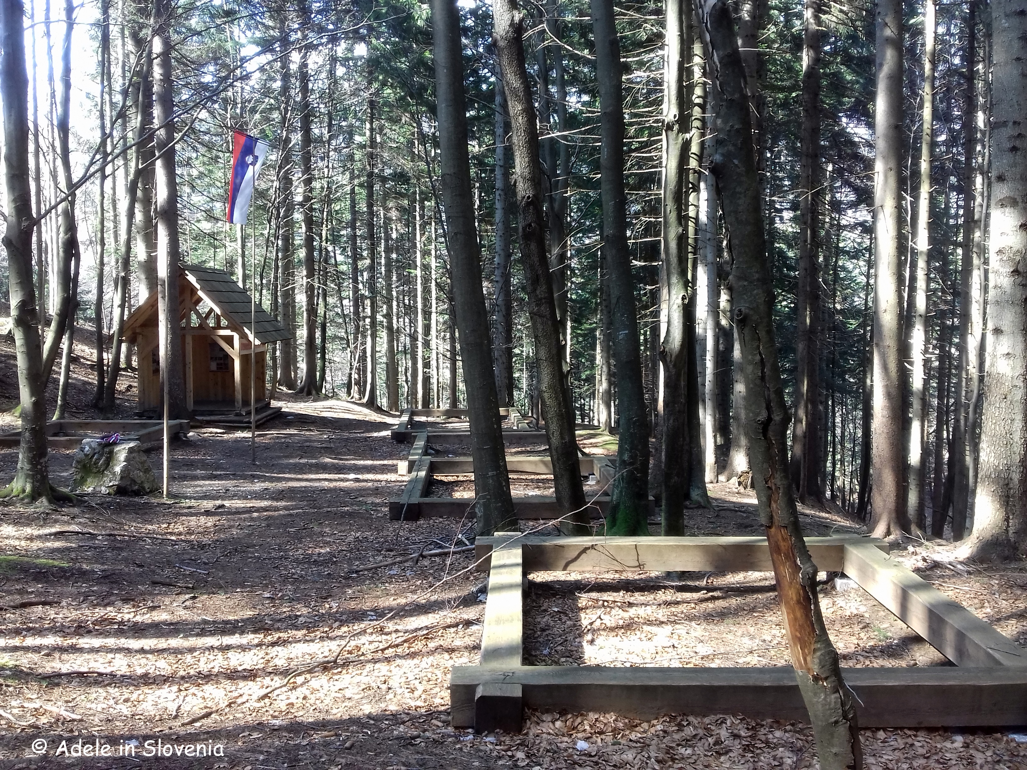
On reaching the sign for Titova vas, you can follow the forest road down to visit the secret World War II partisan camp that was hidden deep in the forest in a remote, hidden and relatively inaccessible location beneath the peak of Smokuški vrh. The camp had its own newspaper, a choir, butchery and everything needed for everyday life at that time.
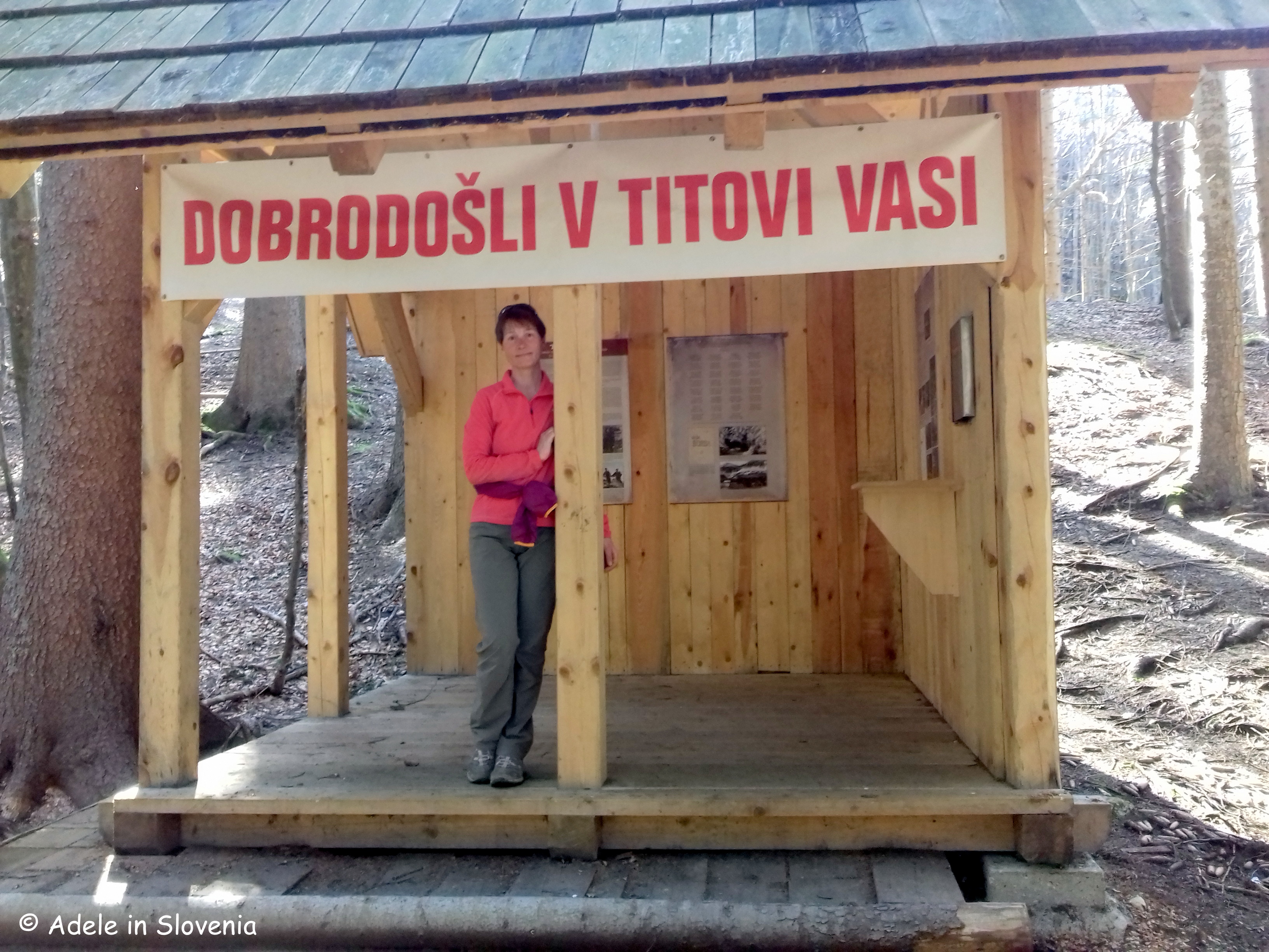
The camp provided partisans with shelter from the German occupiers. Considering its location, in close proximity to German strongholds in nearby Žirovnica, Bled, Koroška Bela, Javornik, Jesenice, Lesce, Radovljica, Brezje, Poljče and Begunje, the existence of the camp from 21 November 1944 – 31 January 1945 – though only 2 months – was considered long for those times.
You can either return along the outward route described in my previous blog about Tito’s Village, or return by the same route, or, at the junction of paths, take the wide stony path downwards to the right, which leads down to the village of Smokuč, from where you can either walk back to the start along the road, or, to avoid having to walk along the road, follow the signs for the Žirovnica Path of Cultural Heritage (Pot po kulturni dediščini).
If you want a great base for a hiking holiday in Slovenia, why not consider Žirovnica; there’s a wealth to see and do, it’s off the main tourist trail – and therefore you get a more genuine experience of Slovenia than one does in the main tourist towns – there are plenty of places to eat, and it’s great value too!
© Adele in Slovenia
