If I crane my neck, I can see Stol, the highest mountain in the Karavanke range, from my desk. Thus, it’s an ever-present feature in my life and, accordingly so, I can’t resist hiking to its top at least a couple of times per year, and yesterday it was time for the first hike to the summit this year!

The word ‘stol’ in Slovenian means ‘chair’, since when viewed from its western side (not the side I can see from here!), its summit forms a kind of ‘back’ for the flatter slightly lower summit which is home to the Prešernova koča mountain hut.

At 2,236 metres, Stol, along with the other mountains in the Karavanke range, forms a natural border between Slovenia and Austria, hence, on a clear day, there are always stunning views to be had in all directions.
Though quite a large percentage of those who hike to the summit of Stol do so by driving the 5km forest road to the Valvasorjev dom mountain hut and from there setting off on foot, I always opt to do the entire hike from the valley, as otherwise it just feels a bit like cheating to me!

After parking at the Završnica reservoir, I set off on the first part of the trail to the Valvasorjev dom hut (cca. 50 mins) from where, as you can see below, there are numerous paths leading in various directions.

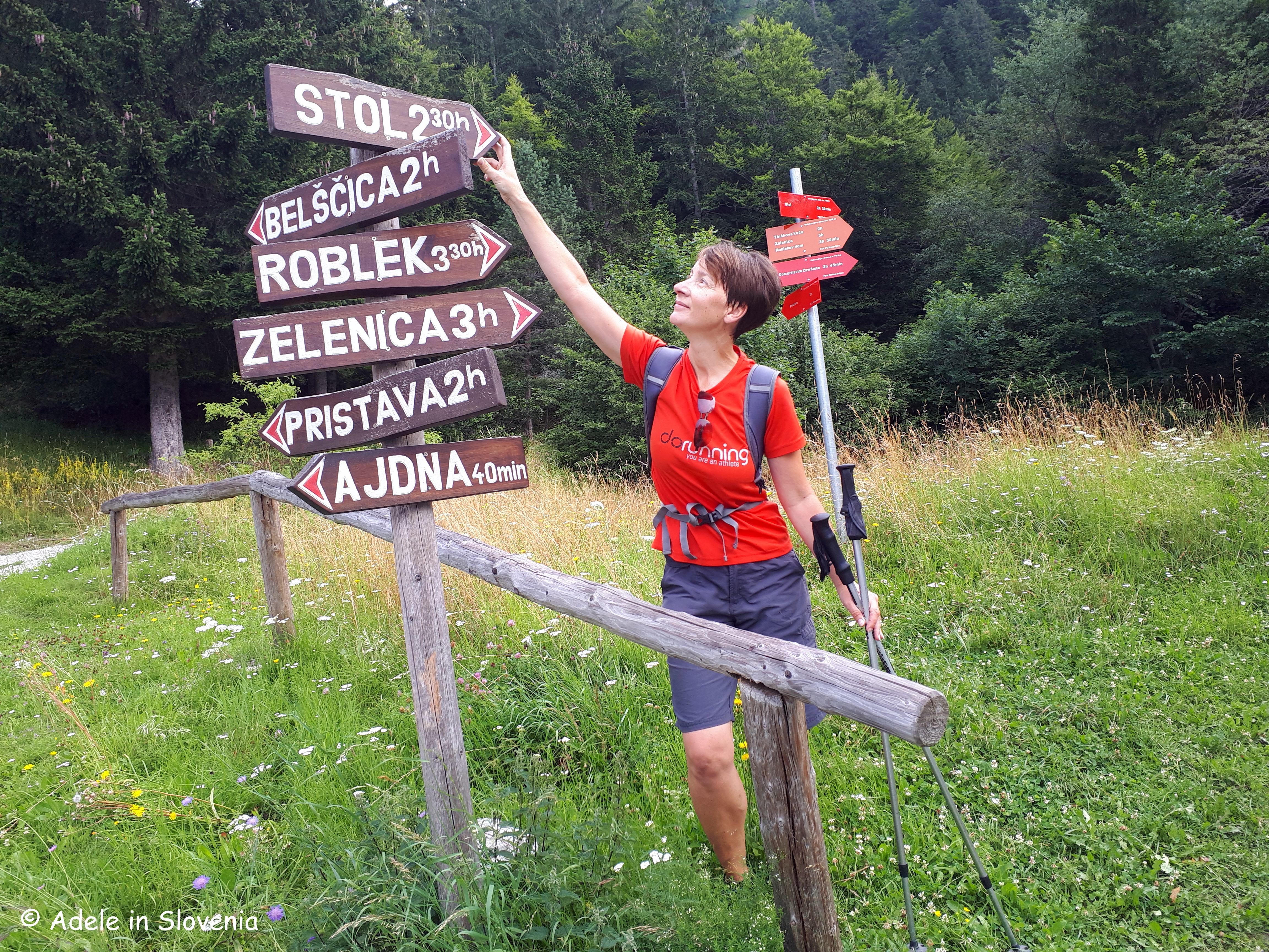
Regular readers will know that I have a penchant for circular walks, and this time was no exception! I took the shorter, steeper Žirovniška pot (Žirovnica path) up, and the longer, less steep Zabreška pot (Zabreznica path) down, which is always my preferred route.

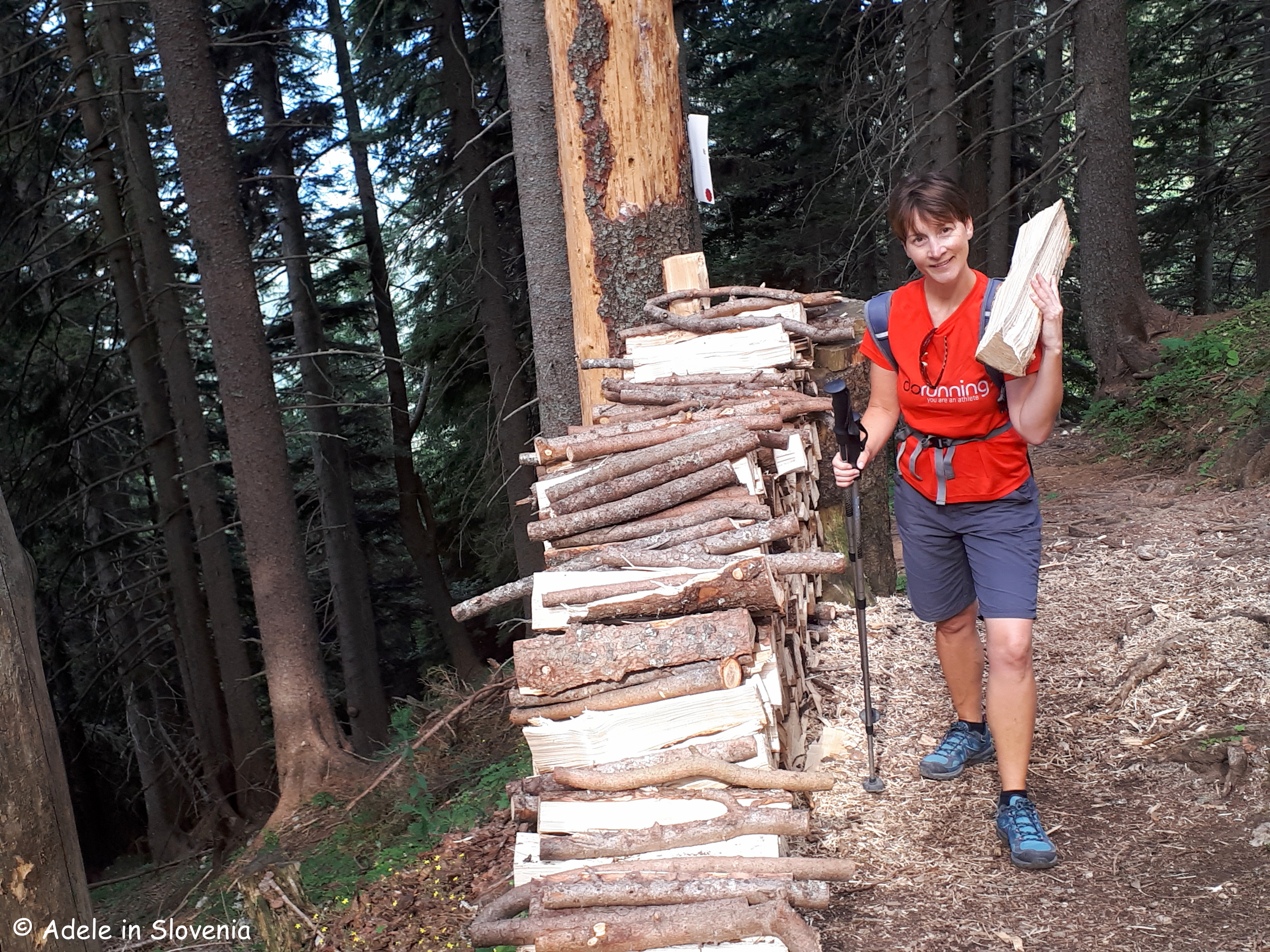
If you are feeling somewhat gallant, you might opt to not walk past the pile of logs without putting one in your rucksack or on your shoulder – the staff at the Prešernova koca mountain hut will be very grateful for your assistance in keeping the stove burning! Whether or not I was gallant enough to carry one up or not, I will leave you to decide!
It was somewhat overcast for the majority of the hike up, the story of this ‘summer’, but in actual fact a bit of cloud cover was welcome on the long, steep hike up, and on reaching the top, the clouds majestically began to part to reveal blue skies and warming sunshine, and, for a change, it wasn’t blowing a gale up there, as can so often be the case!
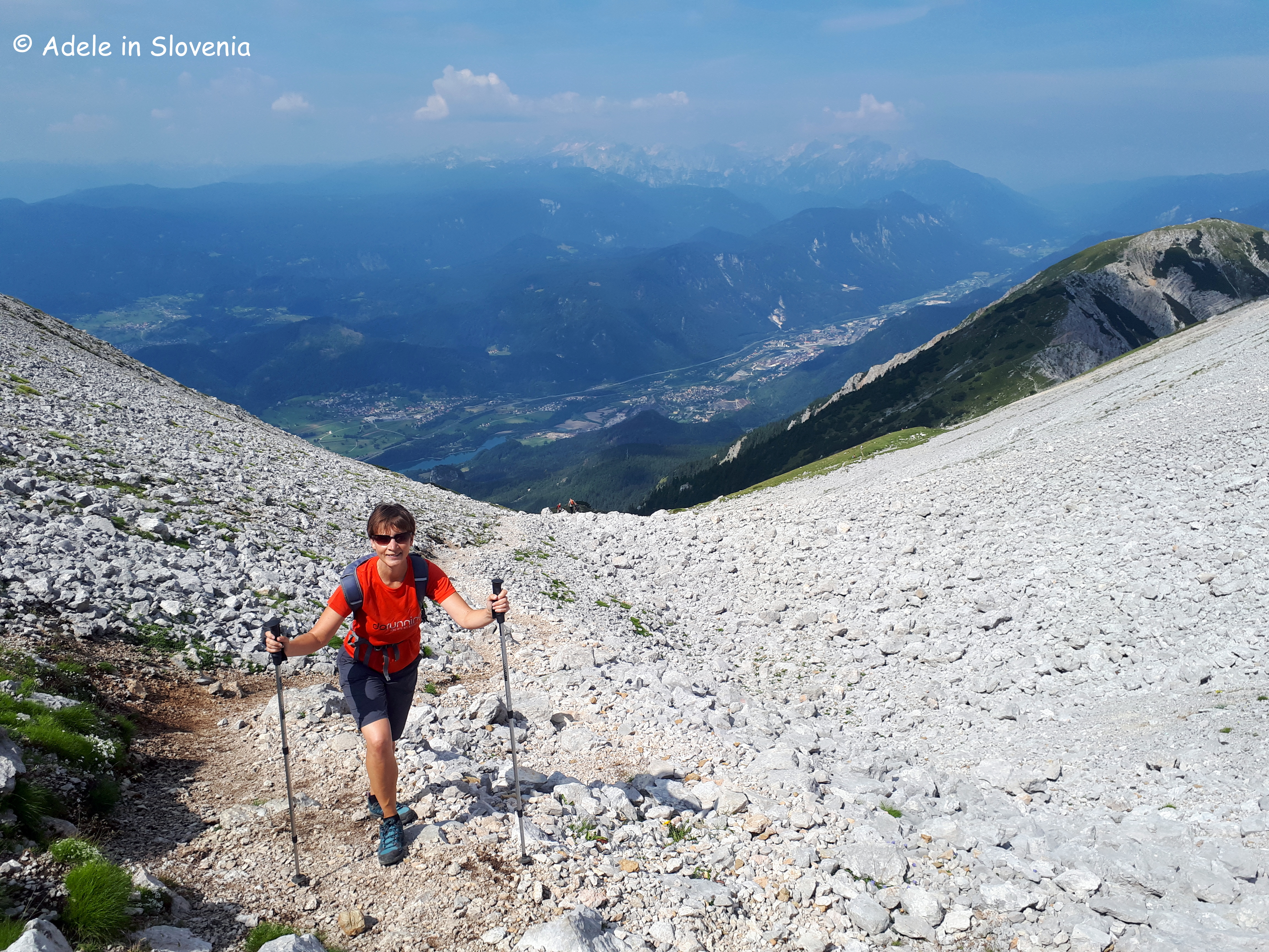
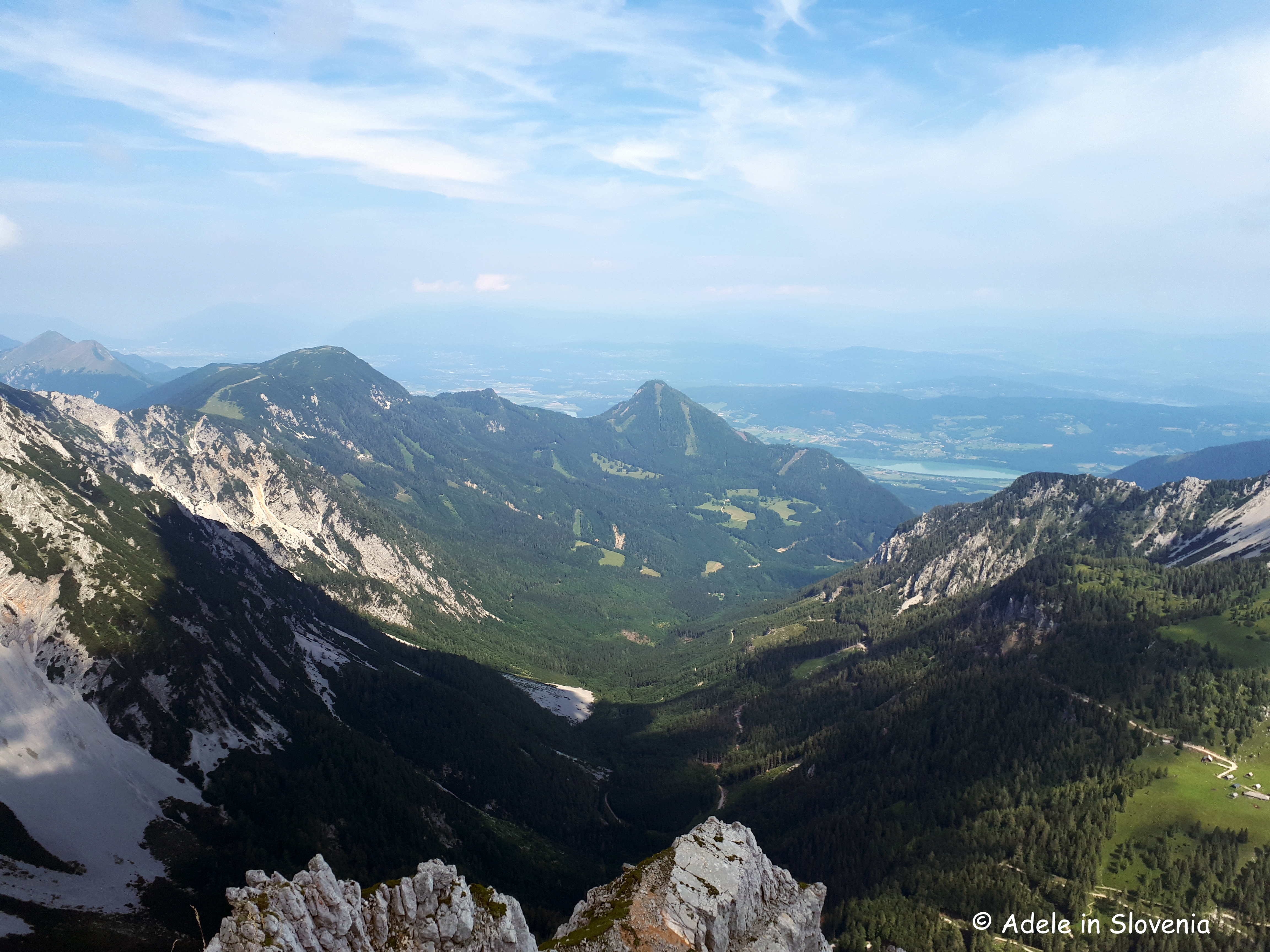
Before the final ascent to the top, the path leads up a steep stony gully, from where there is a real bird’s eye view of the Upper Sava Valley and the Julian Alps in the background. The path is distinct and well-marked throughout.
As you reach the summit, you will notice that the typical red and white Slovenian markers change to red and white with a green outer circle, denoting that the path is on the border with Austria – always a kind of exciting feeling, even after 11 years here!

It took me just over 3hrs 15 minutes to reach the summit. And, as is the tradition, don’t forget to sign the visitors’ book as you take your ‘seat’ at the top of the Karavanke!

Once at the top, among the magnificent sights, you can see Lake Bled on one side, whilst on the other Lake Worthersee in Klagenfurt.

You won’t be alone, since even if there aren’t many other hikers (on Sunday, there were!), there are always some brazen birds that don’t seem in the slightest bit scared of humans as they sit in wait for some tasty tit bits!

After descending from the summit, there was time for a quick bit of sustenance at the Prešernova koca mountain hut, where there is simple, but tasty mountain-type food and refreshments on offer, a(nother) visitors’ book to sign, and then it was time to begin the descent – more about which you can read in my next blog about the myriad of mountain pastures beneath Stol, coming soon…!


Click here for the Visit Žirovnica website where there is more information about this and other hiking trails in the Žirovnica area.
© Adele in Slovenia
