So, having read the title of this blog, you’re intrigued, right?
Well, let me fill you in!
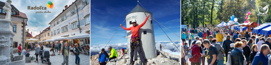
The reason for this quick ’emergency’ blog is that just a short while ago I spoke to the mayor of Radovljica, who was over the moon as yesterday Radol’ca won three (yes, three!) first places at the prestigious annual Moja dezela – lepo in gostoljubna (My Land – beautiful and hospitable) competition, which is run by the Tourist Association of Slovenia.
The town of Radovljica itself was awarded 1st place among all the tourist destinations in Slovenia, followed by Izola in second place and Bled in third place.
The village of Begunje na Gorenjskem was awarded 1st place among all the excursion destinations in Slovenia, followed by Štanjel and Marizege.
And finally the Šobec Camp was award first place among all of Slovenia’s campsites, followed by Camp Danica and Camp Koren.
I told the mayor that I’d share this news with you – dear readers – as soon as possible and he asked me to convey how proud he is of this achievement.
Here’s just a teaser of what to expect when you visit, whether for the first time or for repeat visitors, of which there are many!
Hooray, I am finally the bearer of some good news…it feels like a while since I’ve been able to say that!
Writing this feels a bit like groundhog day, as it was around this time last year that Slovenia began to exit its first lockdown and I published a similar blog on the subject. And here we are today, almost a year later and only now Radovljica, as well as the rest of Slovenia, is slowly beginning to re-open after three, seemingly endless, lockdowns.
Unfortunately, the vaccination programme is still going slowly – to date around one-fifth of the country’s 2 million residents has received at least one shot of a vaccine – but, notwithstanding, things are steadily moving in the right direction and finally, after 6 long months, the terraces of restaurants/bars etc. were able to re-open last week and as of yesterday (Monday 26 April) hotels and other accommodation facilities are able to open up to 30 rooms (regardless of the size of the property). Note, however, that a negative test or proof of vaccination is required to stay in an type of accommodation (camps included).
So, now you, well we if I include myself, can actually begin to start thinking about planning holidays, something that has seemed unthinkable for a long time now. And since most of us will no doubt – sensibly – prefer to avoid places overrun by mass tourism, it is destinations such as Radol’ca that come into their own with its boutique accommodation and numerous hiking trails and other off the beaten track attractions. So, here are a few ideas to help you in planning your visit to Radovljica – whether for a few hours, a few days, or even longer!
After record snowfall in some places, it’s still very much winter in Slovenia’s high mountains, fortunately here in Radol’ca there are plenty of hiking trails at lower altitudes. I’ve written about such trails on numerous occasions, so a quick search back through previous blog posts using key words will turn up plenty of info on hikes to, for example, Suharna, the Vodiška planina mountain hut, the Roblekov dom mountain hut, St. Peter’s church above Begunje na Gorenjskem, and more.
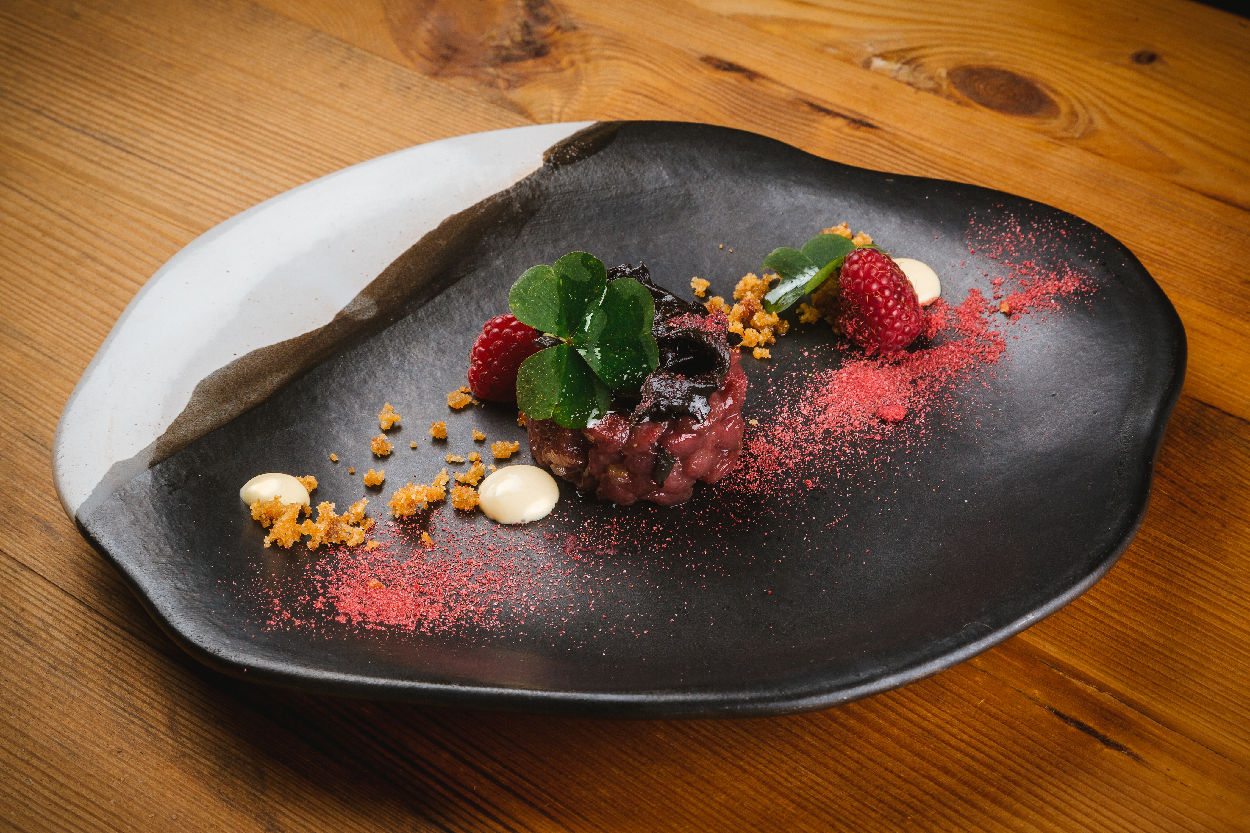
Of course, after all that fresh air and activity you will be in need of some sustenance, and you certainly won’t go hungry at Taste Radol’ca restaurants, the ethos of which is using seasonal, locally sourced, ingredients. At the time of writing, some of the restaurants have yet to re-open, since they are currently only allowed to serve customers outside on the terrace and for those with smaller terraces it is not worth their while re-opening. However, it is to be hoped that it won’t be too long until they are able to fully re-open. Radol’ca even has a Michelin-starred restaurant – Vila Podvin – as well as several other fine dining restaurants and numerous rural inns.
In terms of accommodation, there’s plenty to choose, from river-side camps to apartments, guest houses and other boutique accommodation.
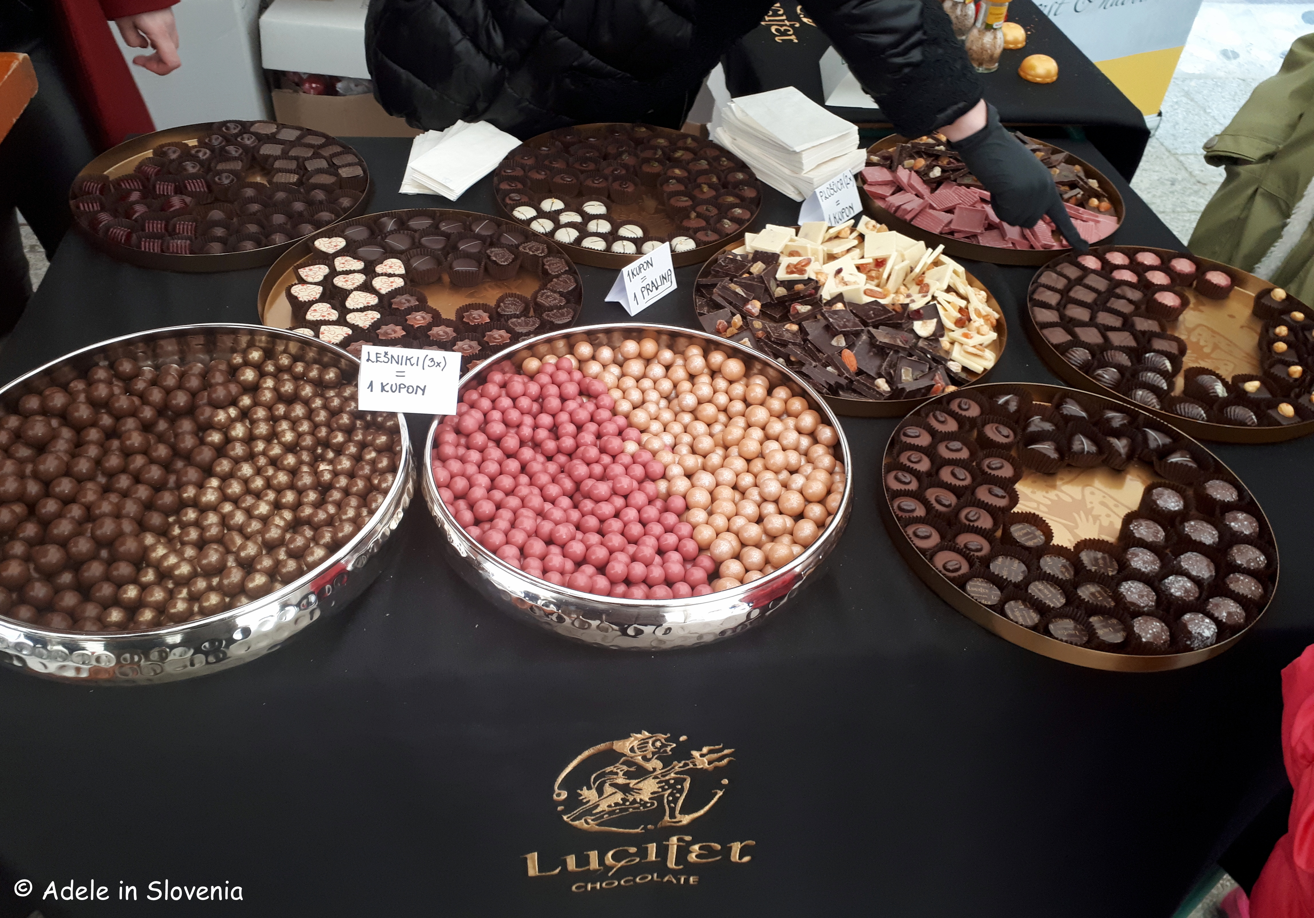
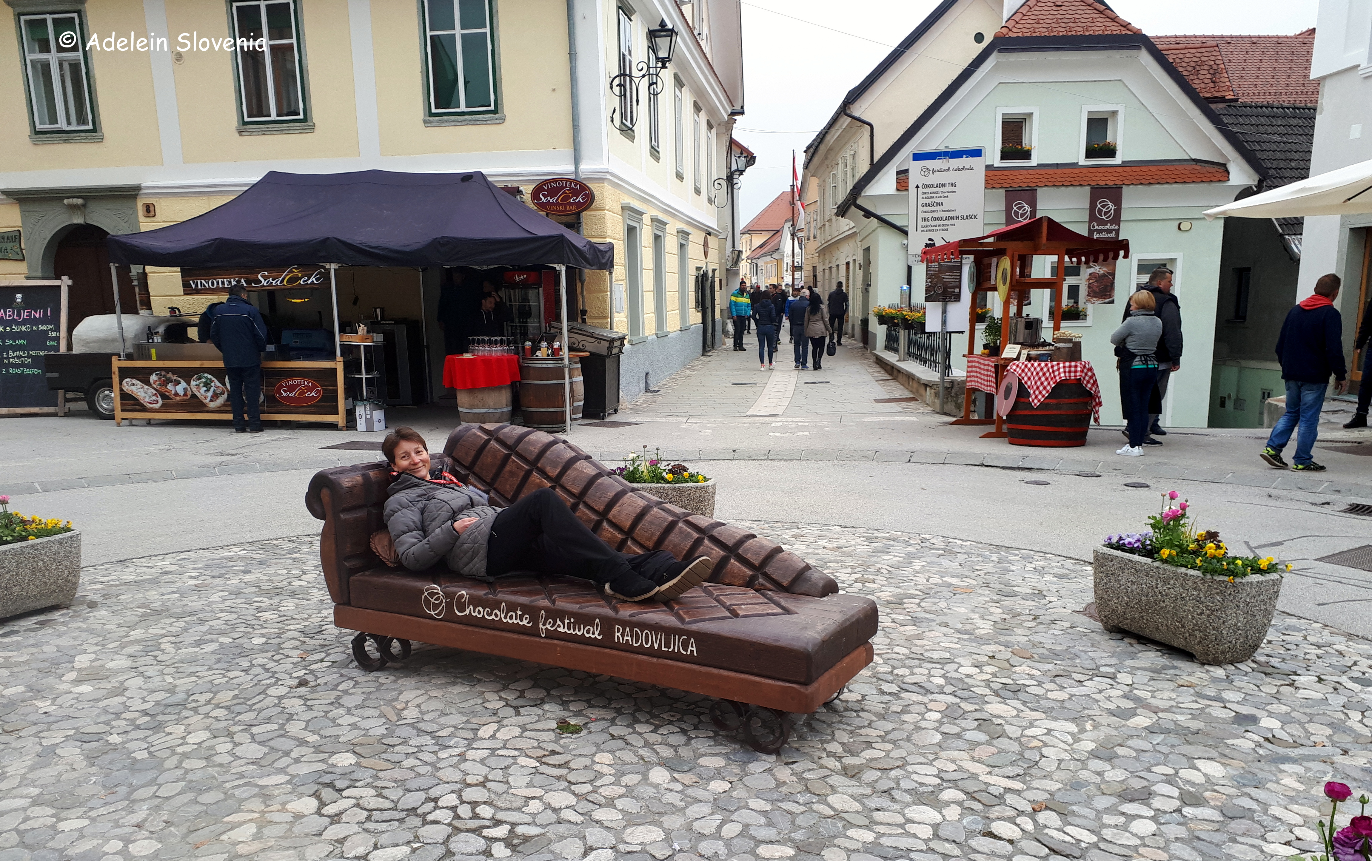
In terms of events, it’s still a bit early to say what will and won’t take place this year. The Radovljica Chocolate Festival, which was cancelled last year and postponed this year, is provisionally scheduled to take place on 11th and 12th September this year, while the organisers are hoping that others events, such as the Craft Beer Festival and live music and food on Thursdays evenings in the square, will be able to go ahead in summer, in some form or another. But at the moment it’s a case of watch this space to see how things pan out.
Of course, all the above-mentioned are in the Radol’ca area itself, meaning there’s still a whole host of other places waiting to be explored in the surrounding areas; the Julian Alps and Triglav National Park are on the doorstep, Lake Bled and Lake Bohinj are close, Slovenia’s capital Ljubljana is just a cca. 40 minute drive, and even places such as the Postojna caves, the Soča valley, and Slovenia’s coast are all within a 1-2 hour drive – nothing is that far away in Slovenia!
So, I hope I have provided you with some food for thought and ideas to help your holiday planning and, as and when there is (even) more news about more things opening up, I’ll be in touch with more up-to-date info, or, in the meantime, do feel free to drop me a line if you need more info. Always happy to help, well, within reason that is!
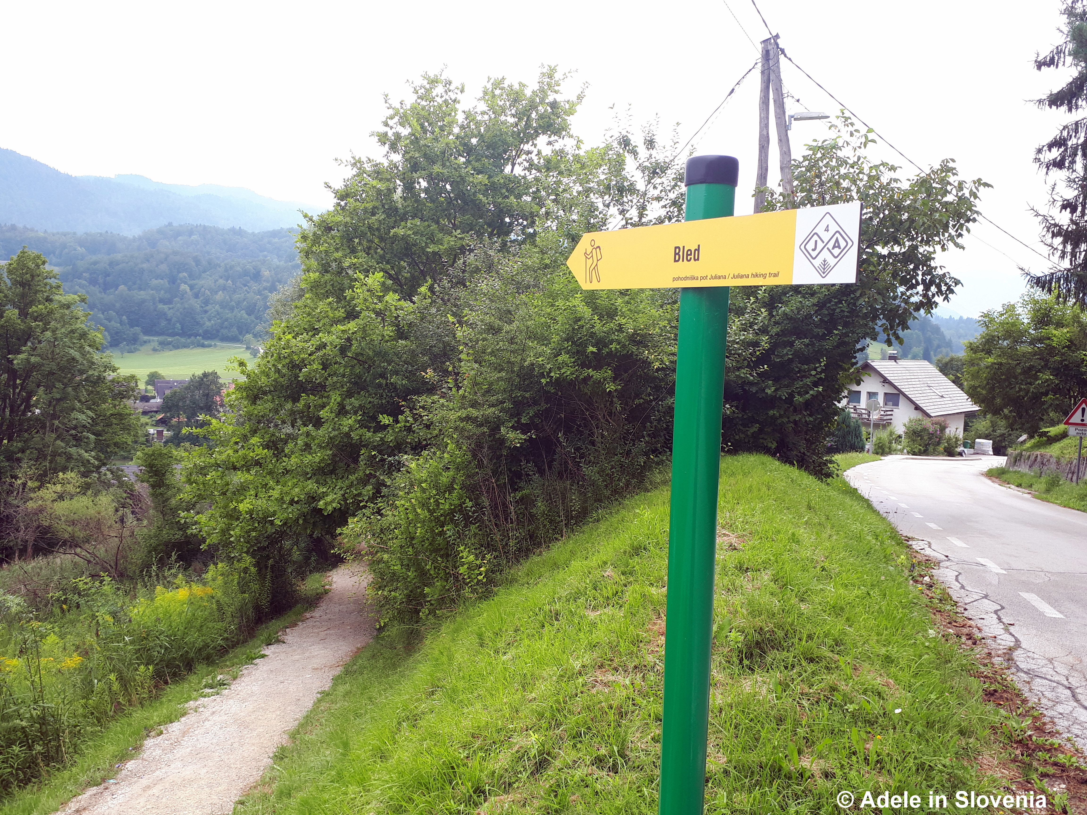
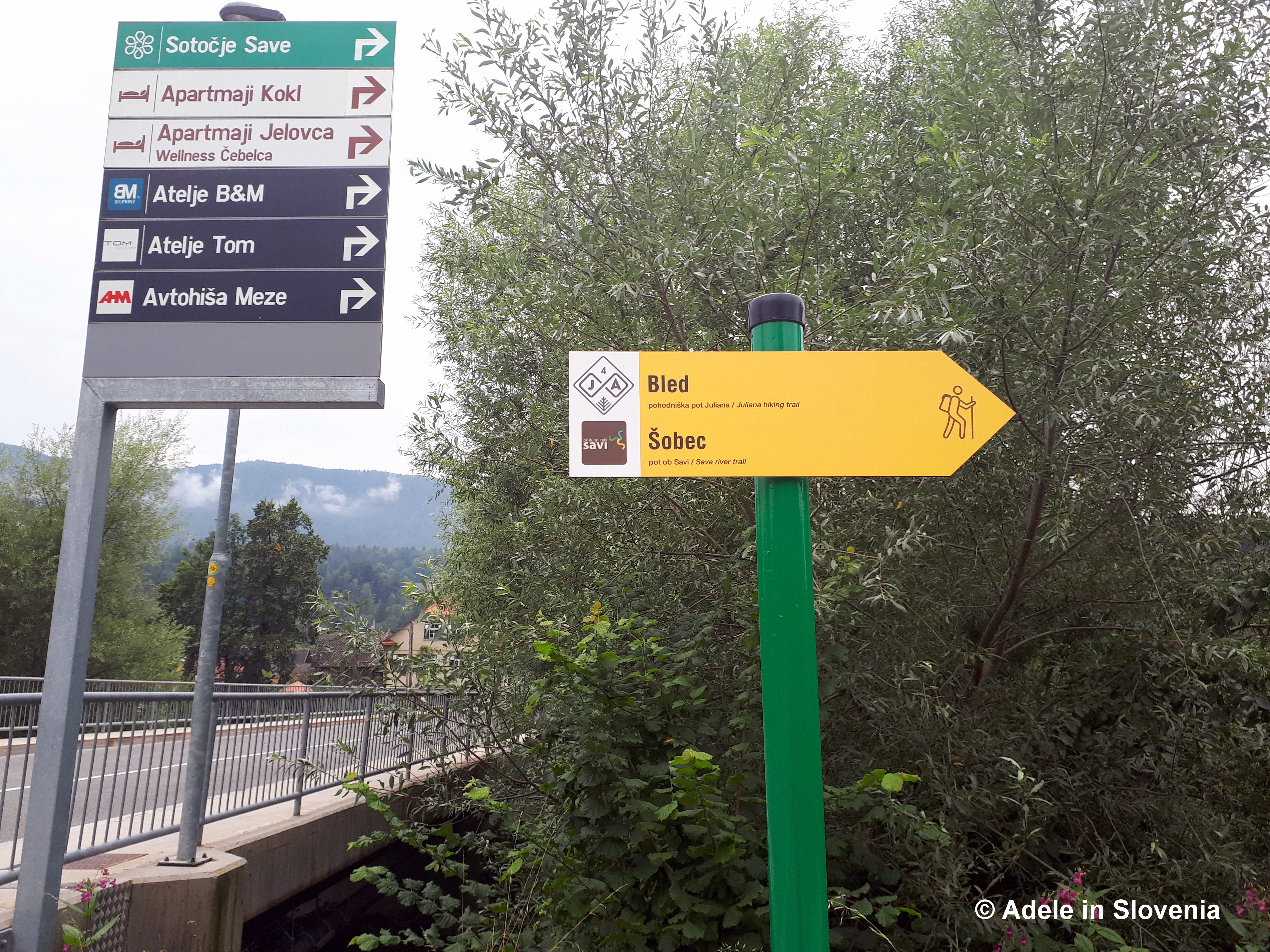
The Juliana long-distance hiking trail covers a total of 270 kilometres in 16 stages, one of which runs through the Radol’ca area.
Though marketed as ‘new’, no new paths or infrastructure were actually built in putting together the trail, rather what it does it nicely link together existing trails and paths whilst taking in picturesque valleys, meadows, plateaus, towns and villages in and around the Julian Alps and provides information on where to stay and what to see and do along the way.
The trail hasn’t been designed for those seeking to bag summits, rather for those wishing to see and experience the beauty and diversity of Slovenia’s alpine landscape without having to be an experienced mountaineer. That doesn’t, however, mean that its to be taken lightly, as some sections of the trail involve some significant altitude gains (the highest point reaches 1,819 metres above sea-level), but it is not technically demanding.
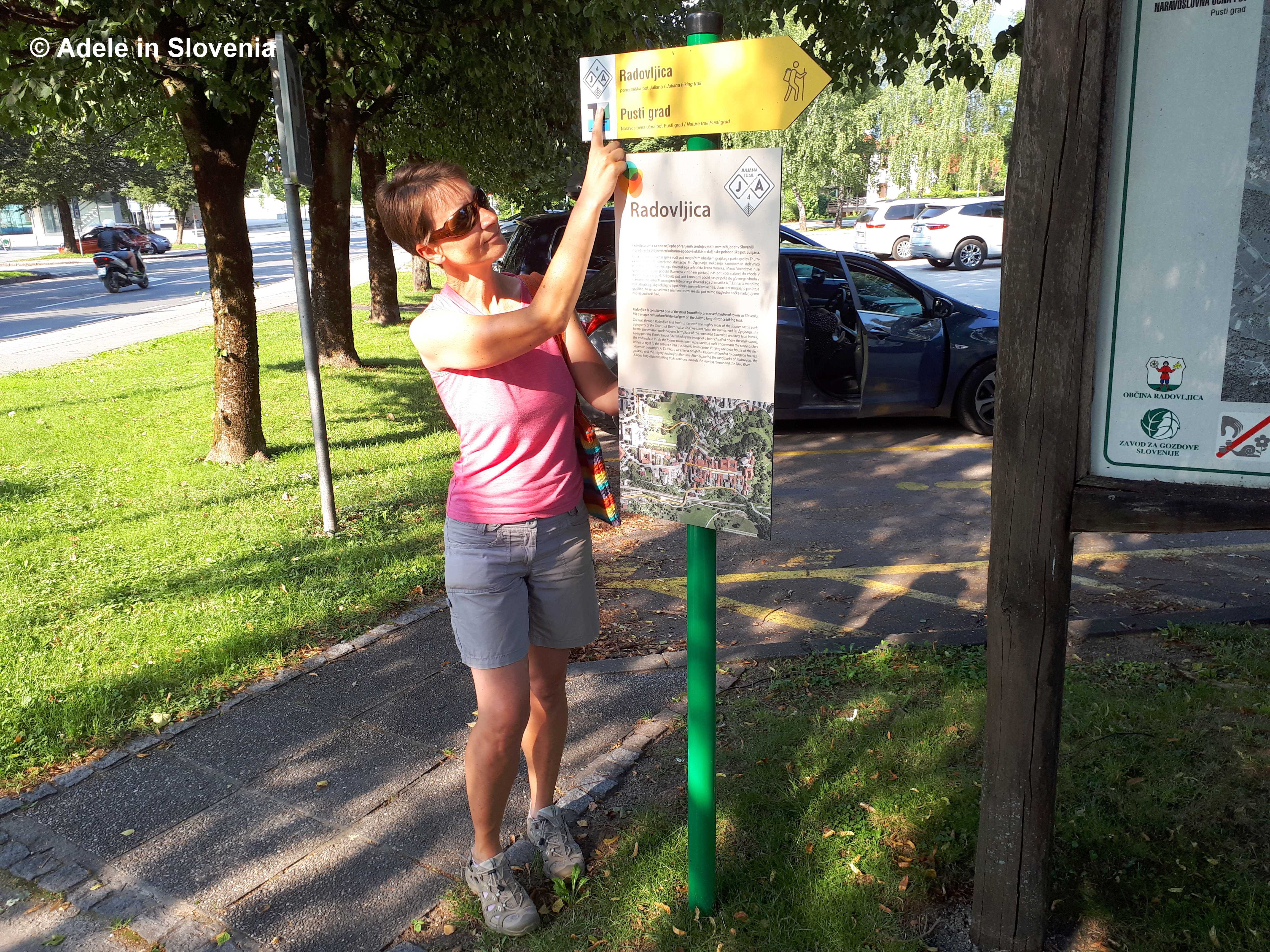
You can choose to walk the entire trail, or just select the sections that are most appealing. Each section of the trail is numbered and is shown by yellow (occasionally also white) signs showing JA and a number – 4 in the case of the Begunje – Bled section of the trail.
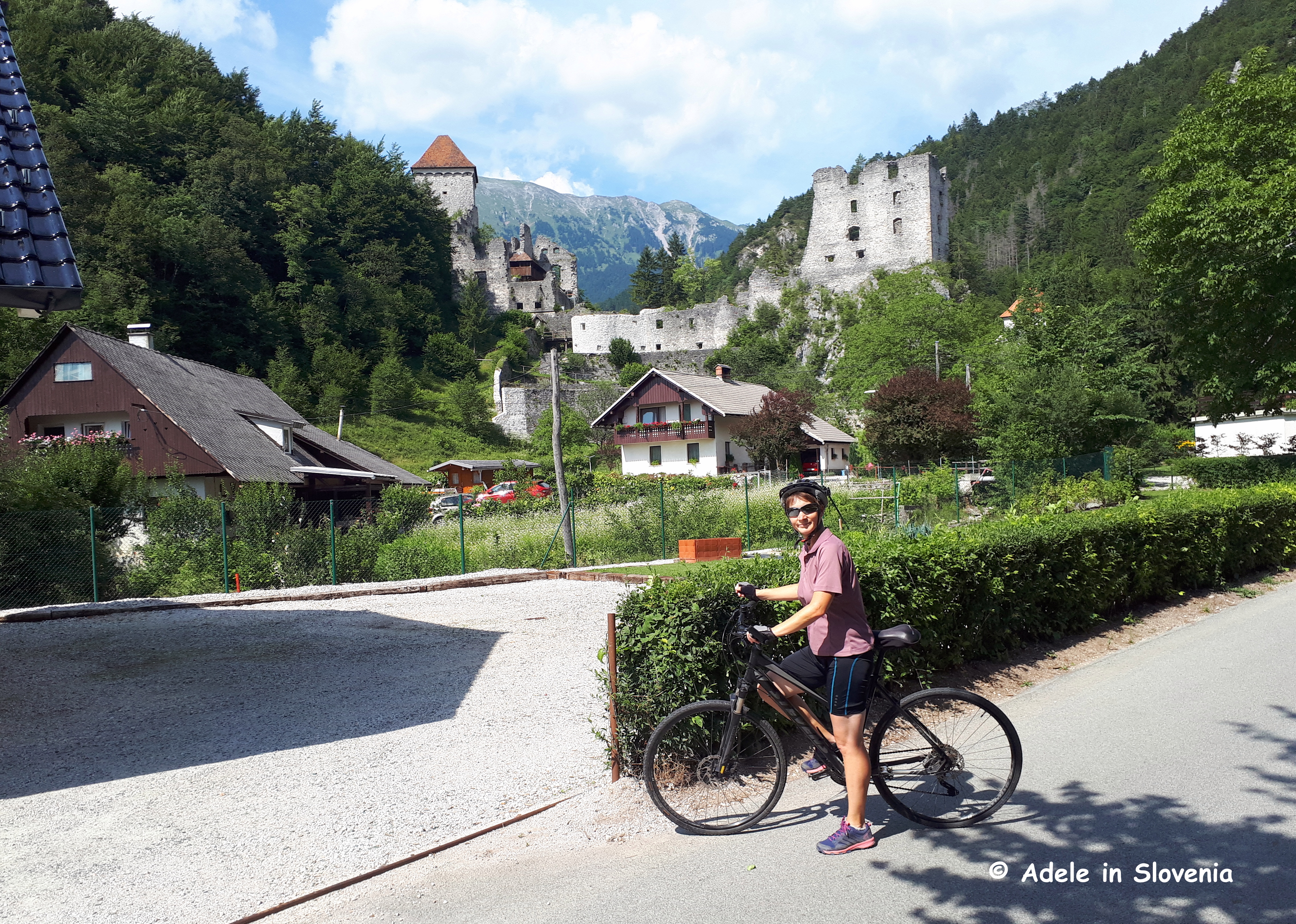
The trail begins and ends in Kranjska Gora from where it leads to Mojstrana and Jesenice before reaching Begunje na Gorenjskem, which is the stage described here.
The first part of stage 4 begins next to the tourist information centre in Begunje na Gorenjskem.
From there it runs through the villages of Gorica and Vrbje before reaching Radovljica, opposite the bus station and adjacent to the market area.
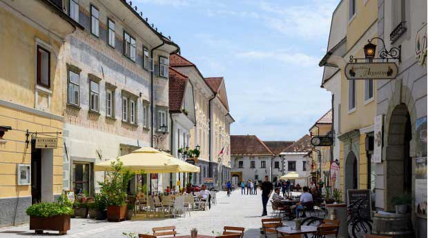
It then leads to Linhart Square, the heart of the historic old town…
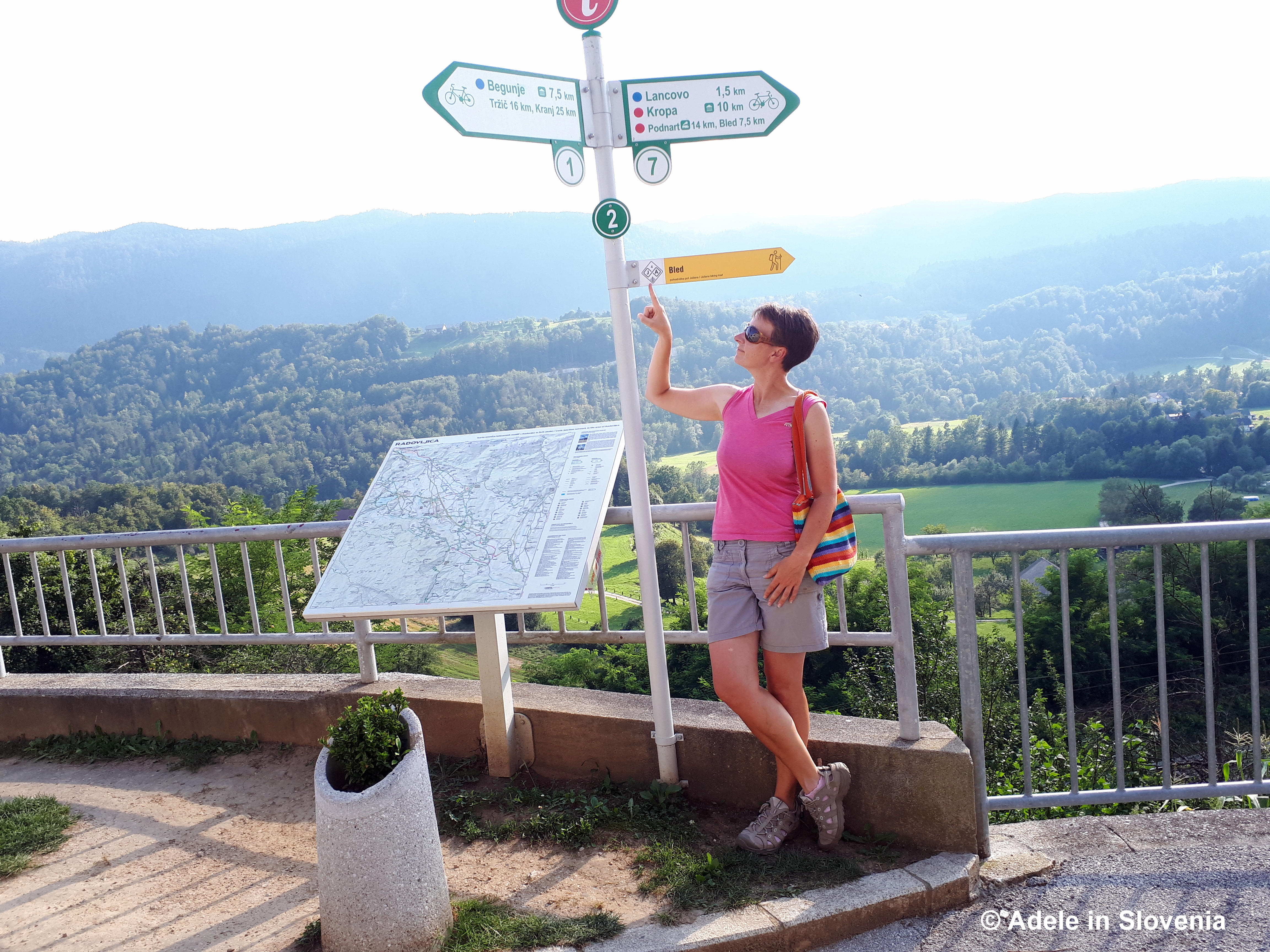
…and on to the viewpoint at the far end of the old town, from where there are magnificent views of Slovenia’s highest mountain – Triglav – and the Jelovica plateau.
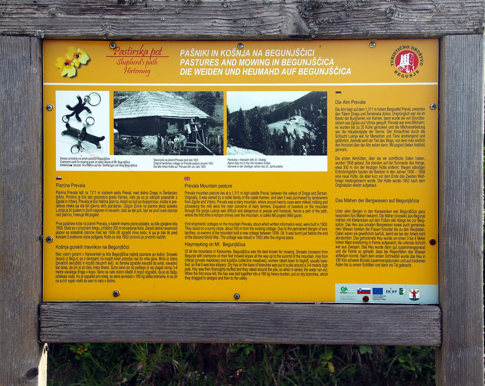
The Begunje Shepherd’s Trail (Pastirska pot) is one of my favourite of all the hiking trails in the Radol’ca area. The sheer variety of the terrain, the stunning views, and the fact that it is entirely circular all add up to one great hike!
The trail begins at the head of the Draga Valley in Begunje na Gorenjskem, where you can park and set off on foot on the 10.2km trail and where there is an information board showing the route.
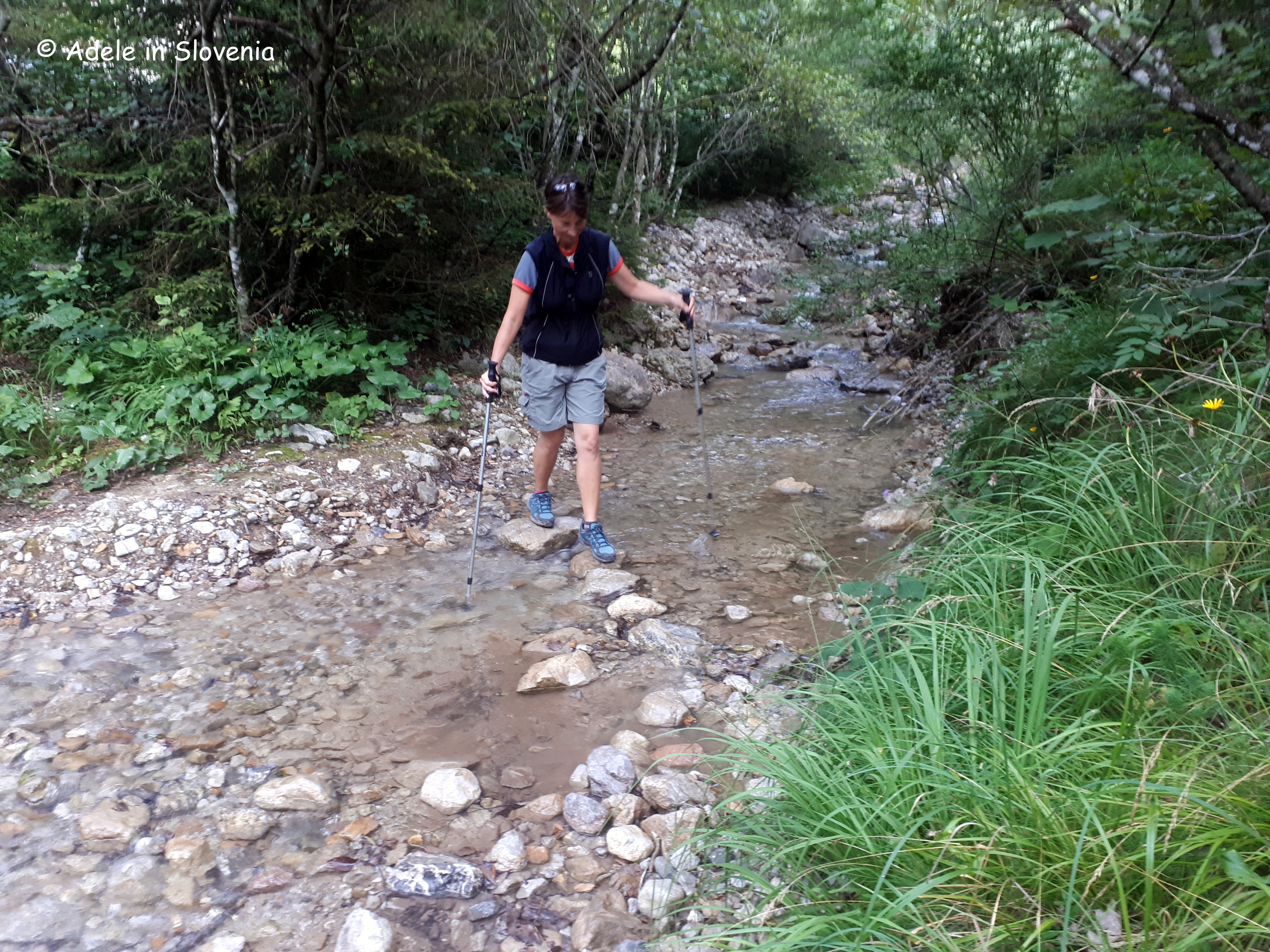
The first mini ‘challenge’ that you encounter after just a few hundred metres, is crossing a stream – not advisable after heavy rainfall! Note: if it is impassable, then follow the road uphill for about 15 minutes to where it branches off steeply through the forest towards the Roblekov dom mountain hut, but continue past the next bend and then take a forest road (unmarked) to the right, which, eventually, meets the path coming up from the head of the valley.
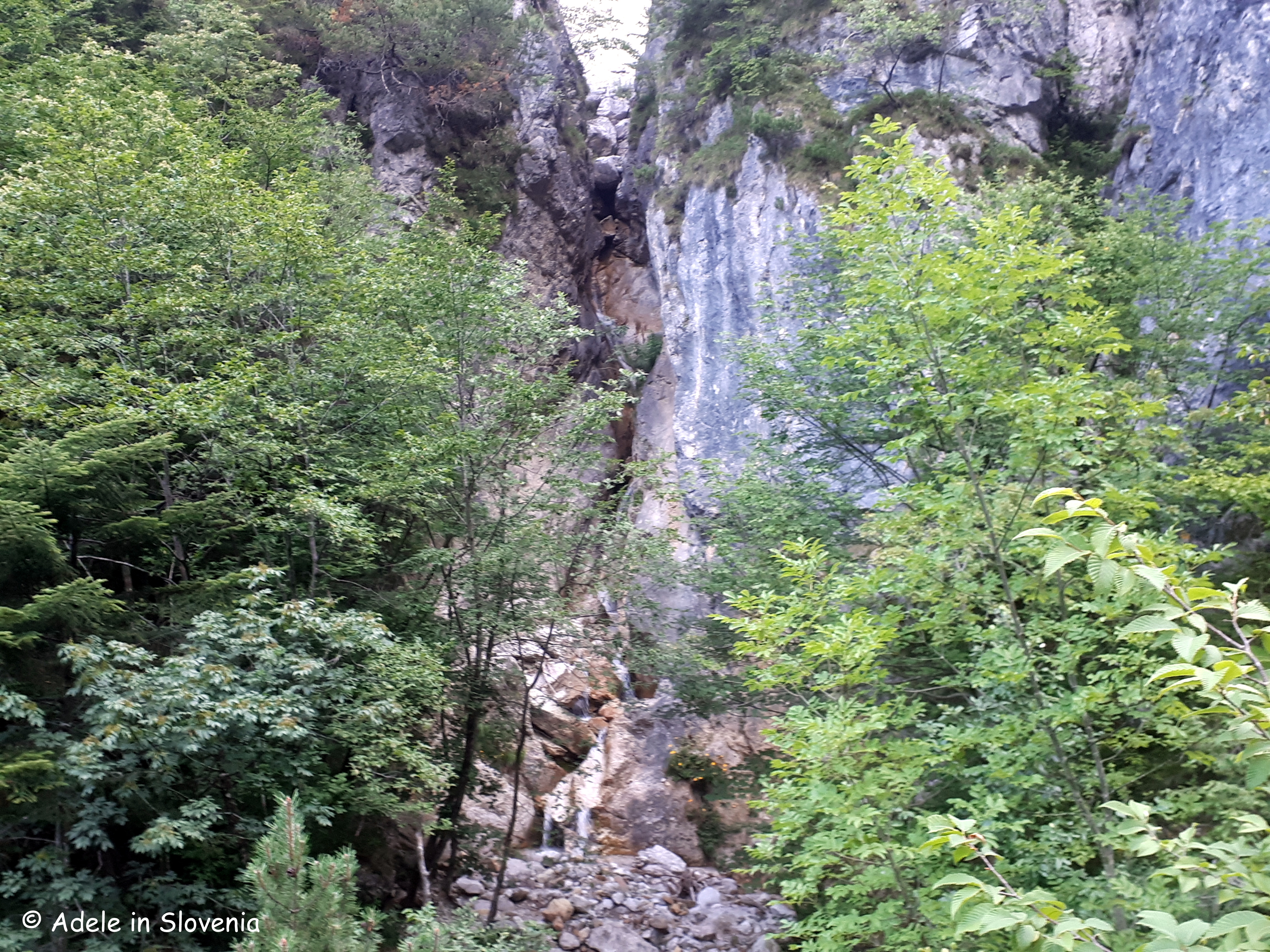
The trail begins to lead up through the forest, passing a cascade of the stream.
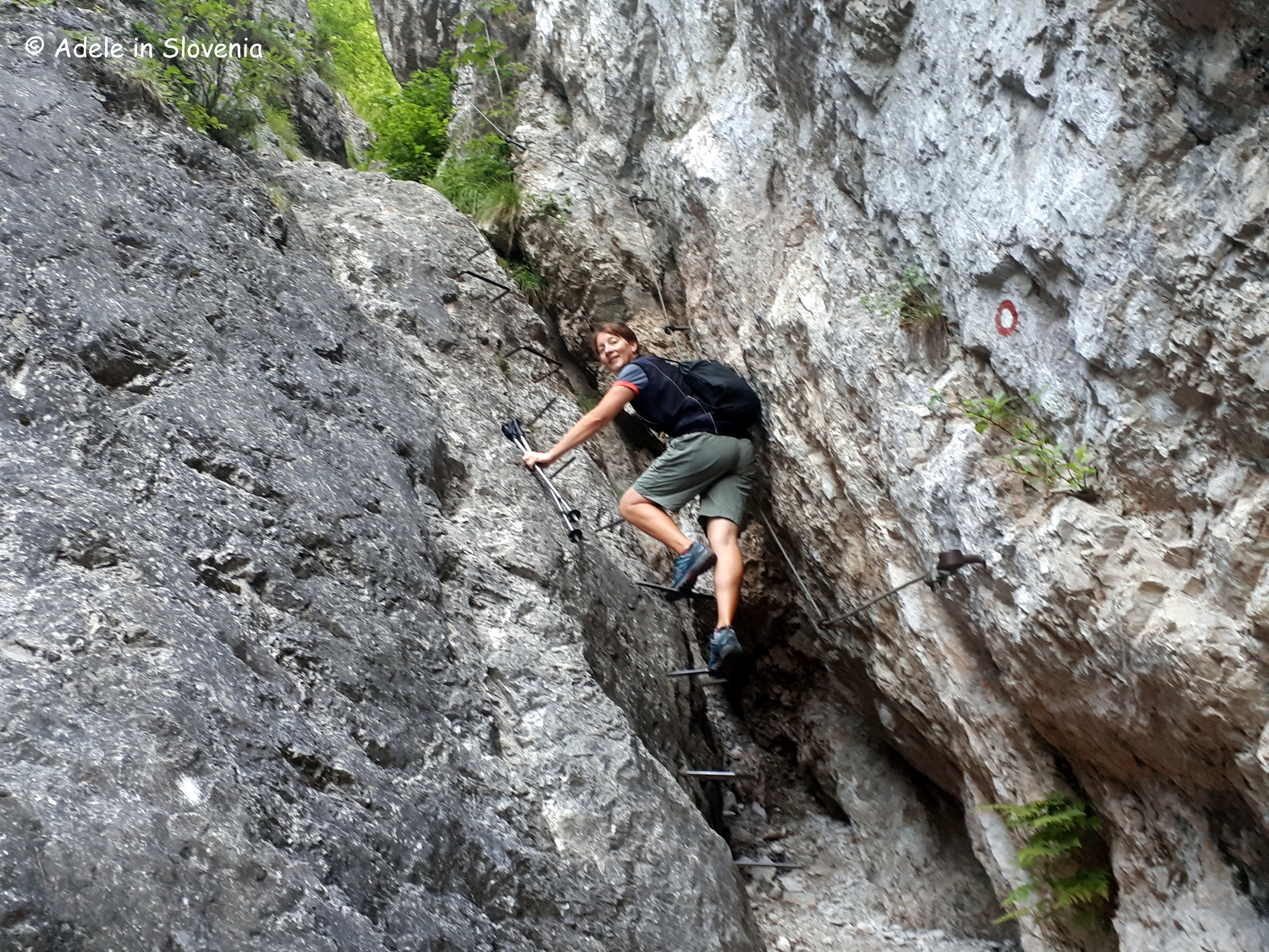
Next comes a slightly bigger ‘challenge’, as the path leads up a steep gully between two rock faces, but there are iron foot rungs and an iron cable to help, so, with a steady hand (and feet!), it doesn’t present a major obstacle.
Its only a short climb, and the path soon levels out, well, until the next bit anyway! But that is why I love this path, as there’s never a dull moment, it keeps you on your toes – literally!
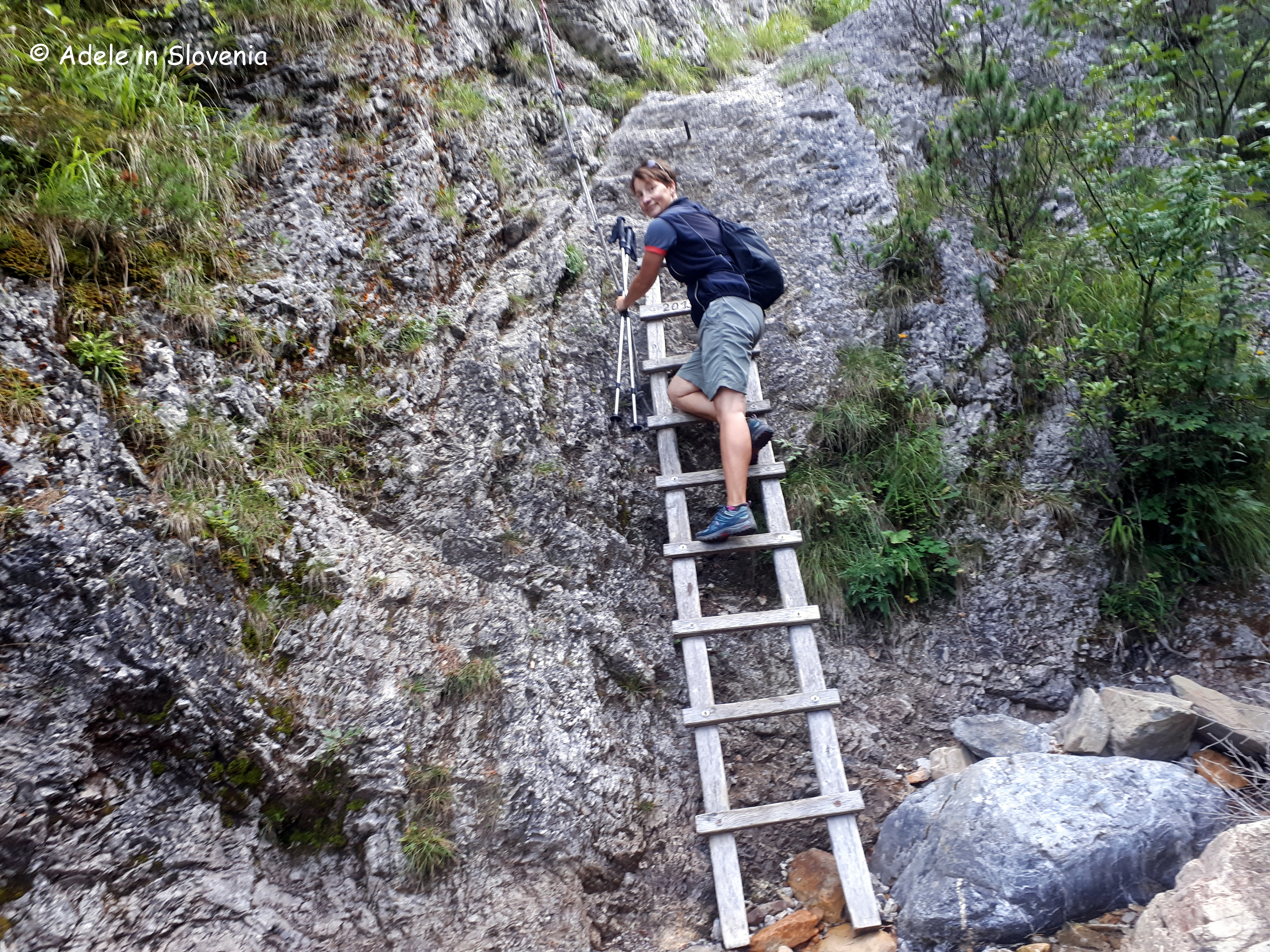
The path crosses the stream in several places, before reaching a ladder, equipped with a rope to hoist yourself up!
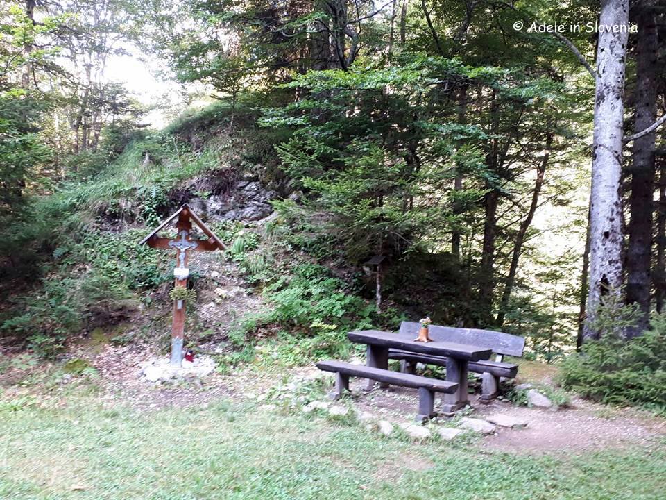
You then cross the stream one last time, before reaching a rest area with a bench, and then continuing up, ever steeper, through the forest.
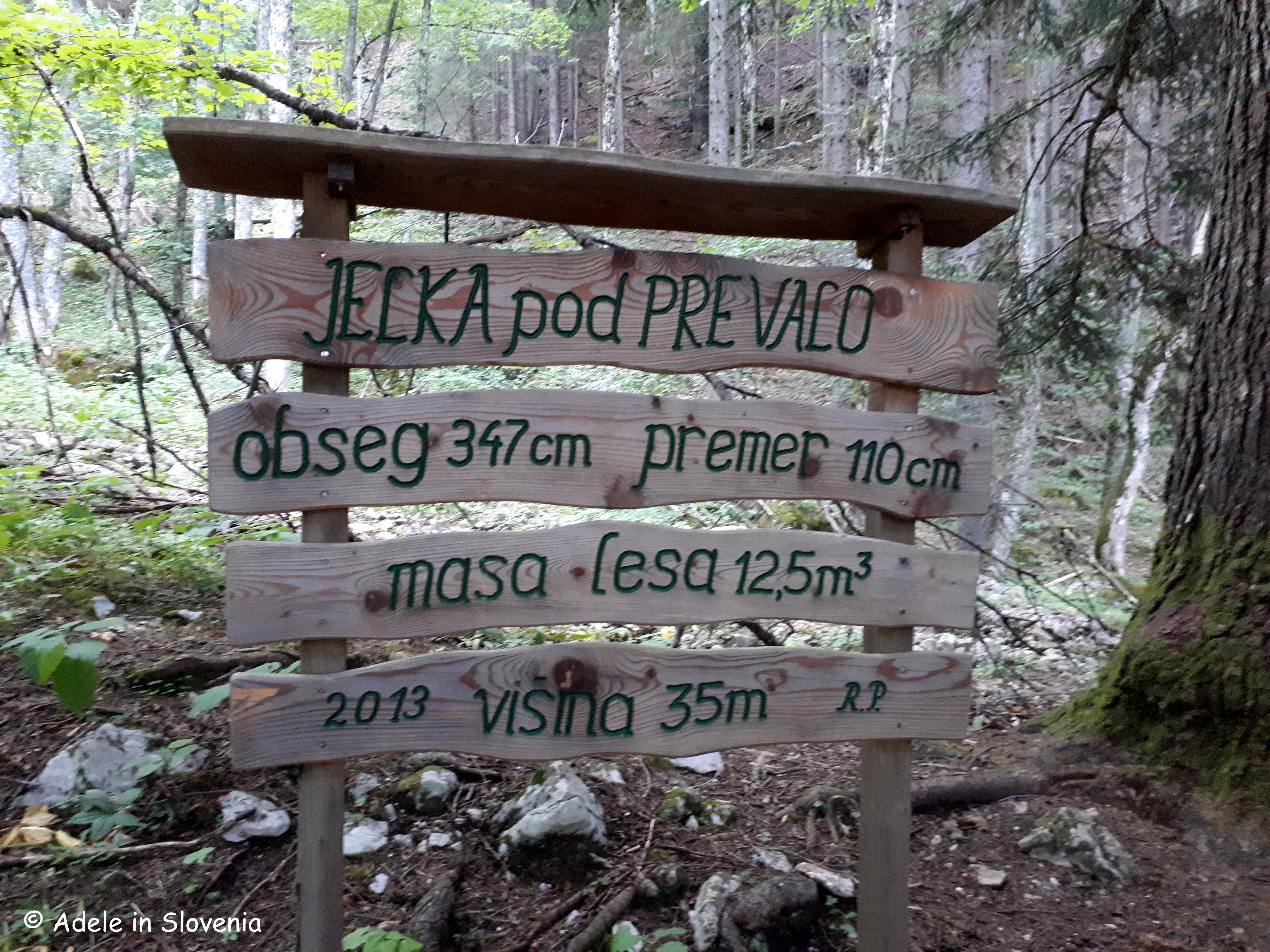
Next you reach a giant fir tree, so giant, in fact, there was no way or being able to photograph it from within the confines of the trail, so you’ll just have to visit and see it for yourself! The statistics on the signpost below give the facts and figures: circumference 347cm, diameter 110cm, quantity of wood 12.5m3, height 35 metres
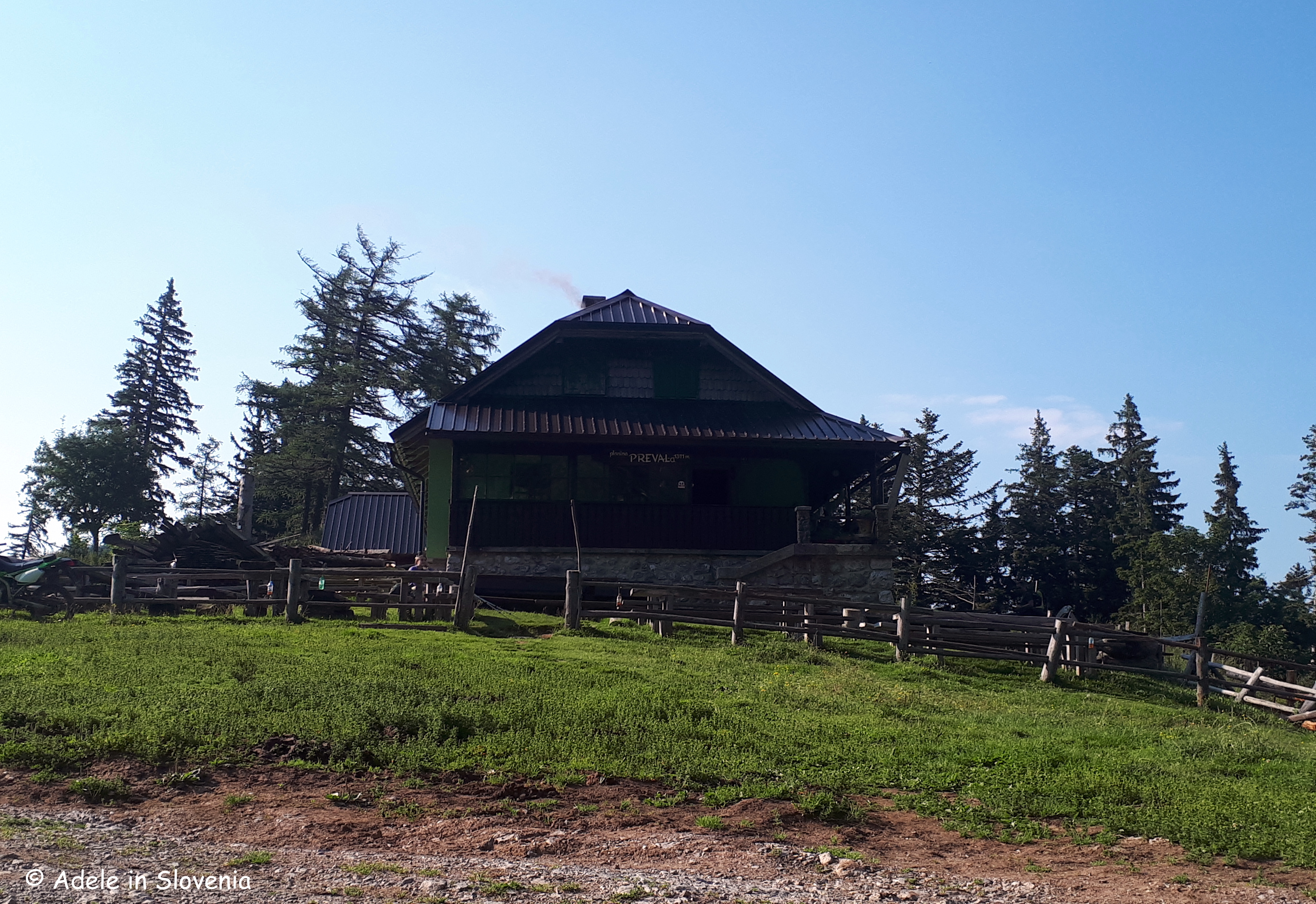
After about an hour to 1hr 15 mins, you reach the Preval mountain pasture and the Koča na Prevalu mountain hut, the first of four (yes, four!) mountain huts that you pass on this trail, where you can stop for refreshments (note: the huts are open daily during summer, but out of season some are closed whilst others open at weekends only) and enjoy the views before continuing on your way.
Now follow the road for about 10 minutes, which provides a mini-break from the steep path, before the path branches off to the right and begins to climb up again on the path ‘cez Roza’. But, it’s worth it, as you are soon rewarded with wonderful views of the Radovljica Plains, the Jelovica plateau, Lake Bled, and the Julian Alps.
There are still a couple of mini ‘hurdles’ to overcome, in the form of gullies to be crossed, but here and there, iron rods are provided to assist, and eventually the path levels out to become sheer enjoyment.
Shortly before the end of the path, you reach an abandoned manganese mine shaft with an information board, and the views open up further across the valley.
Click here for more information about the other themed hiking trails in the Radol’ca, and here for the Radol’ca hiking and biking map.
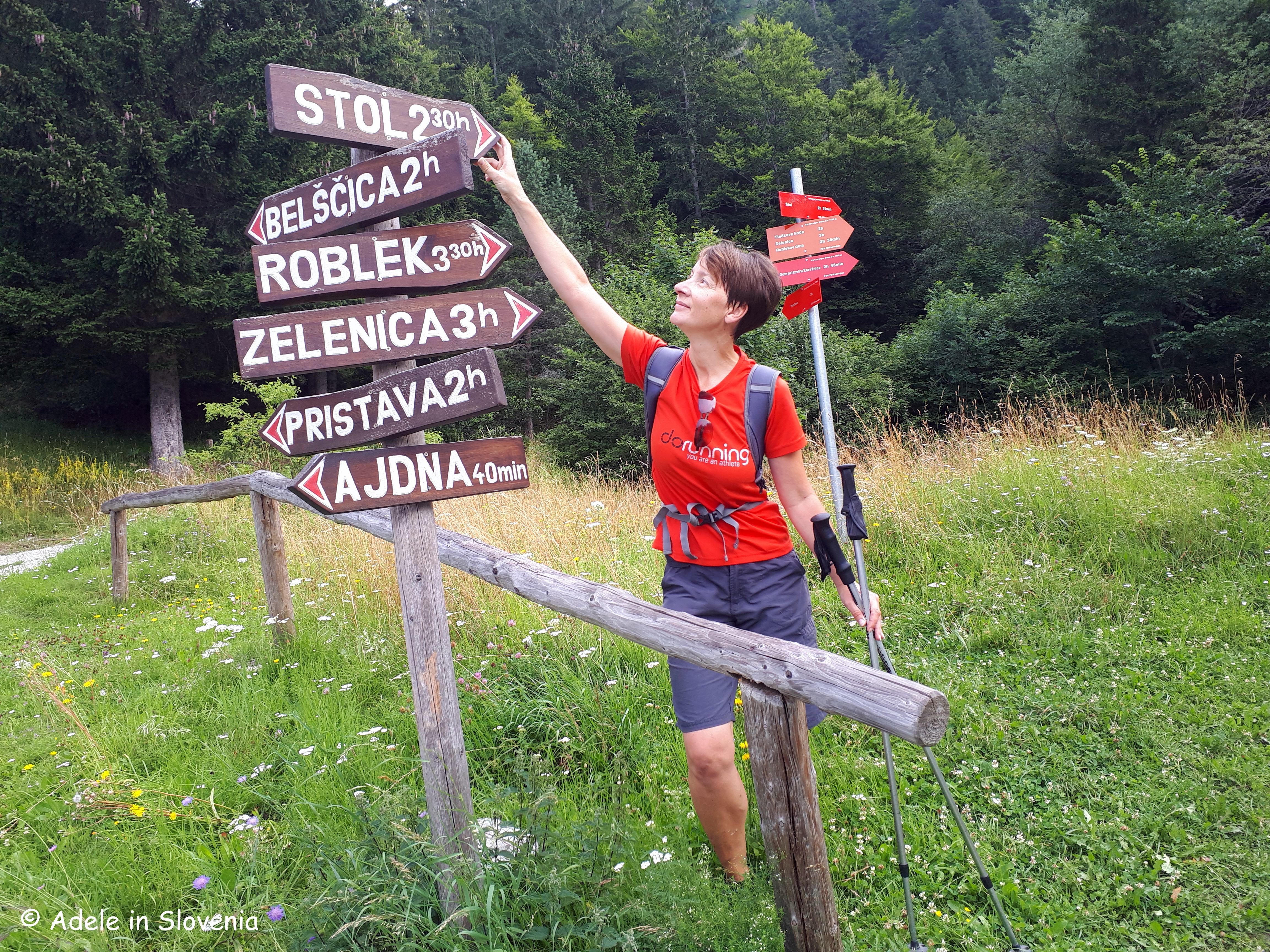
If I crane my neck, I can see Stol, the highest mountain in the Karavanke range, from my desk. Thus, it’s an ever-present feature in my life and, accordingly so, I can’t resist hiking to its top at least a couple of times per year, and yesterday it was time for the first hike to the summit this year!
The word ‘stol’ in Slovenian means ‘chair’, since when viewed from its western side (not the side I can see from here!), its summit forms a kind of ‘back’ for the flatter slightly lower summit which is home to the Prešernova koča mountain hut.
At 2,236 metres, Stol, along with the other mountains in the Karavanke range, forms a natural border between Slovenia and Austria, hence, on a clear day, there are always stunning views to be had in all directions.
Though quite a large percentage of those who hike to the summit of Stol do so by driving the 5km forest road to the Valvasorjev dom mountain hut and from there setting off on foot, I always opt to do the entire hike from the valley, as otherwise it just feels a bit like cheating to me!
After parking at the Završnica reservoir, I set off on the first part of the trail to the Valvasorjev dom hut (cca. 50 mins) from where, as you can see below, there are numerous paths leading in various directions.
Regular readers will know that I have a penchant for circular walks, and this time was no exception! I took the shorter, steeper Žirovniška pot (Žirovnica path) up, and the longer, less steep Zabreška pot (Zabreznica path) down, which is always my preferred route.
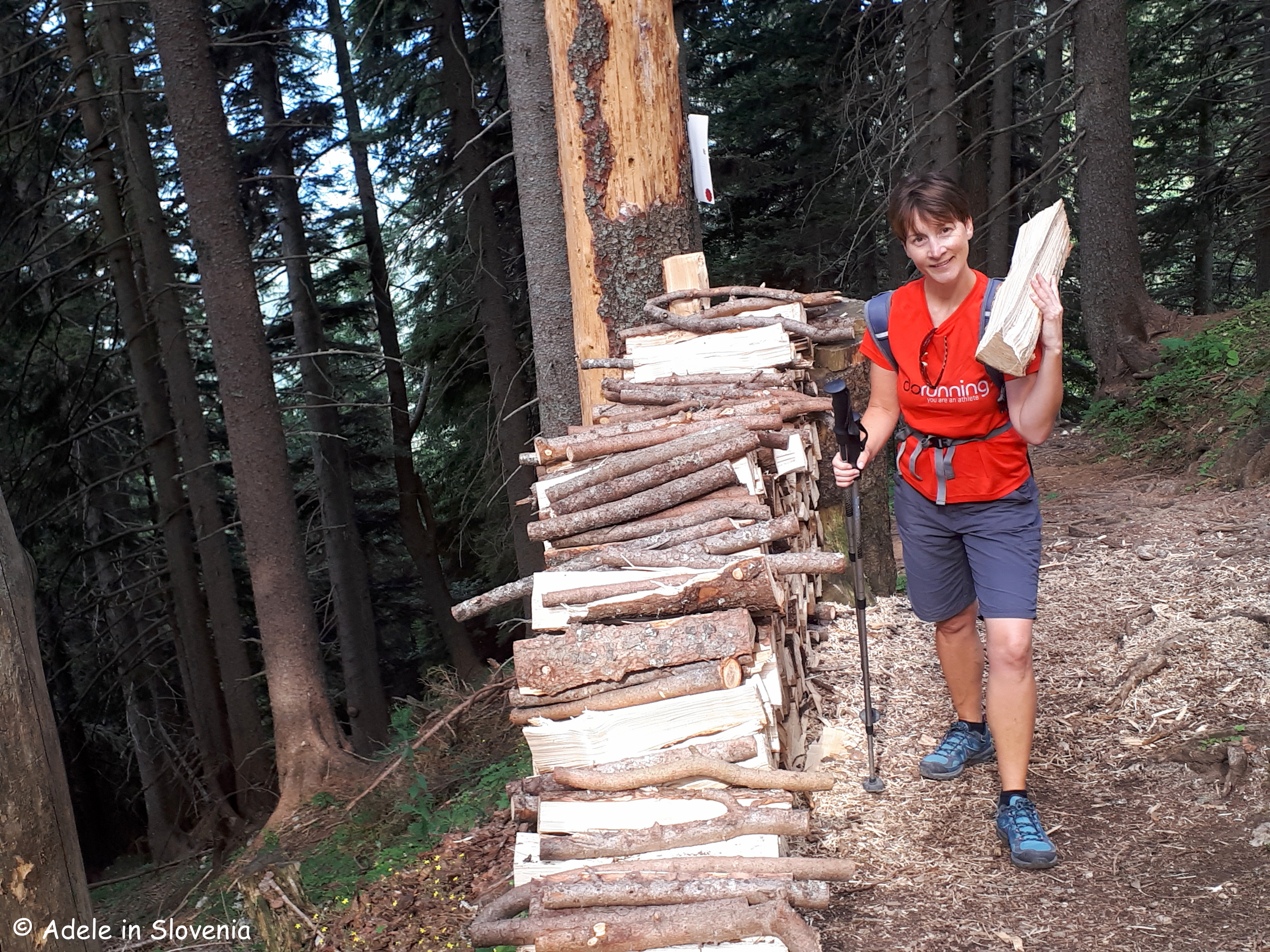
If you are feeling somewhat gallant, you might opt to not walk past the pile of logs without putting one in your rucksack or on your shoulder – the staff at the Prešernova koca mountain hut will be very grateful for your assistance in keeping the stove burning! Whether or not I was gallant enough to carry one up or not, I will leave you to decide!
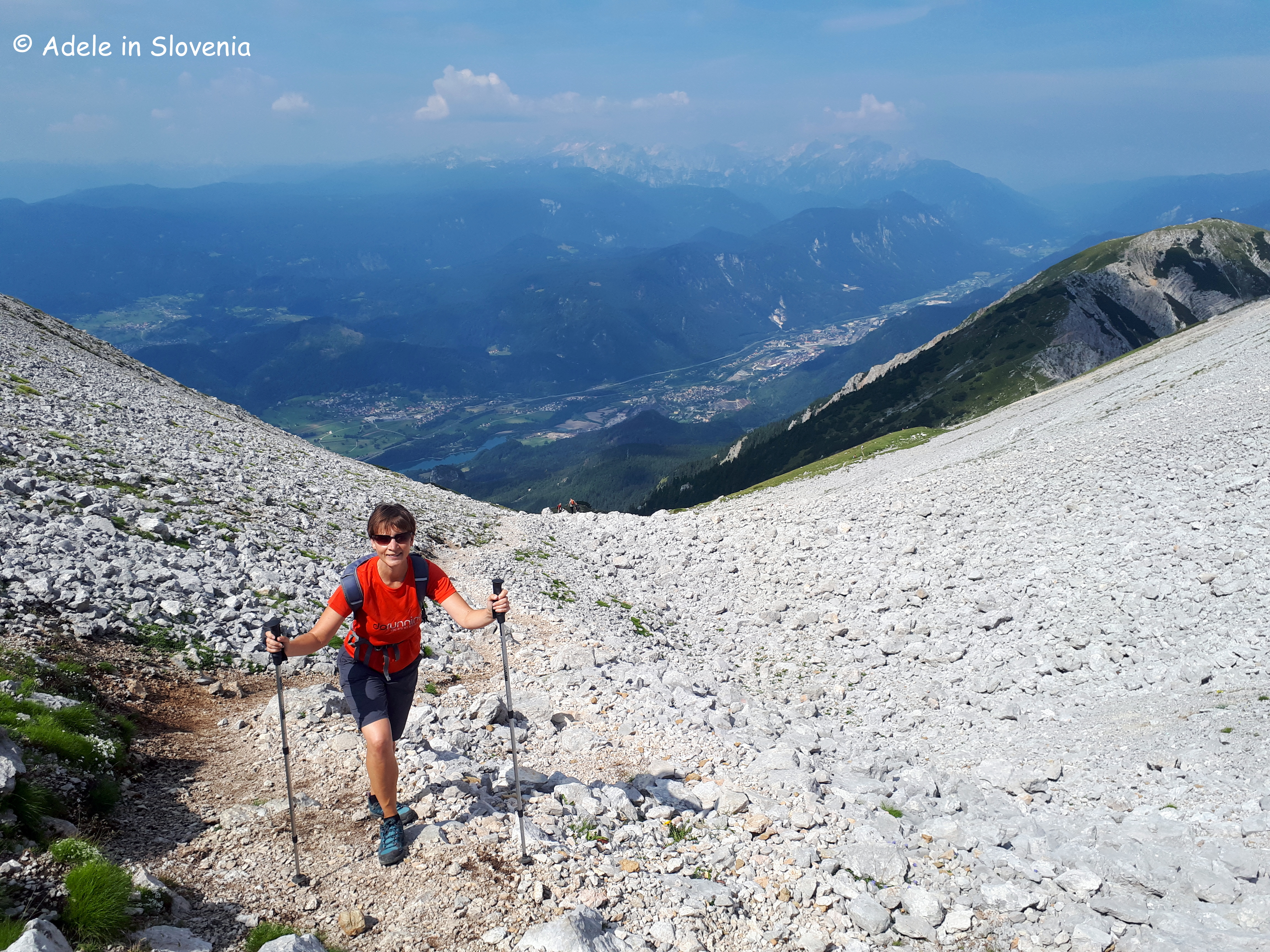
It was somewhat overcast for the majority of the hike up, the story of this ‘summer’, but in actual fact a bit of cloud cover was welcome on the long, steep hike up, and on reaching the top, the clouds majestically began to part to reveal blue skies and warming sunshine, and, for a change, it wasn’t blowing a gale up there, as can so often be the case!
Before the final ascent to the top, the path leads up a steep stony gully, from where there is a real bird’s eye view of the Upper Sava Valley and the Julian Alps in the background. The path is distinct and well-marked throughout.
As you reach the summit, you will notice that the typical red and white Slovenian markers change to red and white with a green outer circle, denoting that the path is on the border with Austria – always a kind of exciting feeling, even after 11 years here!
It took me just over 3hrs 15 minutes to reach the summit. And, as is the tradition, don’t forget to sign the visitors’ book as you take your ‘seat’ at the top of the Karavanke!
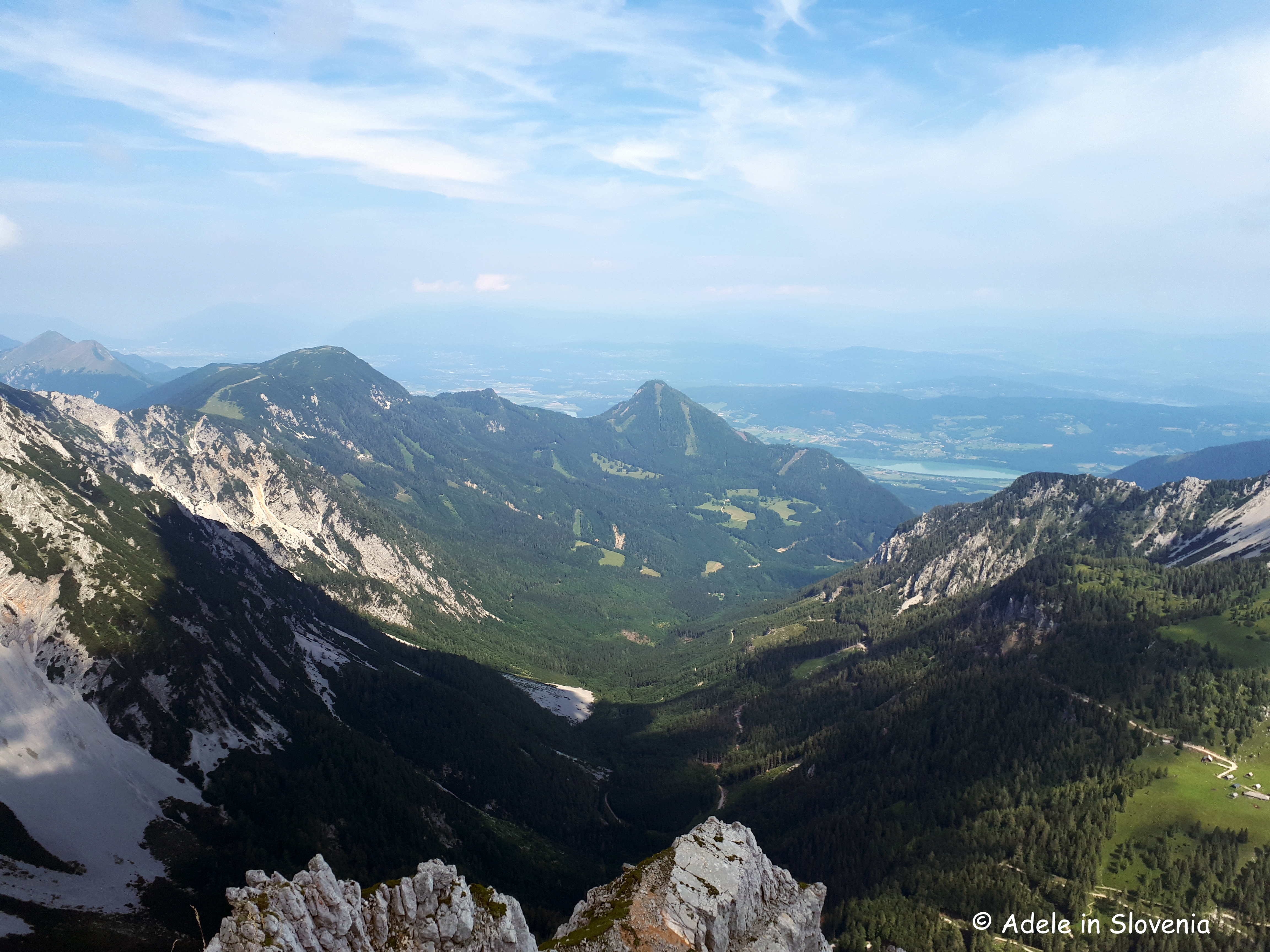
Once at the top, among the magnificent sights, you can see Lake Bled on one side, whilst on the other Lake Worthersee in Klagenfurt.
You won’t be alone, since even if there aren’t many other hikers (on Sunday, there were!), there are always some brazen birds that don’t seem in the slightest bit scared of humans as they sit in wait for some tasty tit bits!
After descending from the summit, there was time for a quick bit of sustenance at the Prešernova koca mountain hut, where there is simple, but tasty mountain-type food and refreshments on offer, a(nother) visitors’ book to sign, and then it was time to begin the descent – more about which you can read in my next blog about the myriad of mountain pastures beneath Stol, coming soon…!
Click here for the Visit Žirovnica website where there is more information about this and other hiking trails in the Žirovnica area.


.JPG)