At 2060m, Begunščica is amongst the highest mountains in the Karavanke range, and a favourite destination among locals and those looking for a moderately challenging and very scenic hike.
The approximately 120-kilometre-long Karavanke mountain range forms a natural border between Slovenia, to the south, and Austria, to the north. Thus, in late-spring it’s not uncommon for there to be snow on the northern facing slopes of the Karavanke, whilst it’s green on the sunny Slovenian side!
Green and sunny to the south, snowy to the north!
There are several ways to reach the summit; the most popular among them is to start from the Draga Valley in Begunje na Gorenjskem. If coming from Radovljica, drive through the village and continue in the direction of Tržič, then on the left you will see the road towards the valley. The valley is a popular starting point for hikes in the Karavanke range. The routes are well-marked and signposts show approximate walking times.

I recommend taking time to stop in the village of Begunje na Gorenjskem to have a stroll around the park, and also at the entrance to the Draga Valley to see the ruins of Kamen Castle.

Continue to the end of the valley to the parking area and from there you set off on foot. You can choose to either go via Preval on the first part of the Shepherd’s Trail, which is the more direct, short, but steeper route, or hike first up to the Roblekov dom mountain hut (1657m), where you can stop for refreshments either on the way up or down – or of course both ways! You can find more information about the Shepherd’s Trail here – http://www.radolca.si/en/shepherds-trail-begunje/

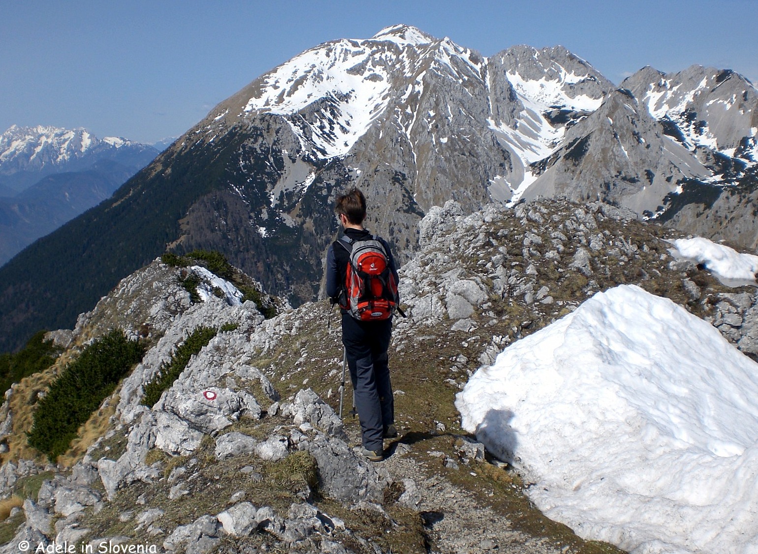
Looking down on the Preval mountain hut on the path up towards Begunščica
If you choose the route to Preval, it takes a good hour from the valley to reach the Koča na Prevalu mountain hut, again an optional break for refreshments here – then prepare yourself for the very steep path directly up to the summit. Here you leave the Shepherd’s Trail and take the marked path to Begunščica which, at times, can feel like an almost vertical ascent. However, apart from one small rocky section, it isn’t overly exposed and is manageable for competent and experienced hikers.

As you approach the summit you can’t fail to notice the ‘carpet’ of sheep droppings from the sheep that are taken to graze on the slopes of Begunščica during summer! I always wonder how on earth so few sheep manage to produce so many droppings! At the summit there is an orientation table which provides assistance when you are gobsmacked by the stunning views and don’t know where to look first!

Personally I prefer to do the hike in the direction as I have described it: Draga – Preval – Begunščica – Roblek – Draga, as the descent from the summit to Roblek is easier and more ‘knee-friendly’ than the steep path from the summit down to Preval. I also like doing it this way as it makes it an entirely circular route.

The path from the summit down towards the Roblekov dom hut
Whilst there is no hut at the summit, there’s no shortage of huts to visit; in addition to the aforementioned Koča na Prevalu and Roblekov dom huts, there is also the Tomčeva koča hut (1180m) on the Poljška Planina highland and the hut on the Planina Planinca highland (1136m), both of which are found at approximately the halfway point between the Draga Valley and the Roblekov dom hut.
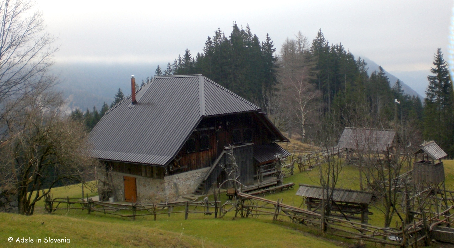
The hut on the Planina Planinca highland
You can find out more about this and other hiking routes nearby on the Tourism Radol’ca website here – http://www.radolca.si/en/hiking/
© Adele in Slovenia

Fantastic report Adele I’ve just returned from Slovenia, with reading your post now: Mt. Begunščica has a position on my to do list:). Love slovenia! Thanks for sharing, inspirational posts!
Hi Stefaan, thanks for the feedback! I hope you had a great time in Slovenia and don’t forget next time to make time in your itinerary to come and visit Radovljica, and Begunščica too!