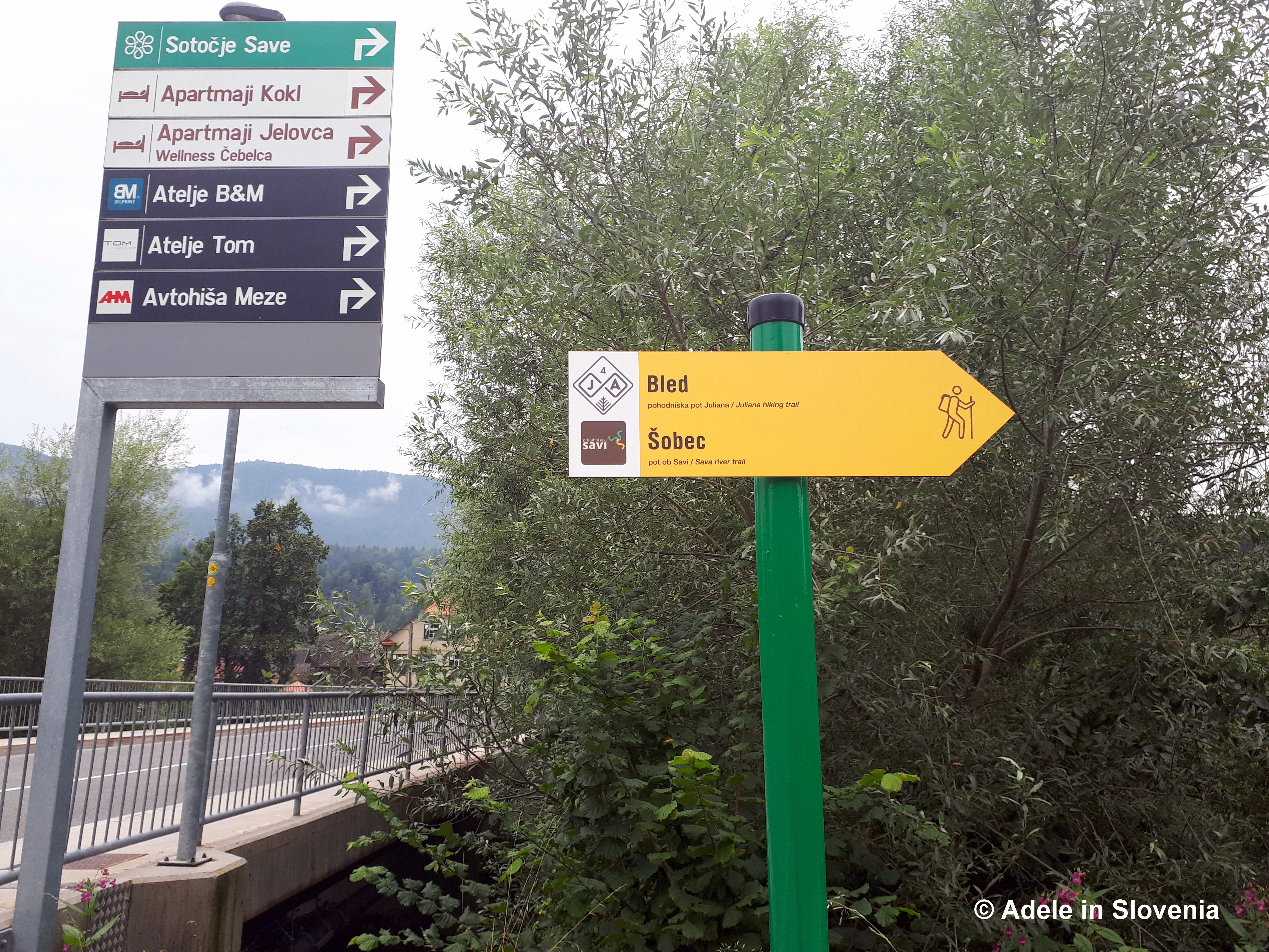
The Alpe Adria Trail, which begins on Kaiser Franz Josefs Hohe in Austria and ends on the coast at Muggia in Italy, has 43 stages and a total length of 750kms. The trail is a collaboration between three countries – Austria, Slovenia, Italy and offers lovers of the great outdoors myriad possibilities for enjoying the stunning and ever-changing scenery along the way from the highest glaciers to sea-level.
It’s easy to pick and choose where to start and how far to walk, however, since the route is linear, be sure to have a plan how to get back if you need to do so! In terms of the trail in Slovenia, stage 22 runs from Austria into Slovenia, stages 23, 24 and 25 are entirely within Slovenia, and stage 27 begins in Slovenia ending in Italy.
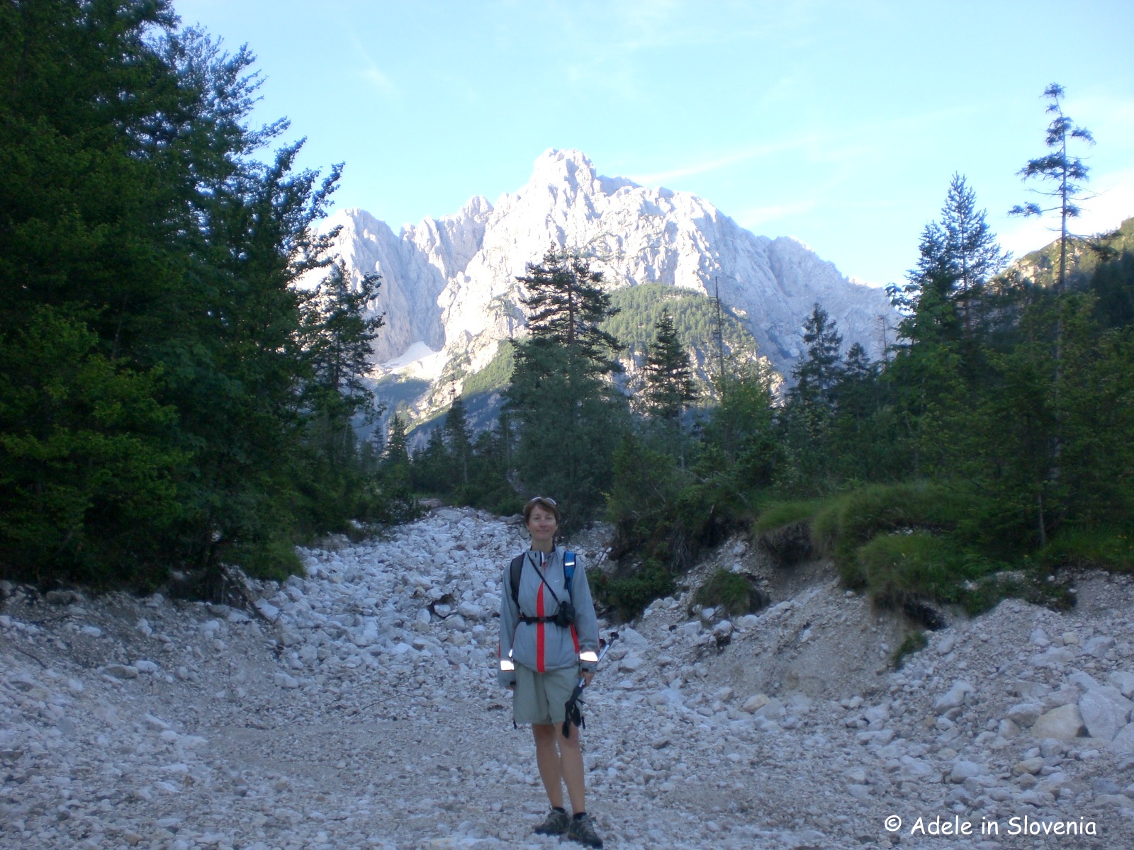
Stage 23 of the trail officially starts in the centre of Kranjska Gora (810m), though I started my early morning hike from the stunning Lake Jasna, which sits at the foot of the Vršič Pass. It was very tempting to linger a while, however, I had a long hike ahead so headed onwards, and upwards.

The mythical golden-horned mountain goat ‘zlatorog‘ is a landmark and obligatory photo spot!

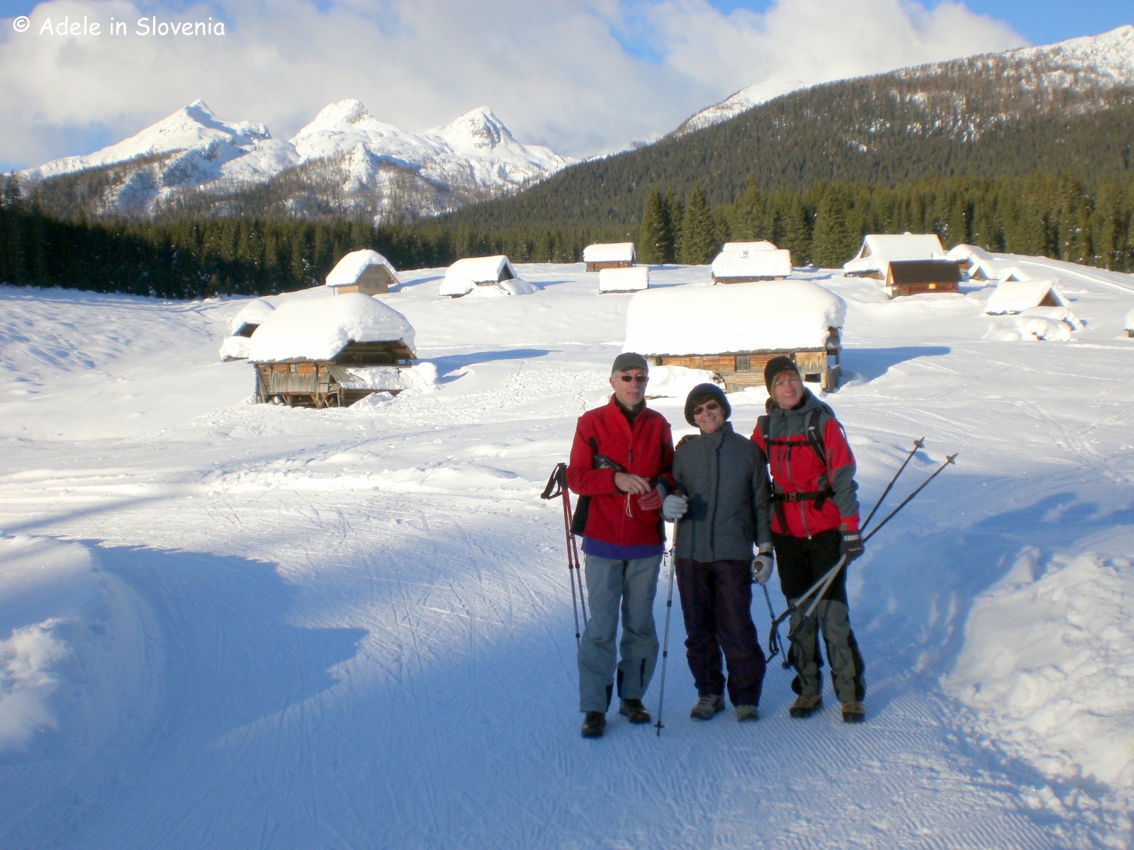
From the far-end of the lake the route then leads along the Krnica valley, beside the Pišnica river and makes a fairly level easy start to the day. Note: If you’re looking to escape the summer heat, this valley is the place to be. Whatever the time of year in the early morning it’s freeeeeezing!!! In winter, Krnica is a particularly popular place for sledging.

The route then turns right, passes the Mali Tamar Memorial to those who have lost their lives in the mountains, crosses a bridge over the stream, and then the ascent to Vršič begins. It is well-marked throughout with Alpe Adria signs as well as the usual Slovene way-markers (a red circle with a white inner).
The Vršič Pass is the highest mountain pass in Slovenia. It was built in the early 19th century, originally for military purposes, and has a total of 50 hairpin bends. You can, of course, drive up instead of hiking, or even cycle – as many do, though note that the pass is usually closed throughout winter when there is heavy snowfall due to the danger of avalanches.
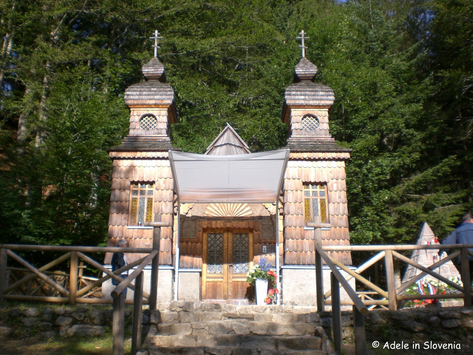
The trail goes largely through the forest, though in places it emerges – or if ‘it’ doesn’t then ‘you’ can – from the forest at sights of interest and to take in the views. The first such sight is the Russian Chapel, which was built in memory of the suffering of the thousands of Russian prisoners during construction of the road. Hundreds of prisoners and their guards – Russian and Austrian – lost their lives due to an enormous avalanche in winter 1916 – the exact number who died was never known.

The route continues to the right of the chapel, again through the forest. I recommend a stop at bend 17 to see the somewhat eerie looking stones that have begun to ‘appear’ in recent years. I guess someone started the trend and others followed!

The view from here isn’t half bad either!

It’s now not far to reach the top, less than half-an-hour and I was already at 1611m at the top of the Vršič Pass.

From the top it was easy to see where I was heading, down towards the Soča Valley and I could hardly wait to glimpse the always-stunning emerald-green Soča river.

When leaving the top, look for this sign and walk down the road for approximately 500 metres.

As tempting as it is to admire the views, be sure to keep your eyes to the ground here, as here the way-marker for the trail is only on the ground and could easily be missed.

From here the trail re-enters the forest and leads on a pleasant gently-descending path, eventually emerging between stones walls into the parking area at the source of the Soča river, where there is a small hut offering refreshments. In places the trail is marked by the letters AAT – as shown below.

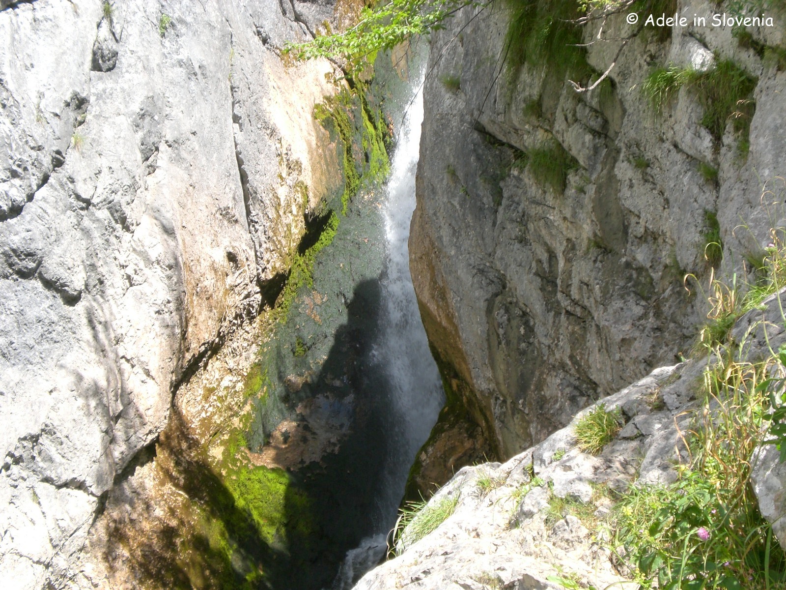
If you choose to take a detour to see the source of the Soča river, it takes about 10-15 minutes to reach the first viewpoint – a relatively easy path, thereafter its a bit of a climb, assisted by iron pegs and rope, so not for the faint-hearted! Knowing I still had a way to go, I just went to the first viewpoint (well, that’s my excuse anyway!).

From here it is downhill all the way. The Soča River Trail leads on traffic-free paths to Trenta, home to a Triglav National Park Information Centre, and where there is a mini-market, restaurant and a sprinkling of accommodation options.

The total distance of this stage of the trail is 17.8km, of which the ascent is 962m and 1146m descent. It can easily be shortened as required – at least during the summer months when buses operate over the Vršič pass from Kranjska Gora to the Soča Valley. Out of peak season, however, you would need to ensure you have suitable onward, or return, transport.
In total the hike took less than 5 hours, including photo stops. If you take time to linger and savour the views, perhaps enjoy a meal at one of the several mountain huts en-route to, or at the top of, the Vršič pass, then it makes a very enjoyable full day trip. Highly recommended!
More information about the trail can be found here – http://alpe-adria-trail.com/en/ and more information about autumn hiking in Slovenia here – http://www.slovenia.info/en/Autumn-hiking-in-Slovenia.htm?aktivna_pohodniska_jesen_slovenija=0&lng=2
© Adele in Slovenia


.JPG)