Srednji Vrh: Seeking the Sun and a Stream in the Karavanke!

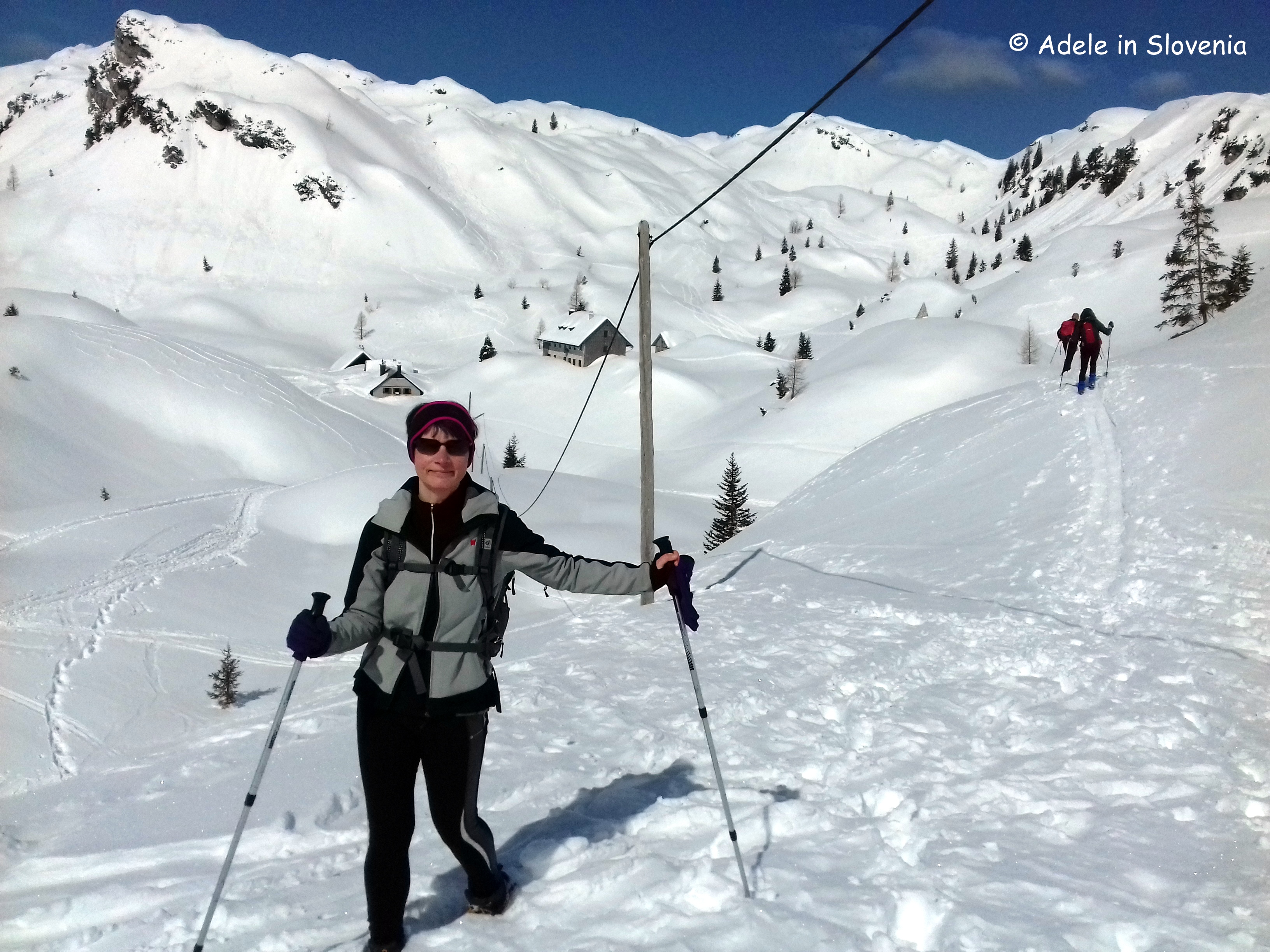
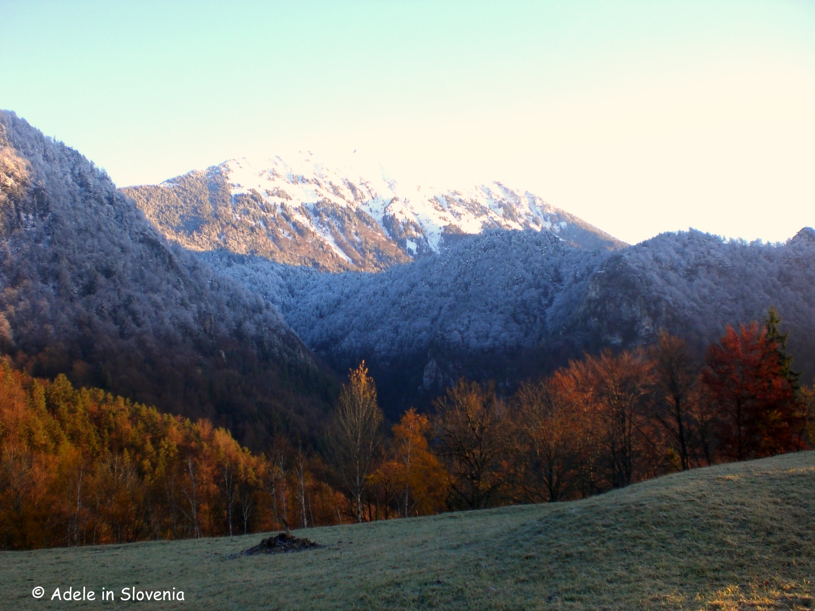
This ‘summer’ – not that it can really be called that thus far – hasn’t been kind to us outdoor types. This time last year we were basking in 35 degrees, whilst a week ago we had temperatures half that, and since the start of June there have only been a couple of days when there hasn’t been rain somewhere in Slovenia.

Thus, trying to find days with clear blue skies for hiking and getting some good snaps for my blog have been few and far between. Fed up with waiting, I just went anyway, and, though not as gloriously sunny as I would have liked, I managed to get in a good hike in the Karavanke mountains to Srednji vrh and the Dom pri izviru Završnice (mountain hut at the source of the Završnica stream) – and even stayed dry too!

Despite the less sunny photos, I hope you, nonetheless, enjoy this glimpse into just one of the many fantastic hikes in the Karavanke mountains in the Žirovnica area. Join me on my trip to see the source of the Završnica stream and Srednji vrh!

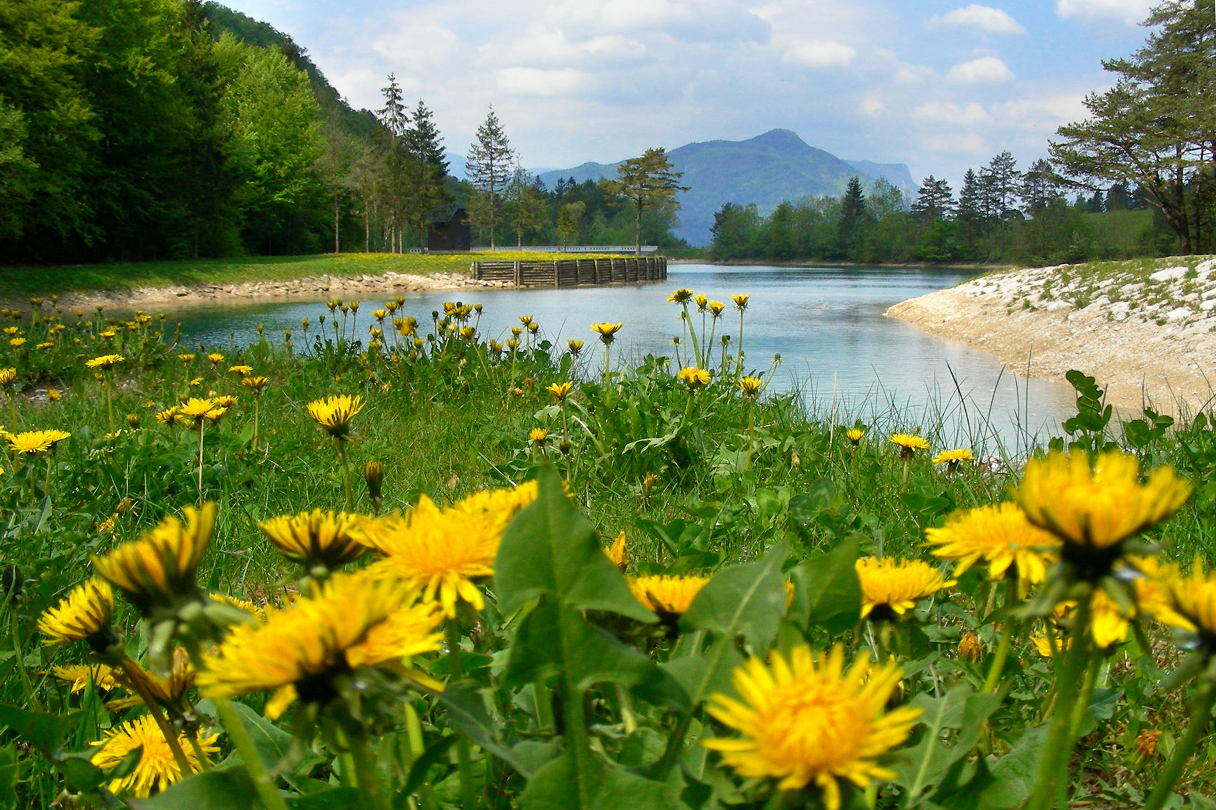
I started my hike from the Završnica valley. How far you go by car is a matter of choice – some choose to drive as far as possible along the valley, whilst I prefer to leave the car and set off on foot along the gravel road. You will want to stop and admire the reservoir (seen below on a sunnier day!), but if you have transport, then do continue along the valley further before parking, as its a long walk from here.

From here the road gets much rougher and it’s best to set off on foot. The area, with its many mountain pastures, is also popular for mountain biking.

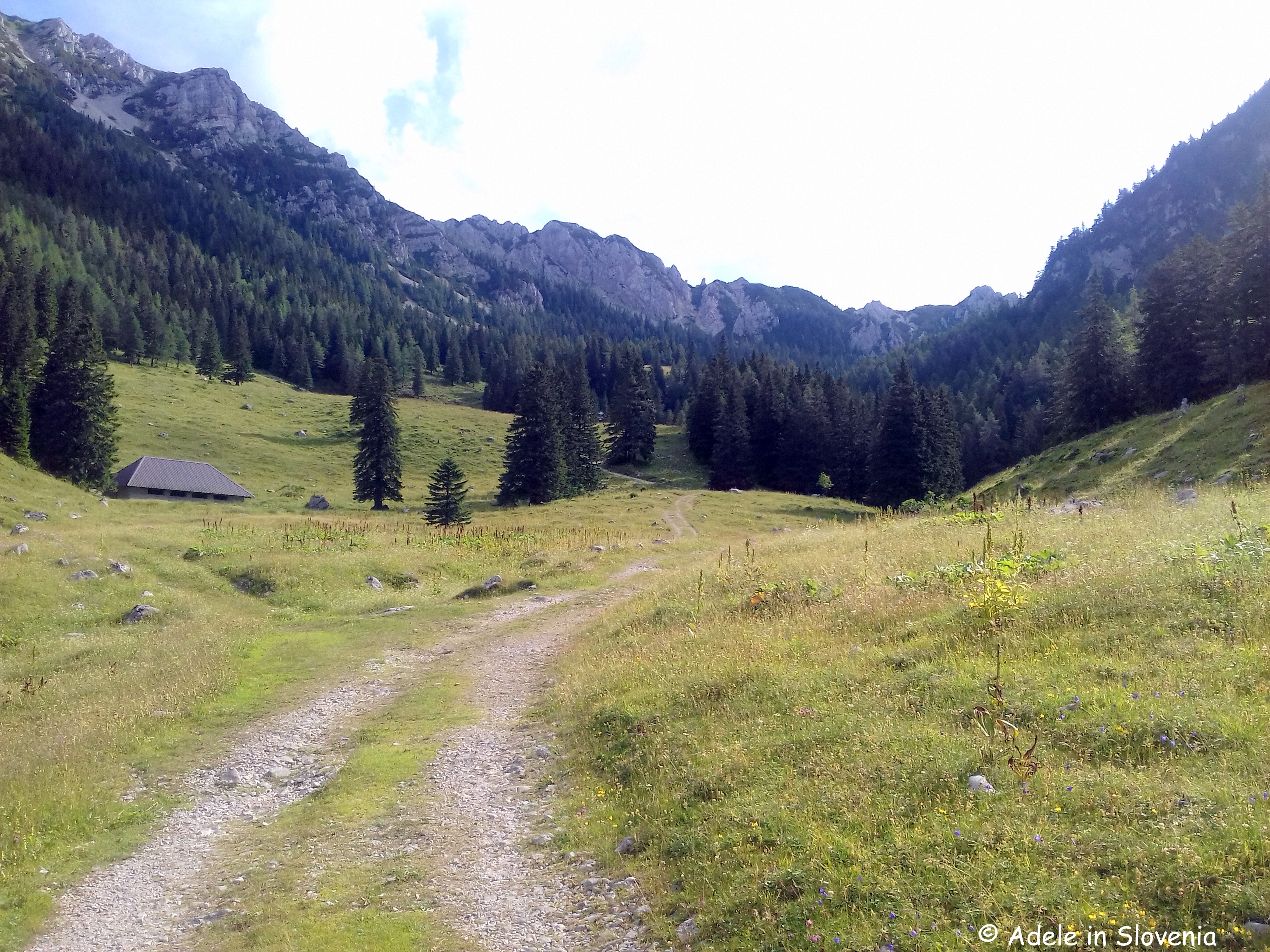
The road rises gradually to reach the Tinčkova koca hut, which isn’t actually an official mountain hut, rather a private hut, but somehow the name has stuck!

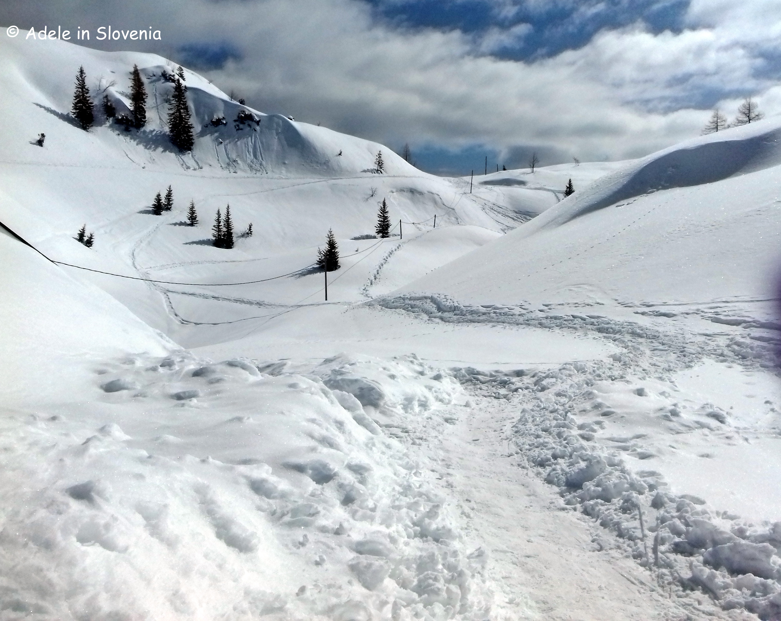
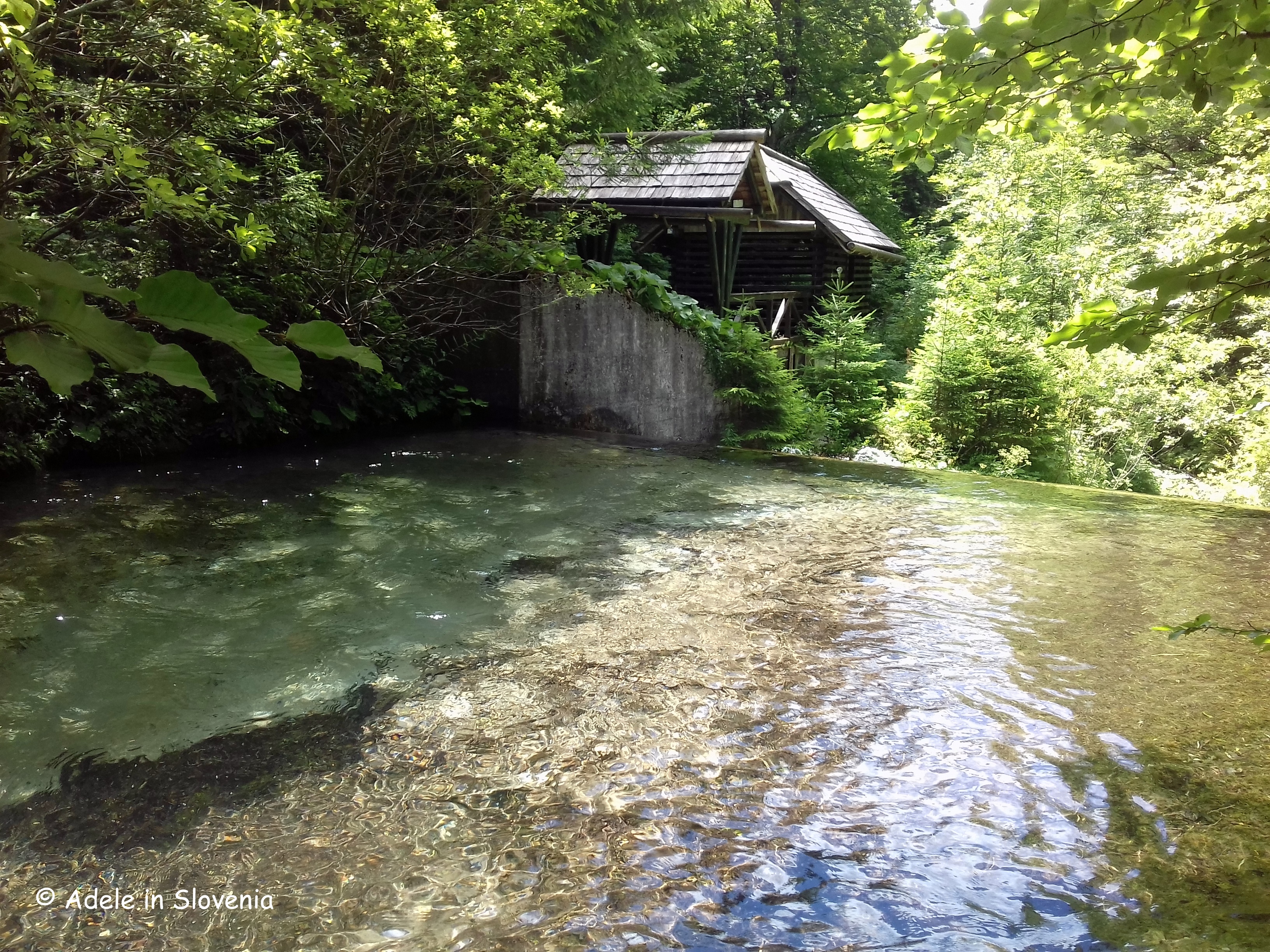
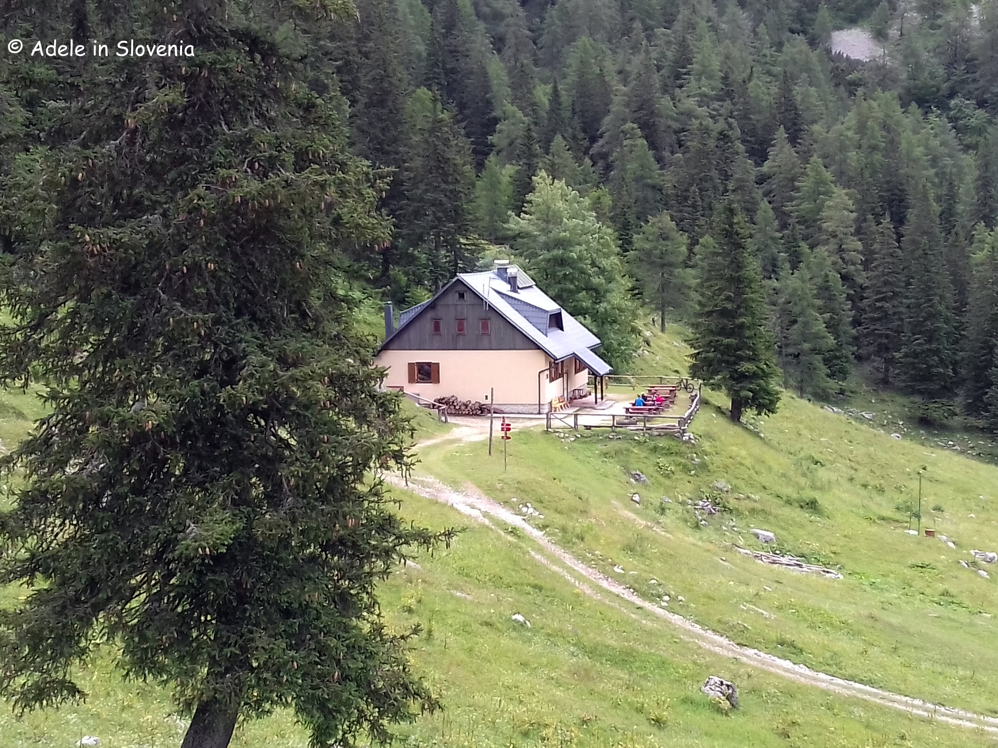
The Dom pri izviru Završnice hut. which was recently renovated and has new beds and furniture, is situated at an altitude of 1425m above the Smokuč mountain pasture (Smokuška planina) and on the backside of the Zelenica ski piste (sadly, no longer operational).

The hut is open from 1st June to 1st October, and at other times at weekends, weather permitting, and by prior arrangement for groups. From the hut there are numerous options for continuing to explore the peaks of the Karavanke including Vrtača, Begunščica and Stol.

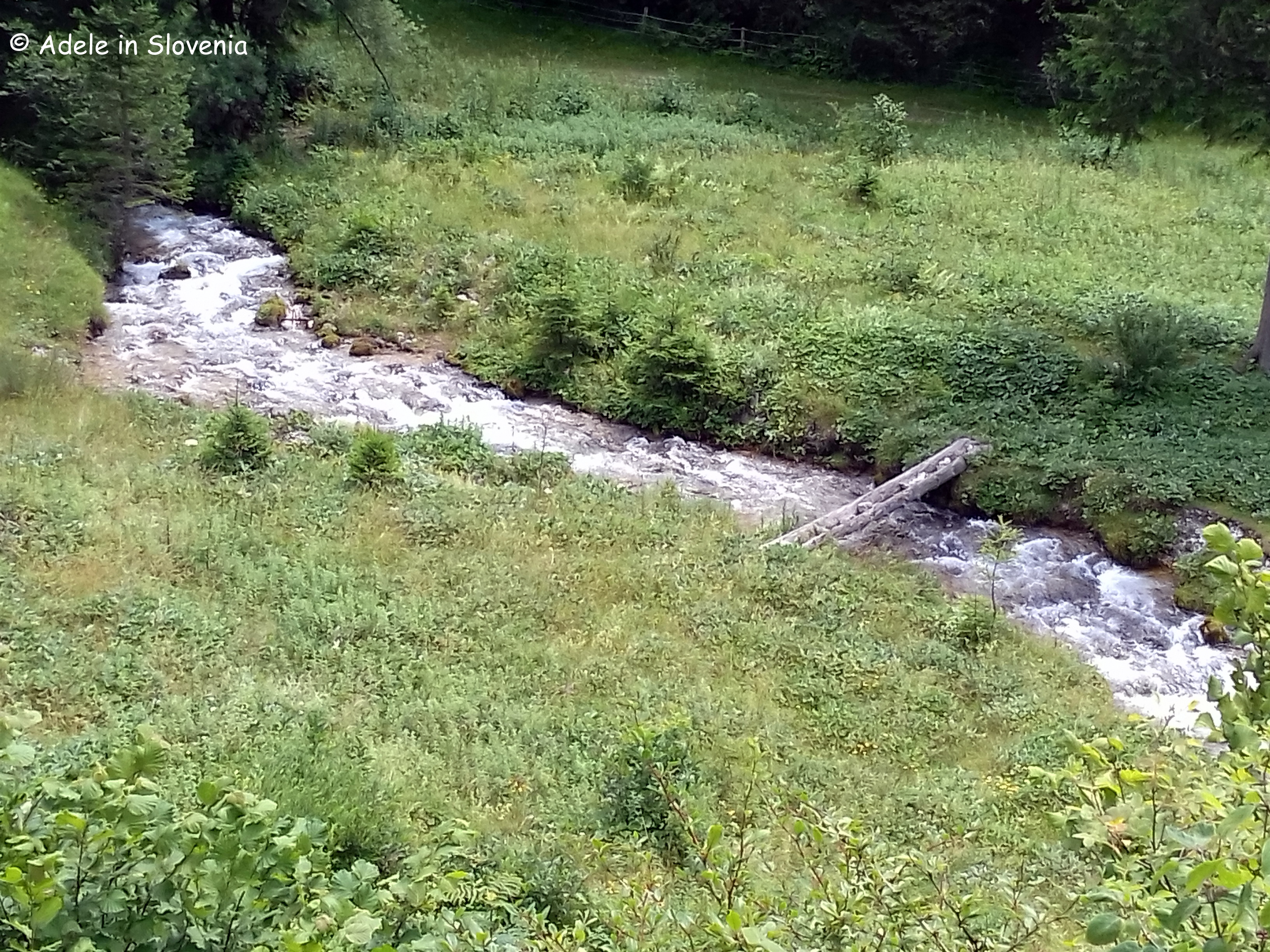
I always find the springs of rivers and streams fascinating. Where on earth does all the water come from? At the source of the Završnica stream, there is barely a trickle of water to be seen – and that despite the abundance of snow and rain this year – yet just a little further down the valley, it turns into a gushing stream.

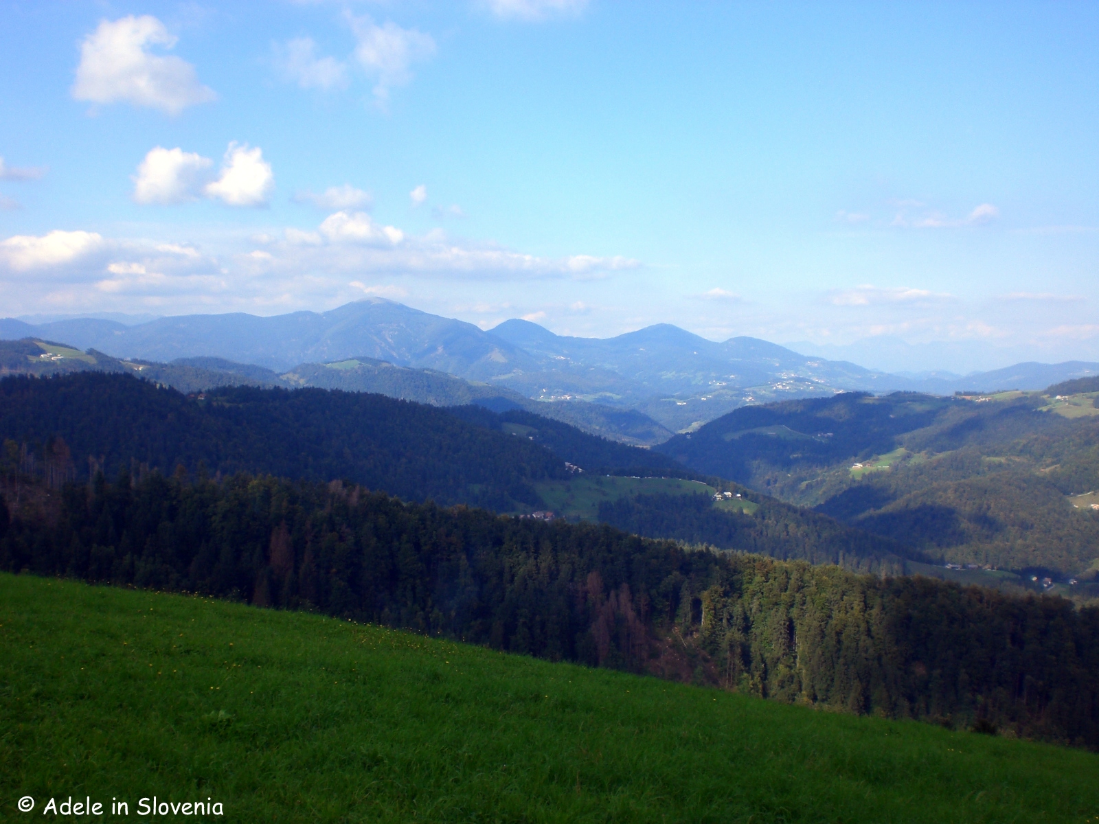
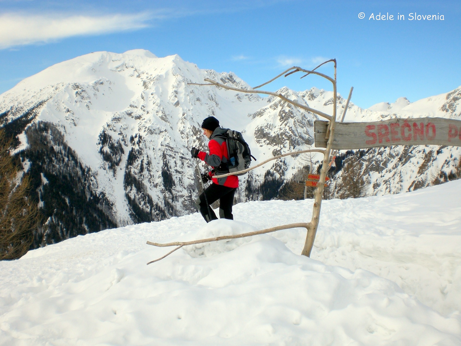
The beauty of hiking in the Karavanke, particularly in the ‘summer’ (ahem!), is the lack of crowds. I hiked for close to 5 hours and only met around a dozen people in that time – bliss for those who really want to get away from it all.

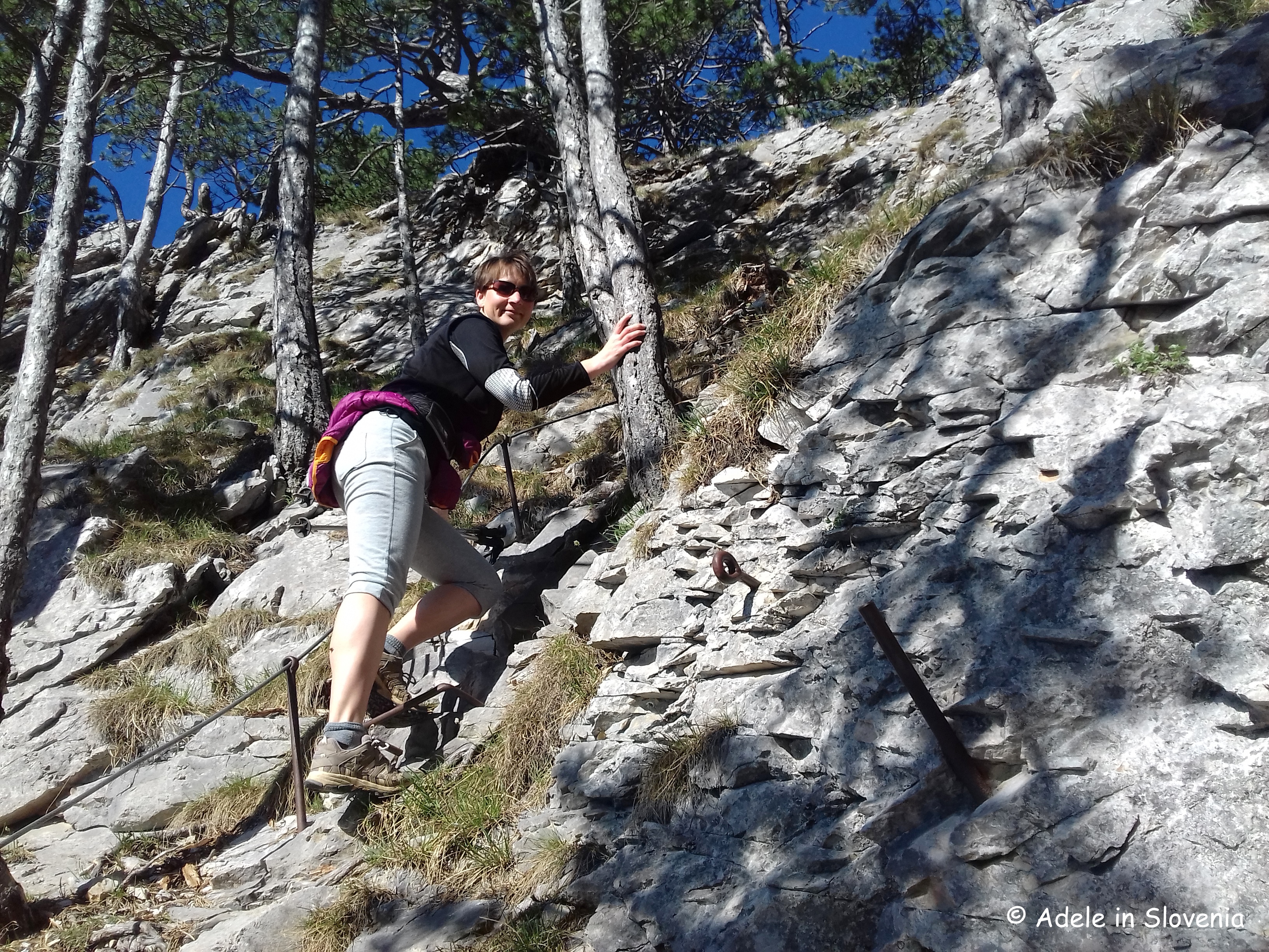
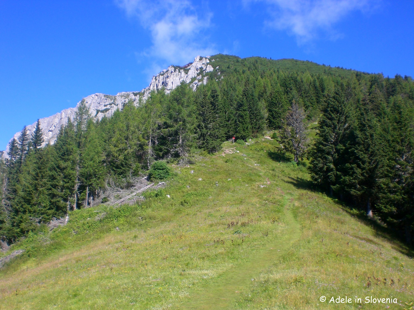
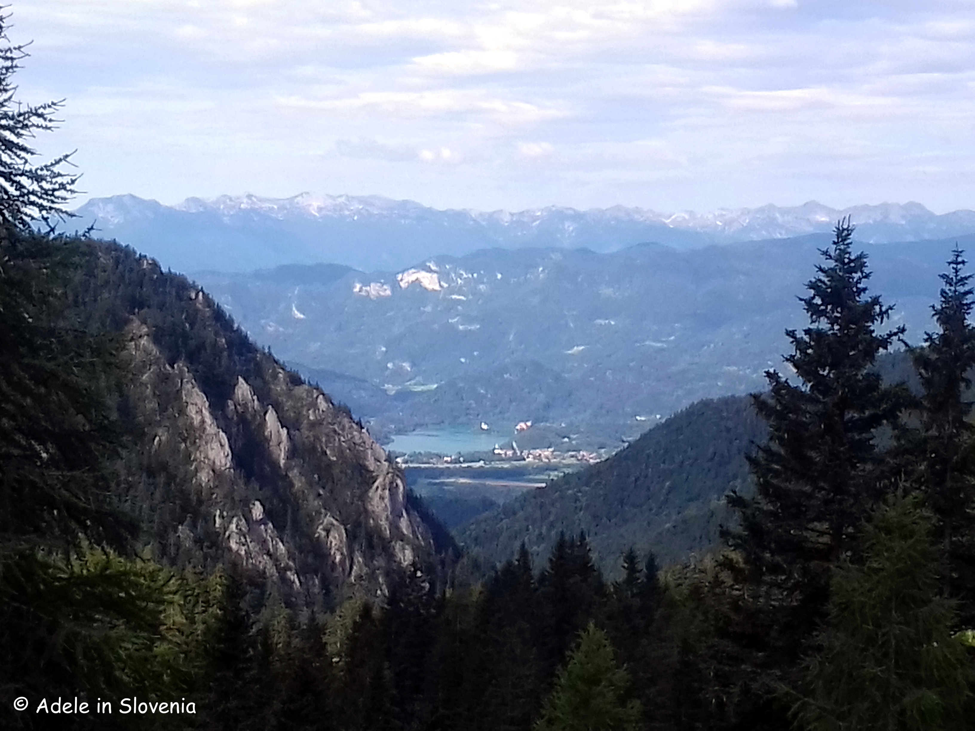
As I like to make my hikes circular, where possible, I continued from the hut up the ski slope before turning left and heading on the slopes beneath Vrtača. In this area there is a lot of loose rock and scree, so you need to keep your wits about you. As you get higher, you are rewarded with a glimpse of Lake Bled in the distance.

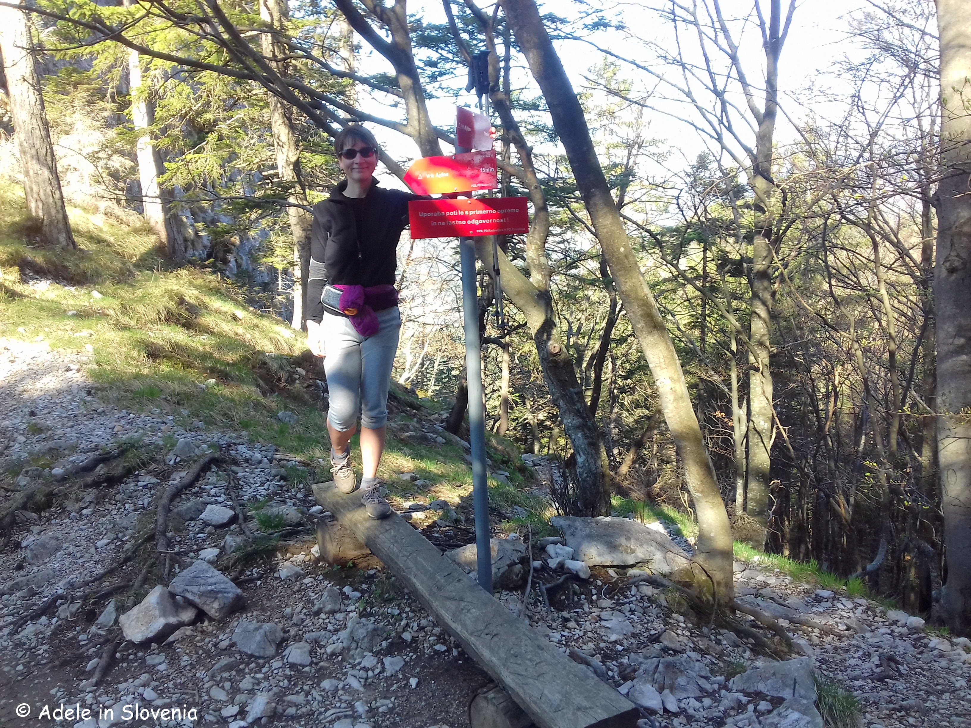
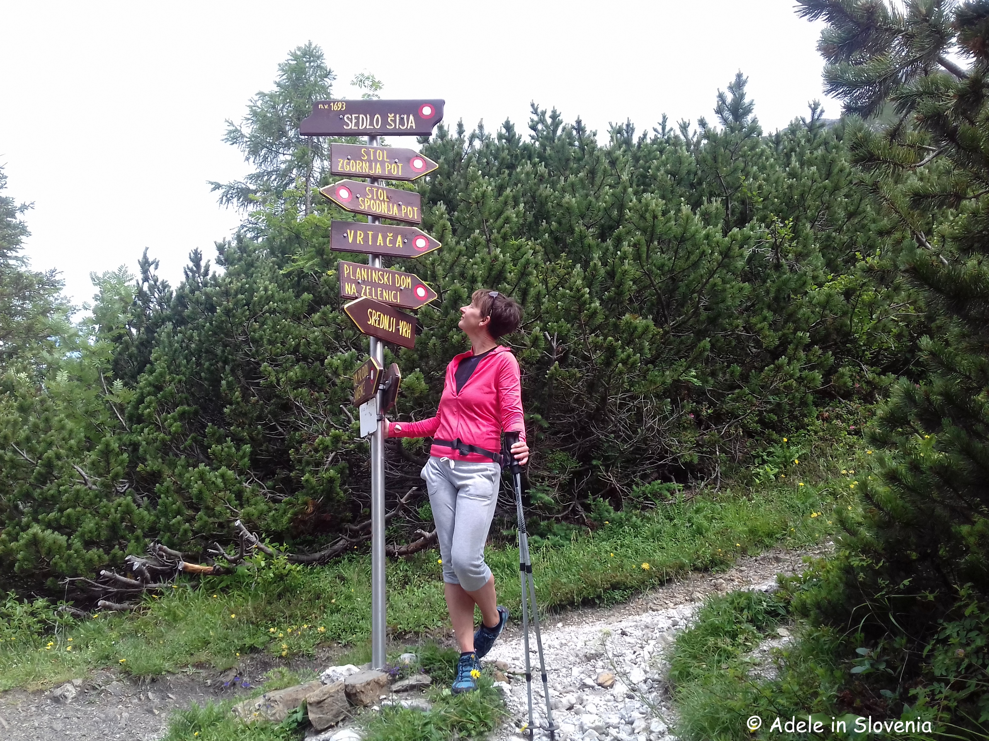
Where the path branches off right to ascend the summit of Vrtača, I took the left fork marked for Stol. On reaching a junction I then descend to the Šija saddle, from where there is certainly no lack of choice of where to go next!

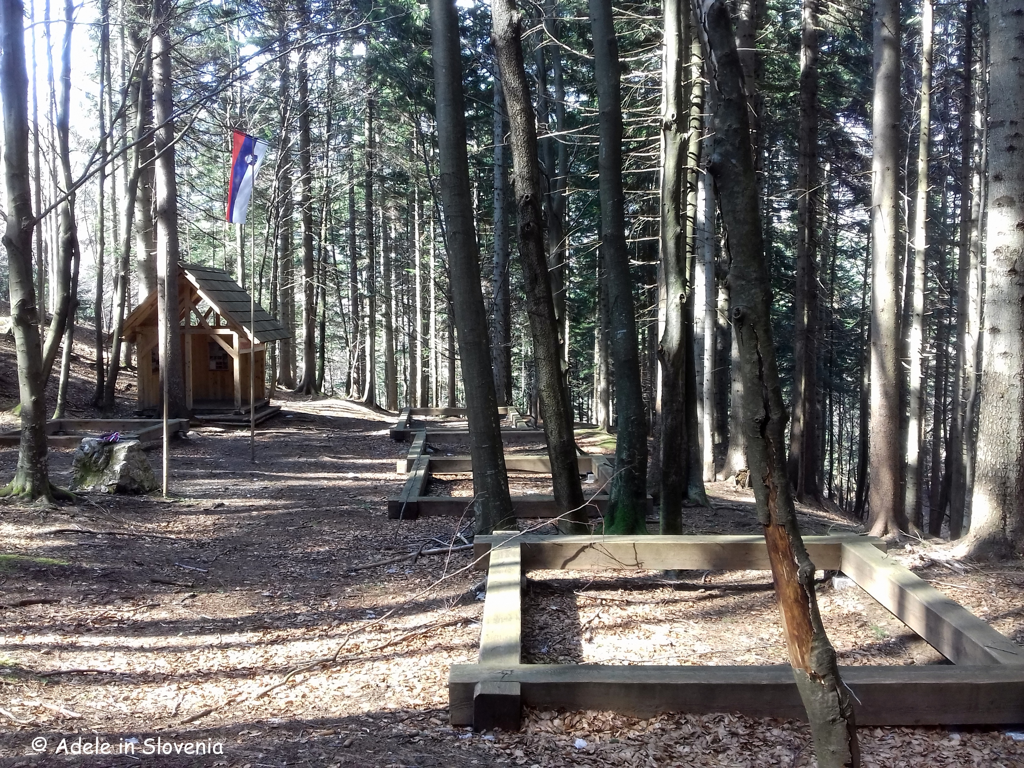
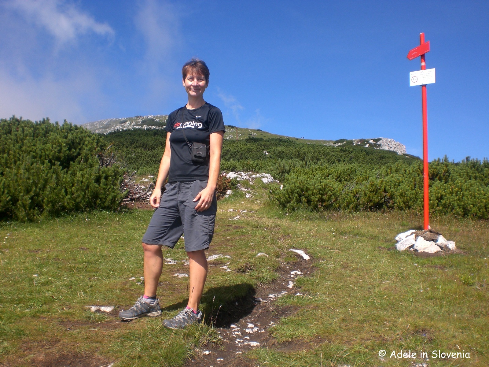
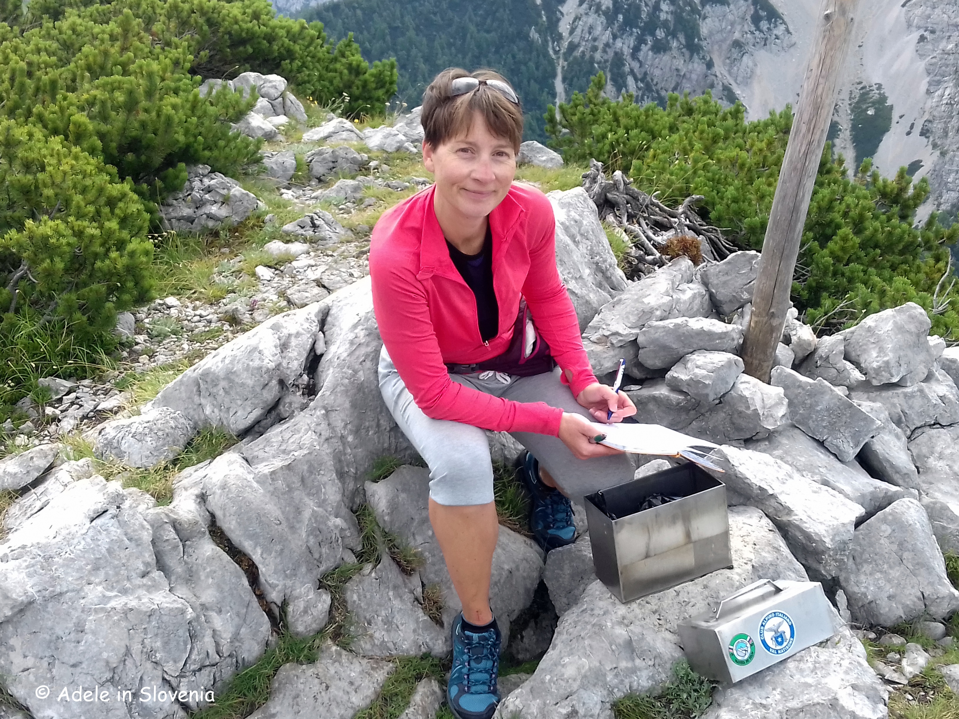
I chose the path to Srednji vrh (1796m), which is just a further 15 minute climb from the saddle. At the top there is a visitors’ book, a solitary bench and fab views!

I then descended back down towards the hut, which is less than half-an-hour from the Šija saddle before returning on the same road.

Click here for more information and this and other hikes in the Žirovnica area.

© Adele in Slovenia

Car-Free and Carefree in Bohinj and Triglav National Park

This summer you can take advantage of the new shuttle system in Bohinj, which enables visitors to leave their cars and cares behind and enjoy the beauty of Triglav National Park.

By parking in the one of the designated car parks and taking a bus, not only does it remove the stress of looking for somewhere to park, but it’s more environmentally-friendly and easy on the wallet too – in fact it’s FREE – so what’s not to like?!

I went to try it out for myself last Friday and it really is as easy as pie. So join me on my journey to Bohinj!

First, park your car in the large FREE car park at Camp Danica in Bohinjska Bistrica.

Next, take a FREE ticket from the machine and display it on your dashboard.

Then just hop aboard one of the FREE buses that run every 15 minutes from 9am to 8pm on Fridays, Saturdays, Sundays and public holidays from Camp Danica to Bohinj lake during July and August, and every 30 minutes in June and September.

The buses have various liveries, some easier to spot than others, but all offer the same FREE journey to/from the camp and the lake.

All that is left is to sit back and enjoy the short, scenic ride! You alight the bus just metres from the lake and the Monument to Four Brave Men – which commemorates the first four men who climbed to the summit of Slovenia’s highest mountain, Mount Triglav (2,864m) in 1778.

The rest of the day is yours to enjoy at your leisure, or to be as active as you like in the knowledge that you can easily and quickly get back to your car at day’s end when you have had your fill. Though, does, or can, one ever really have a fill of somewhere so beautiful?!

Walk or hike to your heart’s content, laze by the lake, do water sports in and on the lake, cycle, visit local attractions, soak up the views…

If, however, you are like me, you might like to consider taking a bus one way and walking the other – you get to see more and burn off a few of the calories ingested in ice-cream, too!

Walking on the traffic-free Bohinj Cycle Route from the lake alongside the Sava River back to the bus stop at Camp Danica (or vice versa) takes around 1.5 hours, though allow more as you will want to stop for photos and soak up (more of) the beauty along the way and at the rest areas.

This is just one of this year’s new additions in the Bohinj area. There are also additional car parks as well as buses running from Senožeta to the Blato mountain pasture, a favourite starting place for hikes in the Seven Triglav Lakes Valley, as well as the Hop-On Hop-Off bus to the Pokljuka plateau.

If you are staying in the Bohinj area for at least two nights, you can also avail of the Summer Mobility Card, which provides visitors with free parking, free bus rides and a whole host of other special offers and discounts.

Click here for more about this and what else to see and do in Bohinj, Triglav National Park and the Julian Alps.

© Adele in Slovenia

The Forgotten Village on Ajdna – A Fascinating Archeological Site and a Great Hike Too!

Ajdna is the name of a tooth-shaped peak that lies beneath Mt. Stol, the highest mountain in the Karavanke range. A hike to Ajdna is fascinating, interesting and, if you take the steep way up, also a little challenging – but don’t worry, there’s an easier route up there as well!

The site was first discovered by the field archaeologist Andrej Valič, who climbed to Ajdna with hunters in the 1970s. He identified the remains of an ancient village and archaeological excavations began in 1977. What they uncovered was, or rather is, truly fascinating. Below is an artist’s impression of the village on Ajdna.

Ajdna provided locals with an excellent refuge from the troubles taking place down below in the valley, though one can only imagine what conditions must have been like that led people to flee to somewhere so inaccessible and, particularly in winter one would imagine, inhospitable. Mind you, they certainly found a place of peace and with stunning views!

Ajdna was settled during the crisis times of the collapse of the Western-Roman Empire in 476 AD. Extensive, expensive and exceptionally complex conservation work was carried out and today there are well-preserved buildings and remains of buildings that are thought to date back to the late Antiquity, though some evidence shows that it may even have been inhabited far earlier.

It is estimated that Ajdna was destroyed at the end of the 6th or beginning of the 7th century. The desecration of the church points to the destruction most likely being the result of it being pillaged and set alight by attackers of other religions.

There are several ways to reach Ajdna, depending on which direction you are coming from and also depending on how far you want to walk. I took the path that leads from the reservoir in the Završnica valley. It first follows the path towards the Valvasor mountain hut, where, about 15 minutes before reaching the hut, you turn left onto a gravel road. From here its along the road for approximately 15-20 minutes until the junction with the turn off marked for Ajdna. The path at first goes downhill, through the forest, until reaching the base of the peak. From here there is a choice of the harder, climbing path (15 mins) or the easier path (20 mins). It is well marked throughout.

I chose the harder path up and the easier path down. The path up, though not technically difficult, does require sturdy footwear, a steady hand, concentration and no fear of heights as it leads directly up the rock face – but it is well-equipped with steel cable and rungs. For those not so keen on such ascents, or those with small children, take the slightly longer and easier path to the right. Whichever way you reach Ajdna, you will be richly rewarded for your efforts!

All the information boards at Ajdna are in both Slovenian and English (I should know, I translated them as part of the exhibition catalogue!), so you can read more about the finds and the history of the site.

In addition, to complement a visit to Ajdna, you can visit the Ajdna Museum Room in Čop’s Birth House (Čopova hisa) in Žirovnica, where you can learn more about the site and see exhibits of the many fascinating finds including tools, earthenware, jewellery and weapons.

The house is also the seat of Tourism Žirovnica, thus you can also find out more about what to see and do in the area and/or click here for more information.

© Adele in Slovenia

Visit Žirovnica – Visit Tito’s Village (Titova vas)

Tito’s Village (Titova vas) was a secret World War II partisan camp that was hidden deep in the forest in a remote, hidden and relatively inaccessible location beneath the peak of Smokuški vrh, in the municipality of Žirovnica. The camp had its own newspaper, a choir, butchery and everything needed for everyday life at that time.

For a longer walk, you can start from the reservoir in Žirovnica where there is an information board about the trail to Titova vas and from where it is a pleasant cca. 45 min walk along the valley road which rises gently to the trailhead. If you would prefer a medium-length walk then you can start a little further along the valley at the recreation area by the Zavrh bar, or for a short walk begin at the trailhead itself further along the valley.

Do keep your eyes out for errant kangaroos, though!

From the trailhead it is just approx. 20 mins on foot to reach Tito’s Village.

The camp provided partisans with shelter from the German occupators. Considering its location, in close proximity to German strongholds in nearby Žirovnica, Bled, Koroška Bela, Javornik, Jesenice, Lesce, Radovljica, Brezje, Poljče and Begunje, the existence of the camp from 21 November 1944 – 31 January 1945 – though only 2 months – was considered long for those times.

The well-marked path leads uphill through the forest crossing small bridges and wooden footbridges over a small stream.

One get’s a real sense of how well-hidden the camp was and though today, thanks to the well-arranged trail, it’s a pleasant walk and fun to explore the area. One can only imagine what it must have been like to survive a winter here, although at least a fresh supply of water presumably wasn’t an issue.

On reaching the small camp there is a visitors’ book, information boards (in Slovene only) and a memorial stone.

The walk to Tito’s Village is  interesting, educational and enjoyable, and, combined with the other sights of interest in the Završnica valley, is well worth a visit.

See the Visit Žirovnica website to find out more and this and other hiking trails in the Žirovnica area.

© Adele in Slovenia

A Slovenian Winter’s Tale!

Regular readers and followers of my blog will know that I have been faithfully posting blogs on a weekly basis for around 5 years now.

And now, all of a sudden, it seems to have gone a bit quiet on the Adele in Slovenia front! So this short blog is by way of an explanation to those concerned and loyal readers and followers out there, some of whom, from as far afield as the USA and New Zealand, have even been kind and concerned enough to contact me to inquire about my well-being due to my going AWOL – thank you, sincerely!

The main culprit, in addition to my crazy workload, has been the – for me at least – long, seemingly never-ending, harsh and difficult winter this year, which hasn’t been conducive to much in the way of outdoor activities worthy of blogging – other than those about which I have frequently written previously.

So, my Slovenia Winter’s Tale…. It began with early snow in last November, there was a respite in the second-half of December and first half of January, then February saw 18 days out of 28 of snow, March brought a week of extreme polar-like temperatures, followed by a week of rain, followed by more snow! And that brings us almost to April, and it’s still cold out there! We are being promised warmer temperatures for Easter, hmm……!

Rest assured, however, I haven’t turned into a couch potato, god forbid, I’ve still been out there, gritting my teeth and bearing the winter, since this year there has been little choice. So I thought I’d briefly share with you a few photos of my hike last weekend up to the Komna plateau and onwards toward the Bogatin hut (not open!), above Bohinj lake. Omg, there is a LOT of snow up there – around 3.5 metres!

Although I would still rather it was all lush and green, I have to admit, it was fairytale like and I was lucky enough to catch a few hours sun before it clouded over in the afternoon. The early bird and all that…

No doubt you are thinking ‘What is she moaning about, it looks gorgeous!’. Well, yes, it does, but, believe me, after months and months of it, the novelty soon wears off!

Anyway, according to the calendar at least, spring is here, and this morning I saw these little beauties in the forest as proof!

I would also like to mention here, for those of you planning hiking trips in Slovenia this year, that currently there is double the average amount of snow in the high mountains, so please do take this into consideration, as it will be well into early summer before many places are snow-free.

So, dear Adele in Slovenia readers and followers, you can expect more from me during the course of the year, I promise, providing the weather plays ball and providing I can get away from my computer and from translating, which is, after all, what pays the bills!

© Adele in Slovenia


The Path Along the Rapallo Border

The Rapallo Border Theme Path has been designed to acquaint those who walk along all or part of it with the period between the 1st and 2nd World War and the effect the Rapallo border had on the towns and villages along its length. Armed with a copy of a leaflet giving details of the route and its history, I set off to explore!

The theme path begins at Žiri Museum – more about which, as well as the area itself, you can read in one of my blogs from earlier this year – https://adeleinslovenia.com/2017/04/17/discovering-the-most-ziri-things/

There is an information board opposite the museum. With your back to the board, head steeply – and I mean steeply! – uphill to Tabor and continue to follow the usual Slovenian hiking trail markers – a red circle with a white inner.

After just a few minutes you are already rewarded with a fantastic view over the town and valley.

The Rapallo Border was established as a result of the Treaty of Rapallo that was signed on 12th November 1920 in the Italian town of Rapallo. The treaty required a third of the territory of Slovenia to be handed over to Italy.

The effect on those living in the border areas was dramatic with neighbours, relatives and friends overnight becoming citizens of two separate kingdoms – the Kingdom of the Serbs, Croats and Slovenes (later the Kingdom of Yugoslavia), and the Kingdom of Italy.

The entire border was 244km in length and was divided in 70 sections. At the start of each section there was a main boundary stone, with smaller boundary stones in between.

The Rapallo Border Theme Path covers the area of five main boundary stones numbered from 35 – 39.  The path is rather, or very, sparsely marked in places, so do keep your eyes peeled for the red and white circles (on trees, stones, buildings, behind you, in front of you, etc.) as well as the odd yellow theme path sign. Alternatively, you could contact Visit Škofja Loka and arrange to arrange a guide, thus eliminating any such worries, and getting the added benefit of the chance to find out more interesting facts and figures from a local expert.

You could choose to walk its entire length (46km, 9-10 hours), or for a shorter, easier version, take the circular path from Žiri to Mrzli vrh and back, which is 13km and takes approximately 4 hours, with optional extensions to additional boundary stones.

Shortly after leaving Tabor and emerging from the forest you are rewarded with another great view.

If you’ve got kids in tow, or in fact even if not, trying to spot the border stones can be treated as something of a treasure hunt! No. 39 was easy to spot…

..whereas as first I walked straight past no. 38 as it is somewhat concealed by a tree and undergrowth!

If you choose to continue to Mrzli vrh, at the village of Breznica the path descends a little on the road, before continuing upwards, at first on the road then again leading into the forest, towards the peak of Mrzli vrh and the Koča na Mrzlem vrhu mountain hut. The hut is open on Friday, Saturdays, Sundays and public holidays.

From here you could opt to return by the same route, or alternatively take the circular route via Ledenica to return to Žiri; the latter, however, means quite a few kilometres, though a pleasant walk, back through the valley to return to the museum.

The views that accompany you along the ridge of Mrzli vrh aren’t half bad either!

There is also an alternative start for the route which begins in Sovodenj and leads to Mrzli vrh (14km, cca.4 hours – one way), or you could walk a shorter circular route from Sovodenj to Nova Oselica and back (6km, cca. 2 hours).

For more information, see the Visit Škofja Loka website or visit the Škofja Loka Tourist Information Centre to pick up a leaflet – http://www.visitskofjaloka.si/en/experiences/theme-paths/rappalo-border

© Adele in Slovenia

Roblekov dom – Slovenia’s Best Mountain Hut 2017

The Roblekov dom mountain hut on Mt. Begunščica in the Karavanke mountains has just been announced as the winner of the title ‘Best Mountain Hut 2017’.

Photo: Jani Kolman

The competition was contested by 72 out of the 181 mountain huts (including bivouacs and shelters) in Slovenia, and of the 70,000+ votes cast by the public, Roblekov dom was this year’s clear winner.

There are numerous reasons why Roblekov dom is such a well-known and popular destination for hikers from all over Slovenia – not least due to the popular song, which surely almost every Slovene knows by heart, ‘Na Roblek bom odsel’ (I’m going to Roblek), written and performed by the legend of Slovenian folk music, Slavko Avsenik. Watch and listen here!

These days the song is still performed by the hugely popular Avsenik Ensemble, from Begunje na Gorenjskem.

The Roblekov dom hut has long been a popular destination and now, with the new caretaker managers – Zdenka and Rok Podpečan, who took over the running of the hut last year and assure visitors a warm welcome regardless of the weather – the hut has now become even more popular and they have added a few of their own new touches, too!

For many, myself included, the fact that you can’t reach the hut by car is a major plus i.e. you have to hike up to earn your view and/or tasty treat, making it all the more rewarding, not to mention peaceful and pollution-free.

Roblekov dom is accessible year-round, and is actually probably even more popular during winter than in summer. I love hiking up there in winter to enjoy some winter sun, often finding myself above the cloud that is lingering above the valley.

Even when there is A LOT of snow, you might find me (somewhere!) up there!

Even though I don’t like snow, I will make an exception to visit Roblek dom on a sunny winter’s day!

The hut can be a destination by itself, just sit and soak up the views whilst enjoying some tasty mountain food, or as part of a hike to the top of Mt. Begunščica, which you can read more about in this blog post from earlier this year here – https://adeleinslovenia.com/2017/06/18/the-karavanke-mountains-majestic-mt-begunscica/

The most usual place to begin a hike to Roblekov dom is from the Draga valley, which is reached through the village of Begunje na Gorenjskem, and is home to the impressive ruins of the mighty Kamen Castle. You can either take the direct route up or take the Shepherd’s Trail to Preval then the path ‘čez Roža’ to reach the hut. Note, however, that during winter, when there is snow and/or ice, it isn’t advisable to attempt the Shepherd’s Trail. More about the Shepherd’s Trail can be found here – http://www.radolca.si/en/shepherds-trail-begunje/

Photo: Miran Kambić

Roblekov dom is open year-round; daily during the summer months and at weekends only throughout the remainder of the year, as well as on public holidays.

So, don’t delay, visit today, and find out for yourself why Roblekov dom has been voted Slovenia’s best mountain hut!

© Adele in Slovenia

Fit and Fun in Radovljica!

For many people, no doubt the thought of exercising on holiday couldn’t be further from their minds; then there are those of us for whom being active is a way of life, and whether at home or away, we like to find ways of ensuring we stay fit and healthy whilst also having fun!

So for those of you who fit into that bracket – myself included – Radovljica is the perfect destination!

As is widely known and acknowledged, the key to keeping fit is to find an activity, or activities, that are enjoyable, so taking part doesn’t feel like a chore and we are more likely to stick with it.

With the beautiful backdrop of the Karavanke mountains and the Jelovica plateau, as well as the Sava river and the Draga and Lipnica valleys, there are myriad outdoor sports and activities right on the doorstep or within close proximity of Radovljica, so here are some ideas:

HIKING – the Jelovica Plateau, the Karavanke range, or the nearby Julian Alps

WALKING and/or RUNNING – from short strolls or runs on theme paths such as the Sava River Trail, to long cross-country rambles and runs

CYCLING – of all types, mountain biking, road biking, endless possibilities

FISHING on the Sava river

HORSE RIDING or horse and carriage rides – get to know Lipizzaner horses at the Barbana stud farm in Globoko, or go riding at the Mošnje Horse Centre – just two among the places offering horse riding in the area. More here – http://www.radolca.si/en/in-the-company-of-horses/

WATER SPORTS – rafting, kayaking, canoeing

Other adrenalin-fuelled activities –  paintball, zip line, zorbing, caving, climbing

ARCHERY – on the parcour course in the tranquil Draga valley. Find out more here – https://adeleinslovenia.com/2017/04/10/archery-adventures-and-delicious-draga-delights/

SWIMMING at the Olympic size swimming pool in Radovljica – open-air in the summer, covered in the winter; or at the Kropa outdoor pool

PARACHUTING and PANORAMIC FLIGHTS over the Julian Alps from Lesce Sports Airfield

Find out more about sport, recreation and fun in the area here and I wish you fit and fun adventures in Radovljica! – http://www.radolca.si/en/sport-recreation-and-fun/

© Adele in Slovenia

The early bird catches the early winter of 2016!

Winter seems to have come early this year and, though the snow might look beautiful, I can’t say I’m ecstatic about it!

The past 2 years we haven’t had any significant snow until after Christmas, but last week’s dismal weather brought quite a significant amount of snow to higher-lying areas, and even a bit of the white stuff fell in lower-lying areas too.

I’m trying to be optimistic that perhaps we will still get a (very) late autumn with some milder temperatures, though, it’s look increasingly unlikely. But ‘glass-half-full’ and all that…

So, in an attempt to once again get accustomed to winter, I was up with the lark and braved freezing early morning temperatures to head up St. Peter’s Church above Begunje na Gorenjskem, just 10 minutes drive from Radovljica.

cimg2558

Though its not easy to drag myself out of bed when it’s so cold and dark, the rewards are (usually!) worth it, which was certainly the case this time, as you can see below!

cimg2559

The valley was still shrouded in low cloud and Triglav and the other peaks of the Julian Alps were looking particularly majestic.

cimg2562

I continued up to Smokuški vrh.

cimg2565

And this was my reward. Brilliant, warm sunshine and stunning views. It was tempting to linger there for a while, alas, the pile of translating awaiting me at home was ever present on my mind. But, I’d go, and will go, again in a heartbeat, even if it means an all-to-early start to the day!

cimg2567

A case of the early bird catches the worm and the early winter and all that…!

© Adele in Slovenia

Biking and Hiking in Koroška – Through and On Mount Peca!

For lovers of the great outdoors, particularly hiking and cycling, Slovenia’s Koroška region offers a wealth of opportunities and exciting, unique experiences and was somewhere I had long had on my list of places to get round to visiting.

This is not a place of mass-tourism, and is all the better for it. Instead it’s crammed with unspoilt nature, picturesque alpine valleys, peaceful hamlets, remote and hidden delights, farmsteads and tourist farms with hospitable locals. In fact, Koroška is among the most mountainous of Slovenia’s regions – hence it has my name written all over it!

I stayed at the family-run Bike and Eko Hotel Koroš, in Jamnica, near Mežica – the Alpine and mining centre of the Mežiska valley. As you can see below, the views I woke up to of the surrounding countryside and mountains were pretty breathtaking!

CIMG2063

The hotel stands at an altitude of 900m, and is the first dedicated bike hotel in Slovenia.

koros5

As well as offering 10 simple rooms and excellent home-grown and home-cooked food, it boasts the Jamnica Single Trail Bike Park – a paradise for fans of adrenaline-filled mountain biking. Making the most of the idyllic surroundings, and with the agreement and co-operation of the local community, the hotel’s owners have prepared a network of 30km of single trails which you can tackle alone or with a guide. More information about the hotel and bike park here – http://www.mtbpark.com/si/main/ekohotelkoros

Photo: Rupert Fowler

Lead, zinc and iron ore mining was once the region’s key industry and there was, or rather still is, a labyrinth of tunnels under Mount Peca stretching for around 800 kilometres. At the peak of its production, around 2,000 people worked in the mine’s various units, which operated for three centuries, with production finally ceasing in 1994.

Nowadays, just a small part of the mine is open for tourists who can choose from 3 ways of experiencing it. The more sedentary option is to take a tour of the 3.5km Glančnik tunnel on board an original mining train. You also get to don some miners’ gear, to make the experience even more authentic! However, it’s not entirely sedentary, as the experience also includes a 1.5km walk through part of the mine.

vlak

Another option, and for a unique and thrilling experience, is to explore the tunnels on a guided mountain bike trip – which was my choice!

The mountain bike experience lasts around 3 hours and begins with a short van ride to the entrance at Igrčevo, in Črna na Koroškem. Each participant is provided with a helmet and headlamp. Do make sure to have extra layers of clothing as it is a constant 10˚C inside the mines. It was around 30˚C outside on the day of my visit, so warm clothes were not at the forefront of my mind, though, I sure wish I had taken warm gloves!

CIMG2037

It feels slightly disconcerting at first, but you soon adjust to cycling through the narrow low tunnels. Along the way the guide gives information about the working conditions in the mine and you can see some remains of equipment used and names scribbled on the mine’s walls. The total ride itself is only around 6km, with a negligible incline.

CIMG2051

All the experiences begin at the cross-border Karavanke Geopark in Mežica, which in itself is worth a visit, and in 2013 it became a member of the European and global network of geoparks under the auspices of UNESCO.

The centre offers a glimpse into the more than 400 million-year-old history of the area of today’s eastern Karavanke and comprises an exhibition area with exhibits including a fully-preserved smithy, an information area with a café and gift shop, and it also hosts workshops and other events.

CIMG2032

In an adjacent building there is museum, which gives a further insight into the lives of those working in, or connected to, the mines, and a collection of ores, minerals and fossils.

CIMG2058

Note: for bike and kayak tours, prior reservations are required; the minimum age is 10. More information about the Geopark can be found here – http://www.podzemljepece.com/?lang=en

Having spent the afternoon going through Mount Peca, next morning it was time to go ON Mount Peca – this time on foot! Peca is part of the Karavanke chain, which has a total length of around 120km and forms a natural border between Slovenia and Austria.

The Peca massif forms part of the Eastern Karavanke and can be approached from either Slovenia or Austria. I chose to begin my hike from the serene and stunning Topla Valley, which is surrounded on all sides by lush forest and contains just a handful of farmsteads – each with a traditional shingle roof. This protected valley really is like something out of a fairytale and is about as unspoilt as it gets.

CIMG2098

At the far-end of the valley, near the entrance to the Topla mine, a path leads steeply up through the forest taking about 2 hours to reach the Dom na Peci mountain hut (1665m), where you can enjoy delicious home-cooked stews, štruklji, strudel and other types of food, which always seem to somehow taste even better when you have earnt them after a long hike!I

CIMG2076

However, knowing it was still a way to go to reach the top of Peca, Kordeževa glava (2125m), and not wishing to do so with a full stomach, I resisted the temptation and continued onwards and upwards! At first across a meadow, then the terrain becomes more rocky, but still relatively easy, though for those who like more challenging climbing routes (that doesn’t include me, I hasten to add!), there is also an alternative path to the top, which is classified as ‘demanding’.

CIMG2077

The higher you go, the better and more far-reaching are the views, and the more the effort pays off!

CIMG2081

Despite it being a searingly-hot mid-August weekend, I still had the place to myself! Well, not exactly, but in fact there were just about the right number of people for my liking. Enough that one could pass the time of day and exchange a few words with fellow hikers here and there, and find some friendly folk to take the odd snap for me, but not so many that it felt crowded – just perfect!

CIMG2089

Koroška tends to get somewhat overlooked in terms of tourism, at least in terms of those visiting from outside of Slovenia, however, I recommend that for lovers of the outdoors, it definitely deserves to be included in your holiday plans.

This gives just a brief snapshot of the area; more information about what else to see and do can be found here – http://www.koroska.si/en/

© Adele in Slovenia