The Begunje Shepherd’s Trail – My Favourite Hike in Radol’ca!

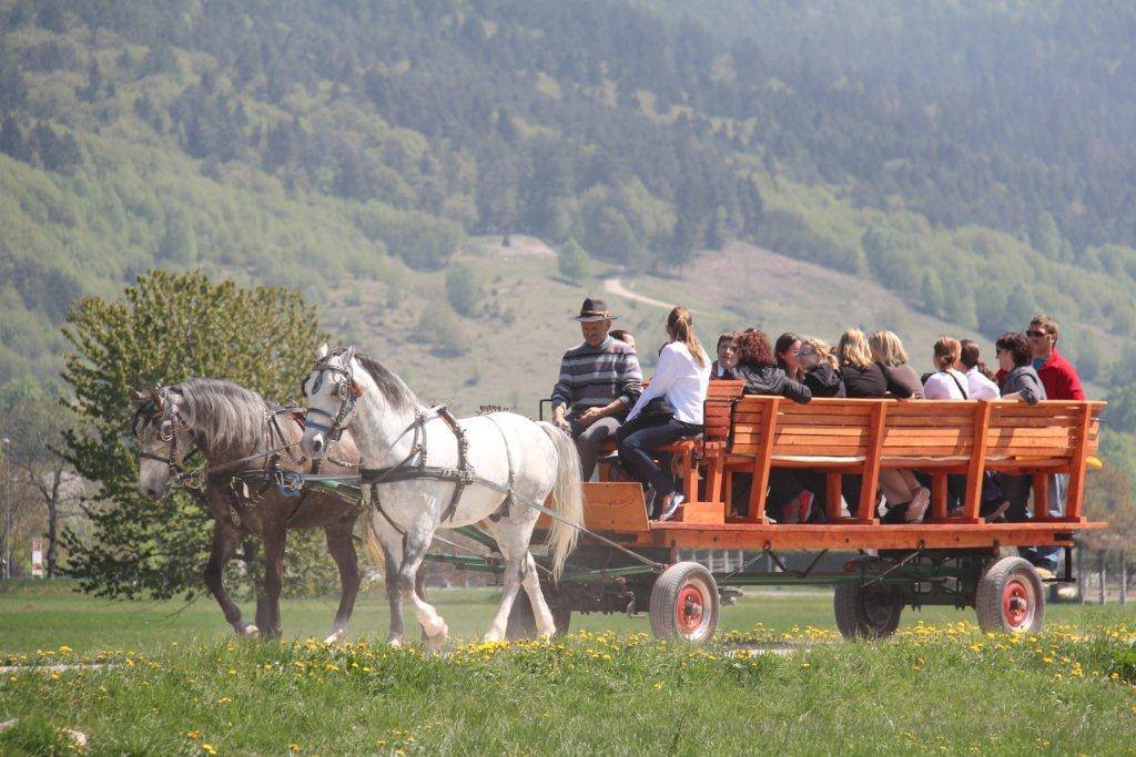
The Begunje Shepherd’s Trail (Pastirska pot) is one of my favourite of all the hiking trails in the Radol’ca area. The sheer variety of the terrain, the stunning views, and the fact that it is entirely circular all add up to one great hike!

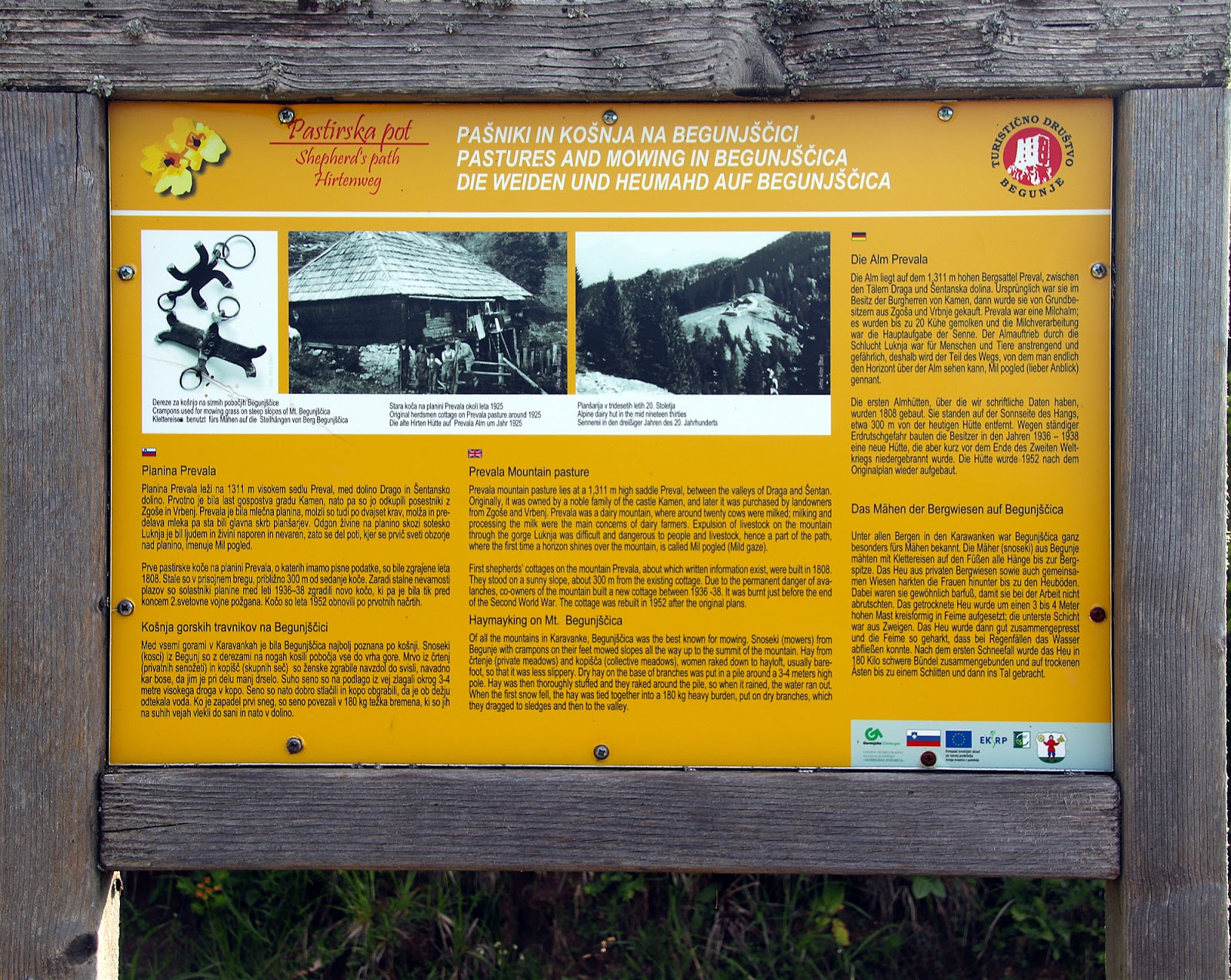
The trail begins at the head of the Draga Valley in Begunje na Gorenjskem, where you can park and set off on foot on the 10.2km trail and where there is an information board showing the route.

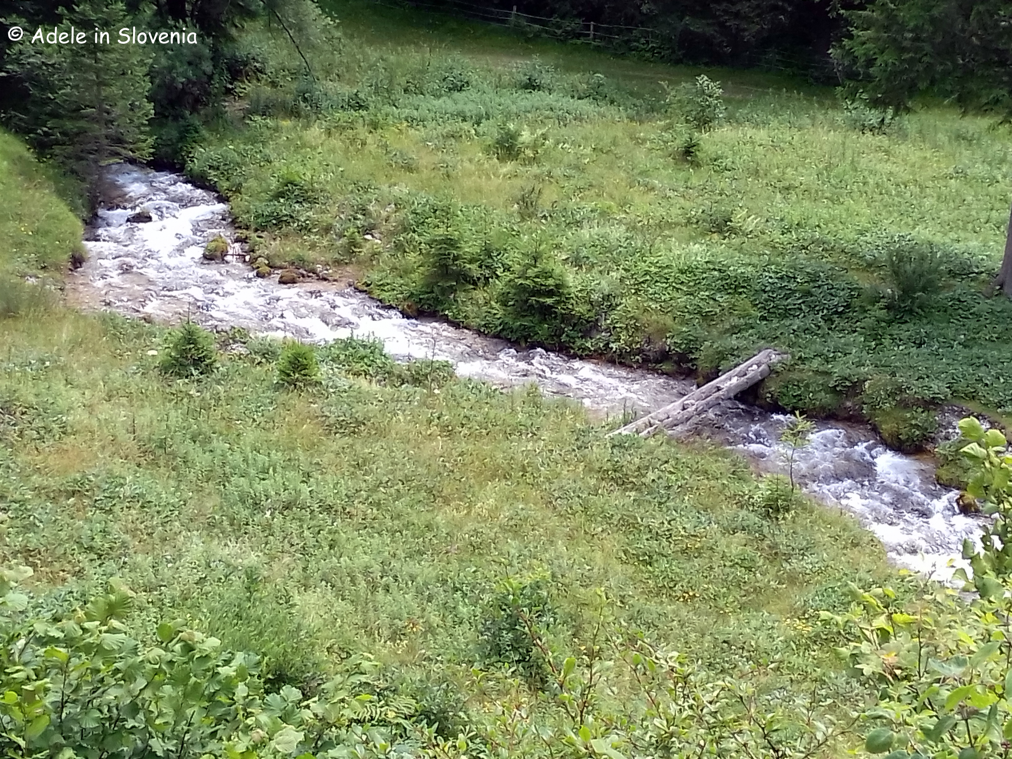
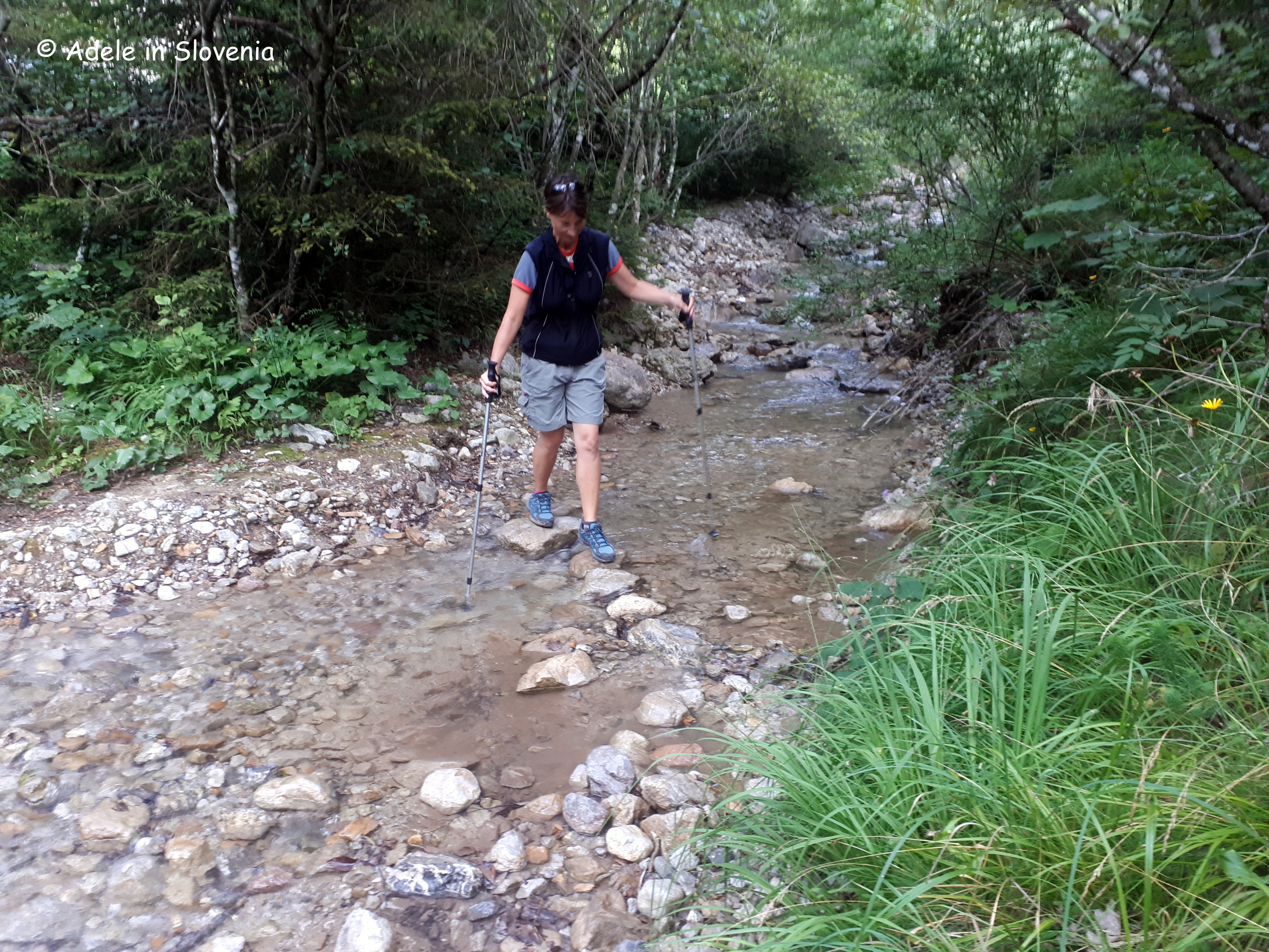
The first mini ‘challenge’ that you encounter after just a few hundred metres, is crossing a stream – not advisable after heavy rainfall! Note: if it is impassable, then follow the road uphill for about 15 minutes to where it branches off steeply through the forest towards the Roblekov dom mountain hut, but continue past the next bend and then take a forest road (unmarked) to the right, which, eventually, meets the path coming up from the head of the valley.

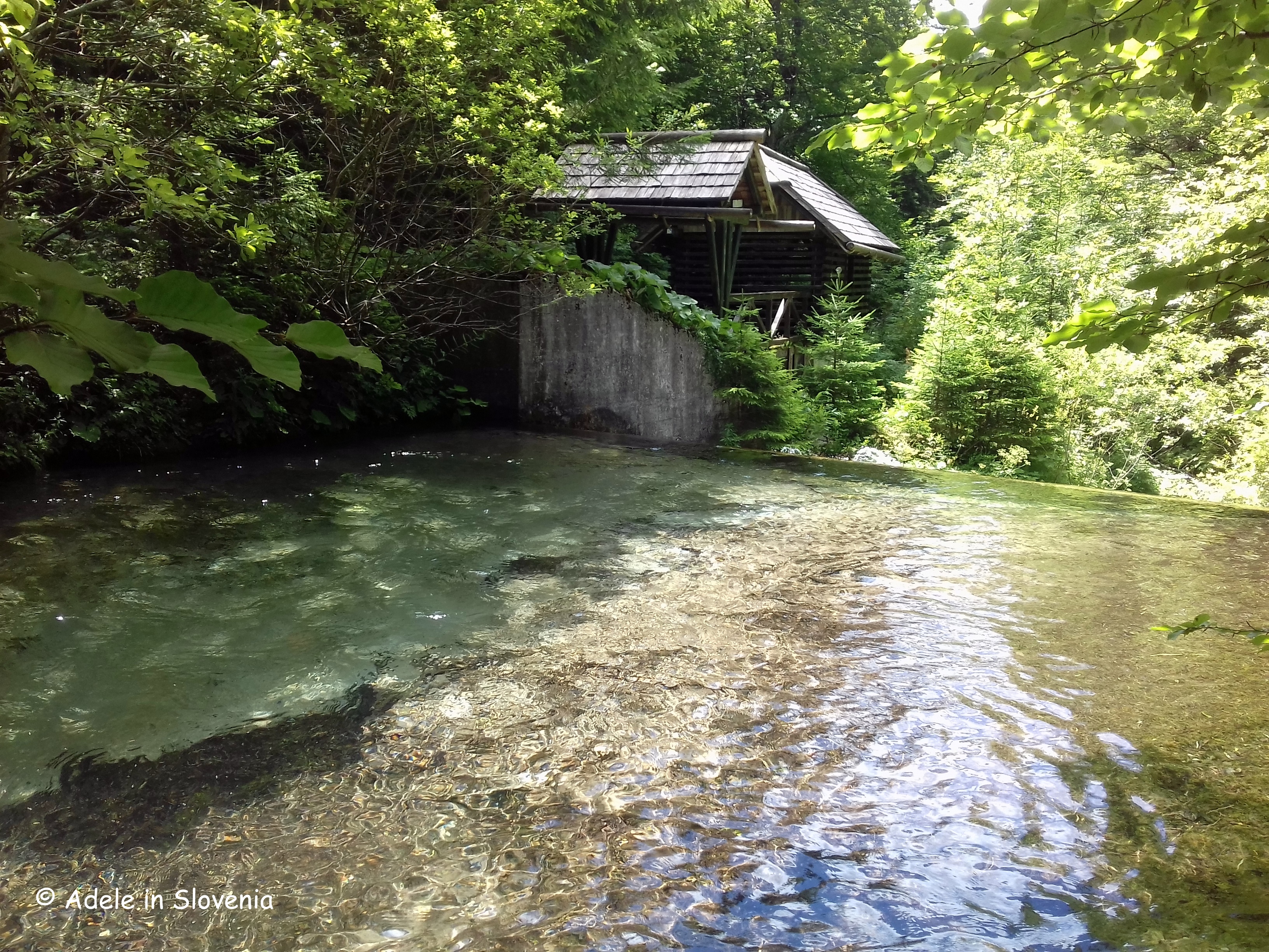
The trail begins to lead up through the forest, passing a cascade of the stream.

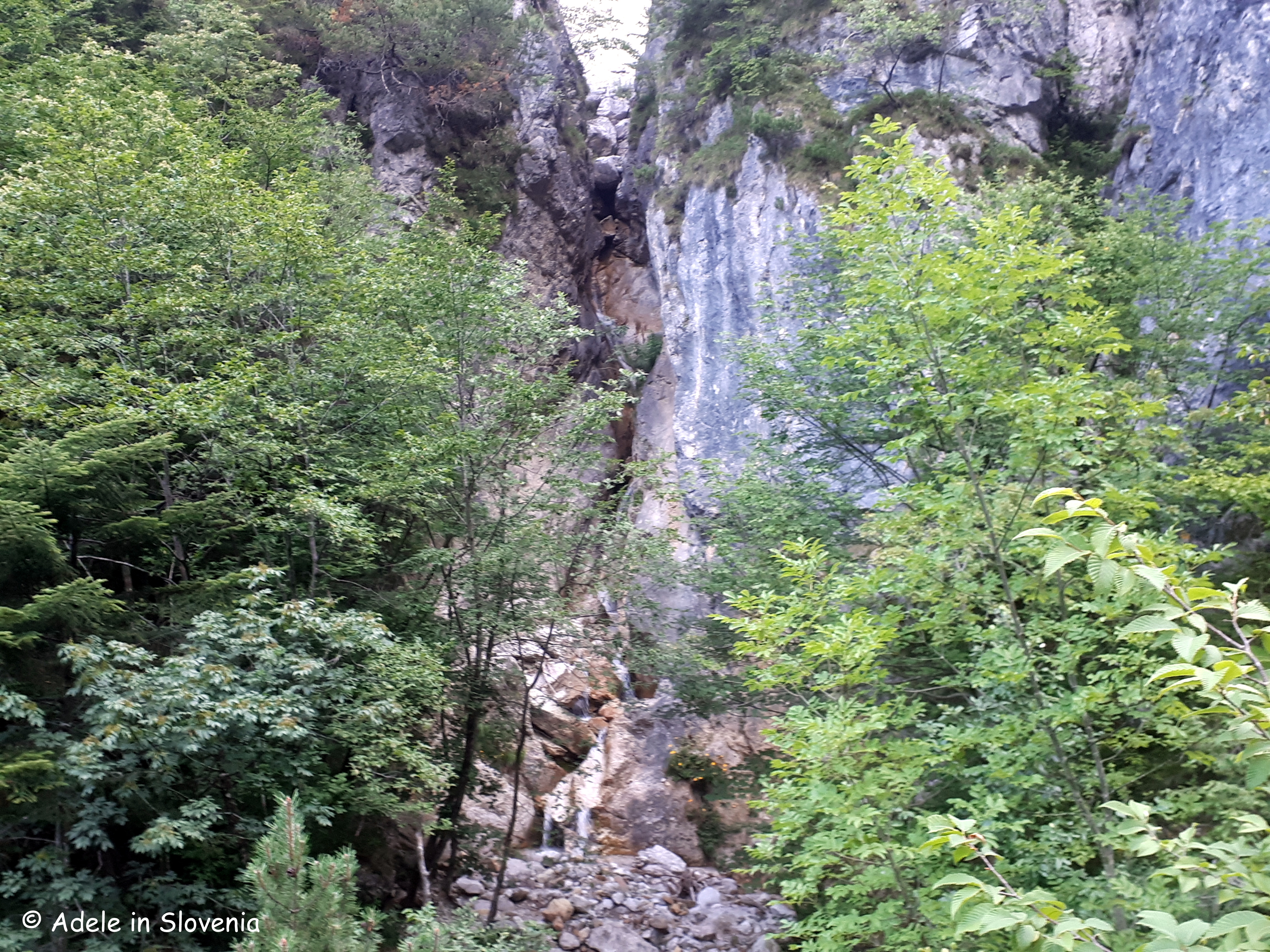
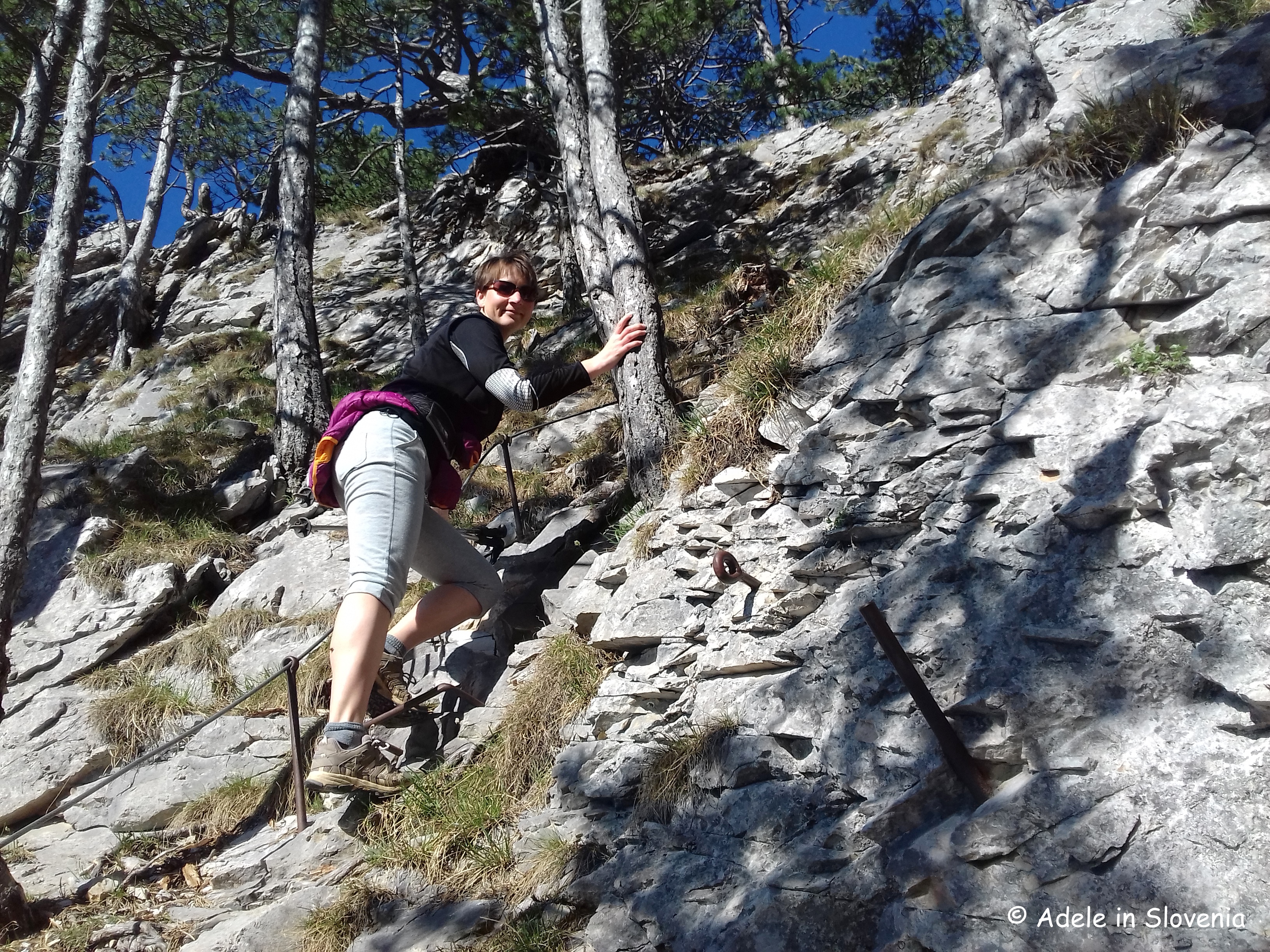
Next comes a slightly bigger ‘challenge’, as the path leads up a steep gully between two rock faces, but there are iron foot rungs and an iron cable to help, so, with a steady hand (and feet!), it doesn’t present a major obstacle.

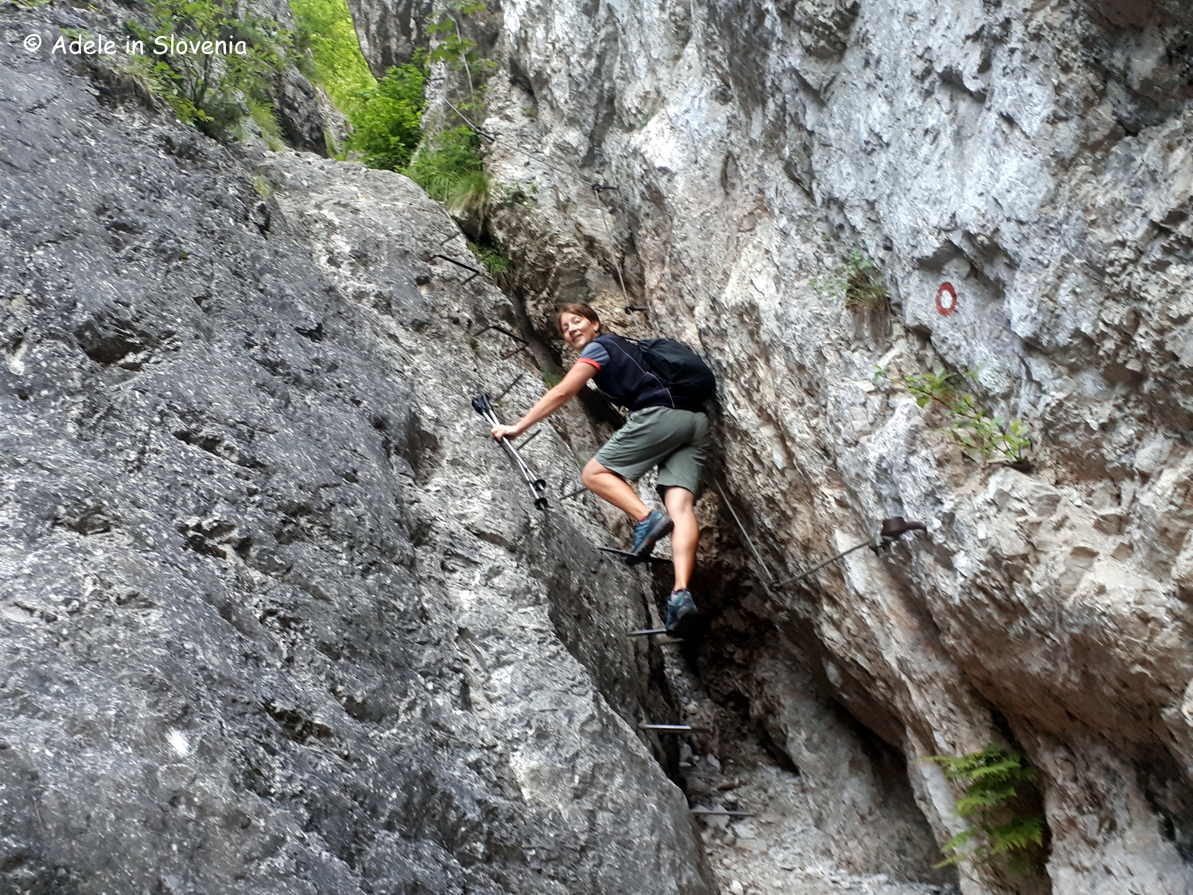
Its only a short climb, and the path soon levels out, well, until the next bit anyway! But that is why I love this path, as there’s never a dull moment, it keeps you on your toes – literally!

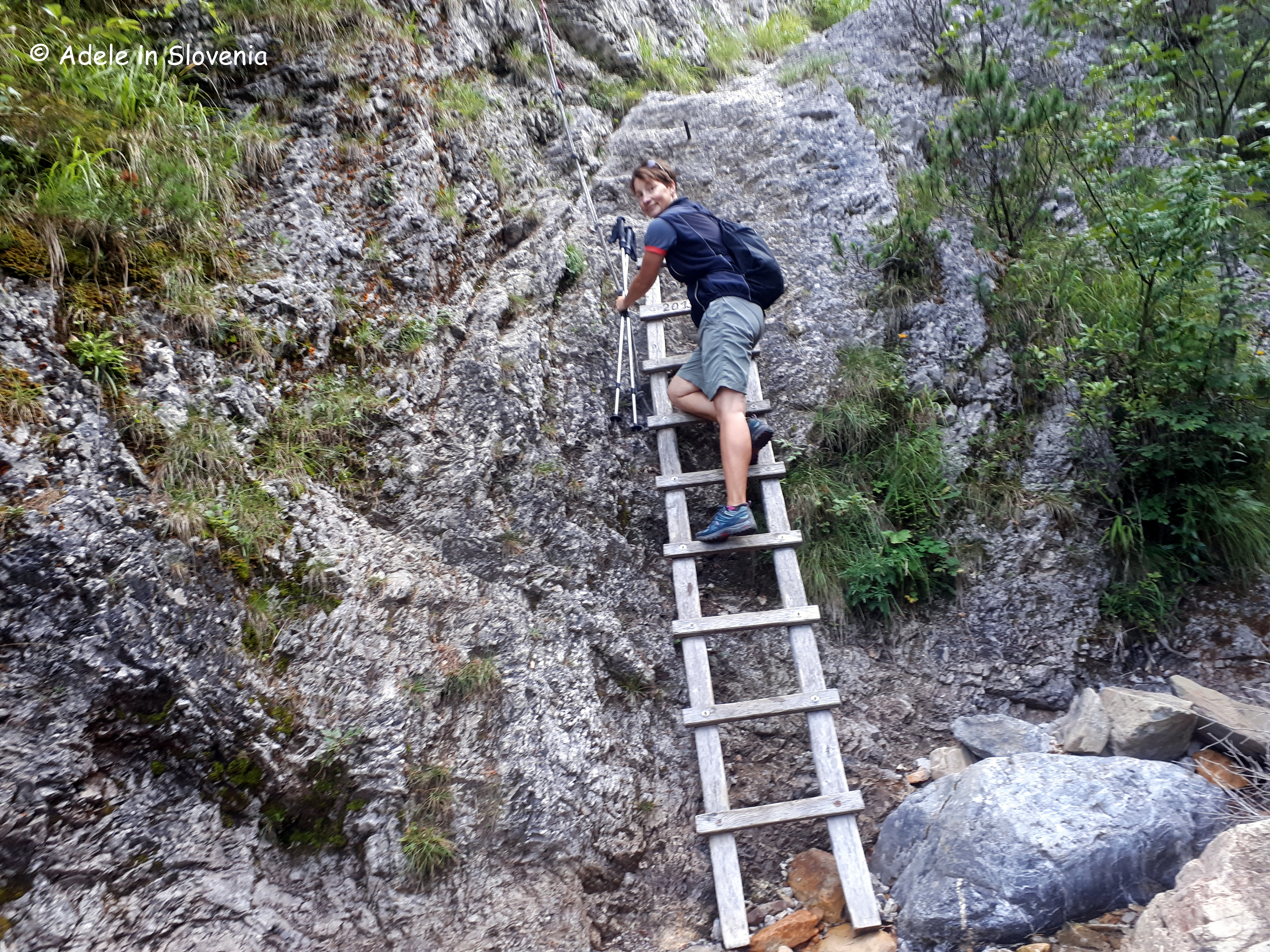
The path crosses the stream in several places, before reaching a ladder, equipped with a rope to hoist yourself up!

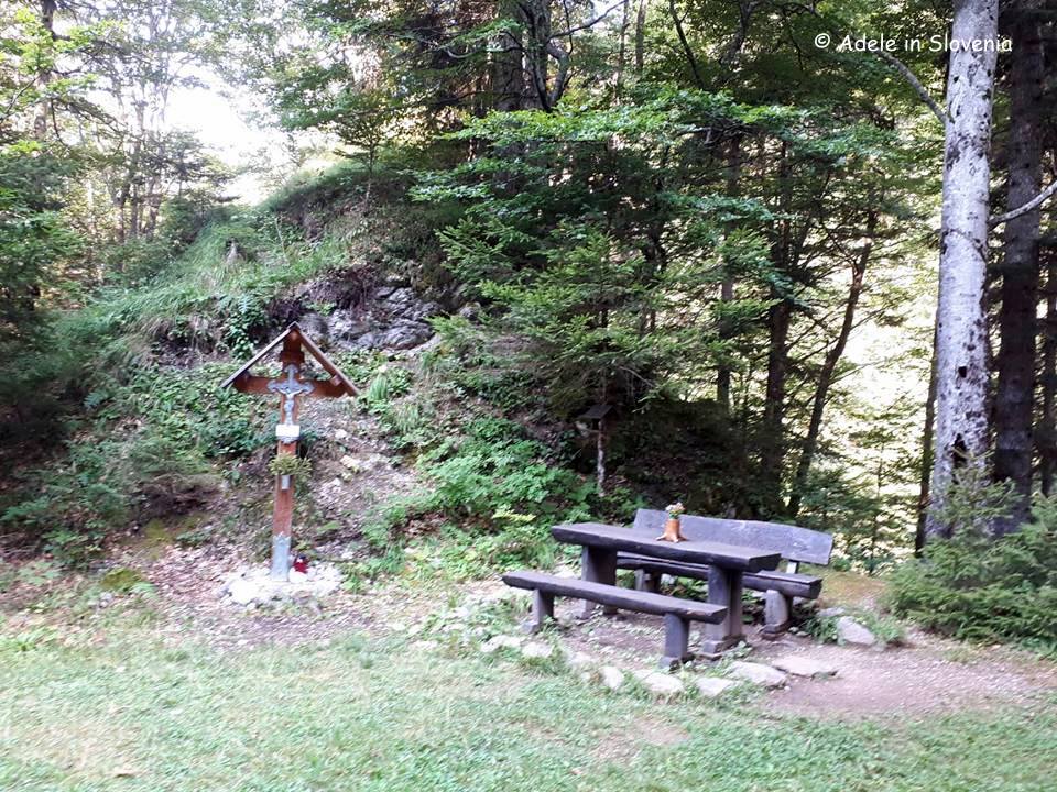
You then cross the stream one last time, before reaching a rest area with a bench, and then continuing up, ever steeper, through the forest.

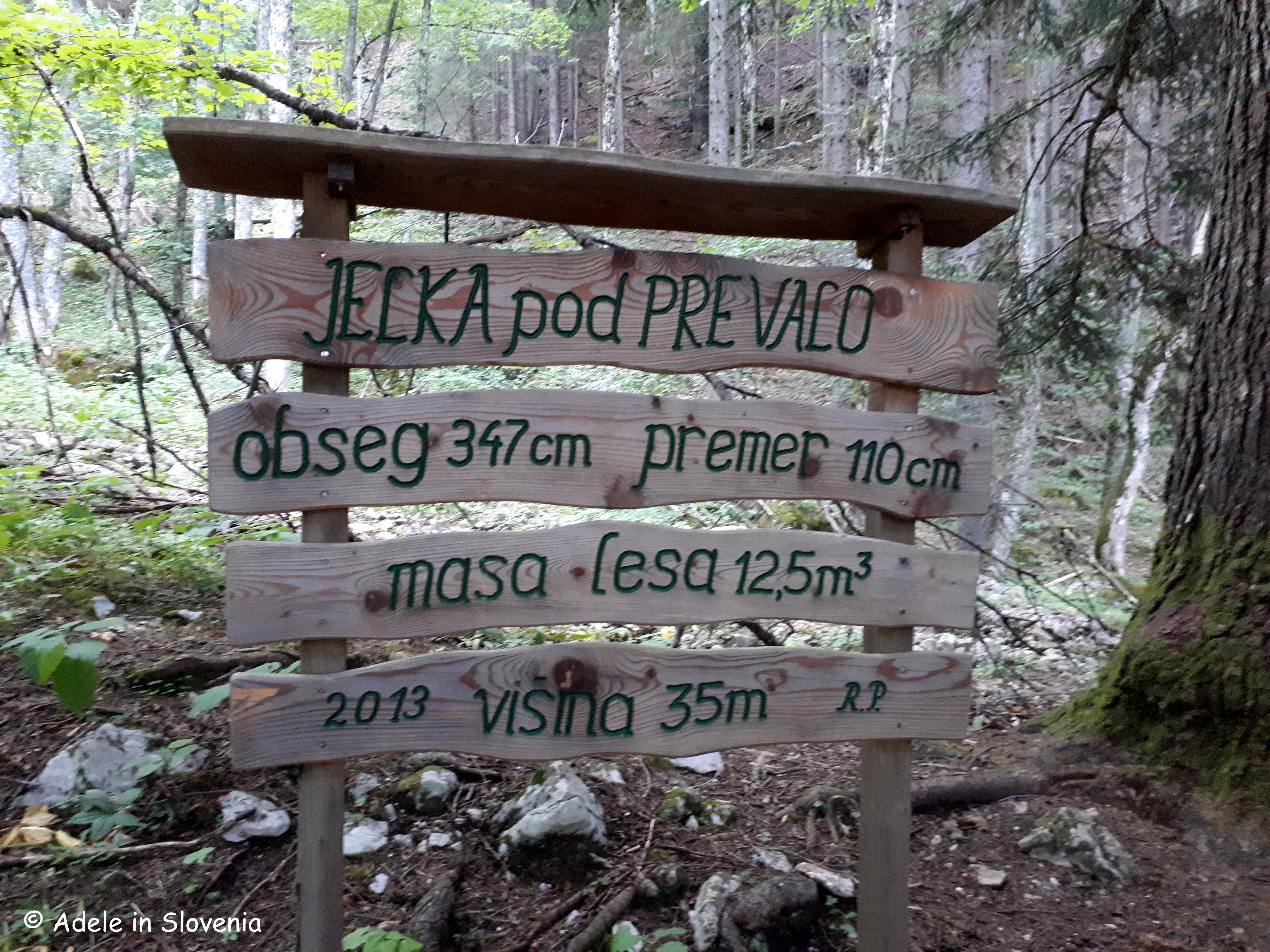
Next you reach a giant fir tree, so giant, in fact, there was no way or being able to photograph it from within the confines of the trail, so you’ll just have to visit and see it for yourself! The statistics on the signpost below give the facts and figures: circumference 347cm, diameter 110cm, quantity of wood 12.5m3, height 35 metres

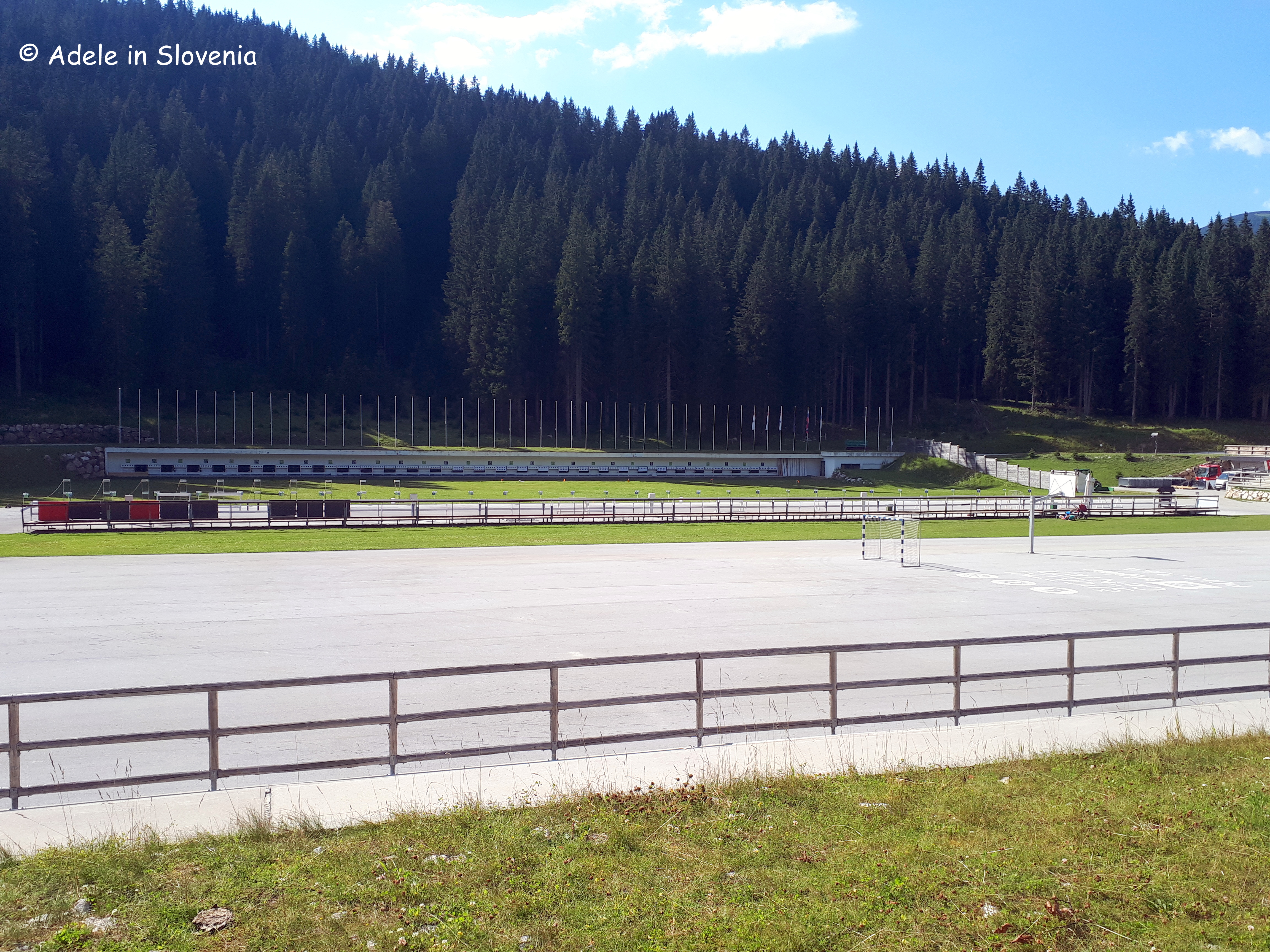
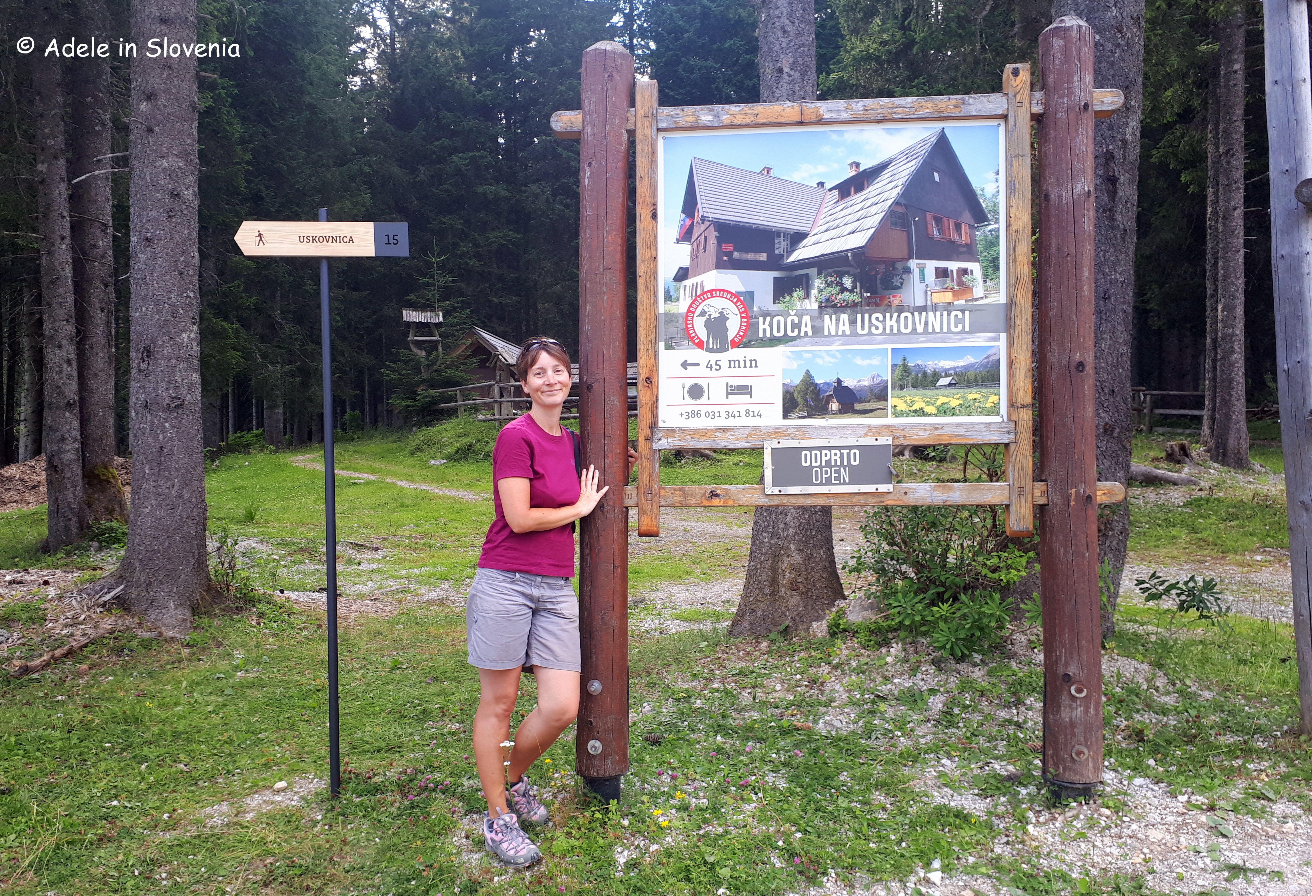
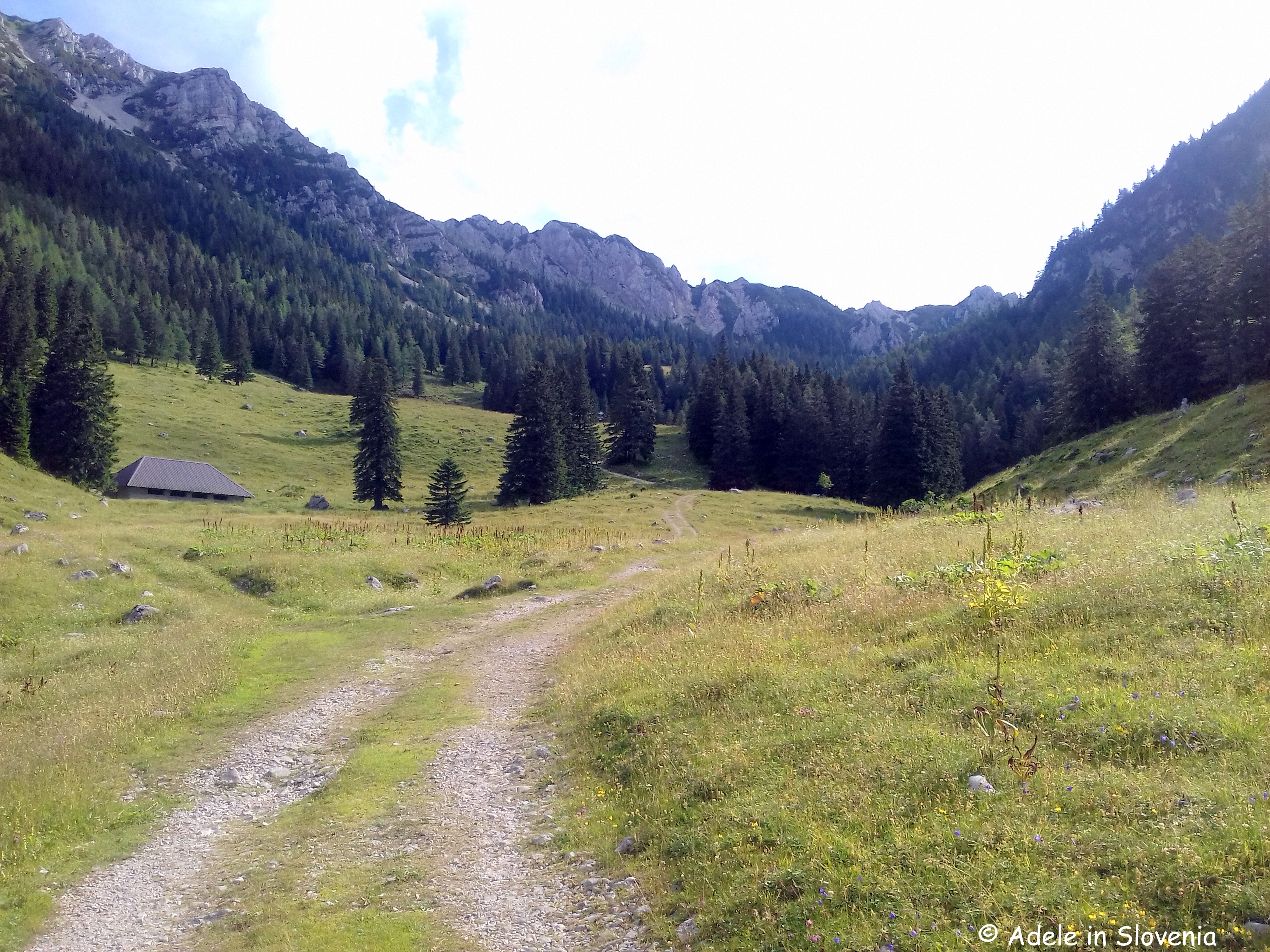
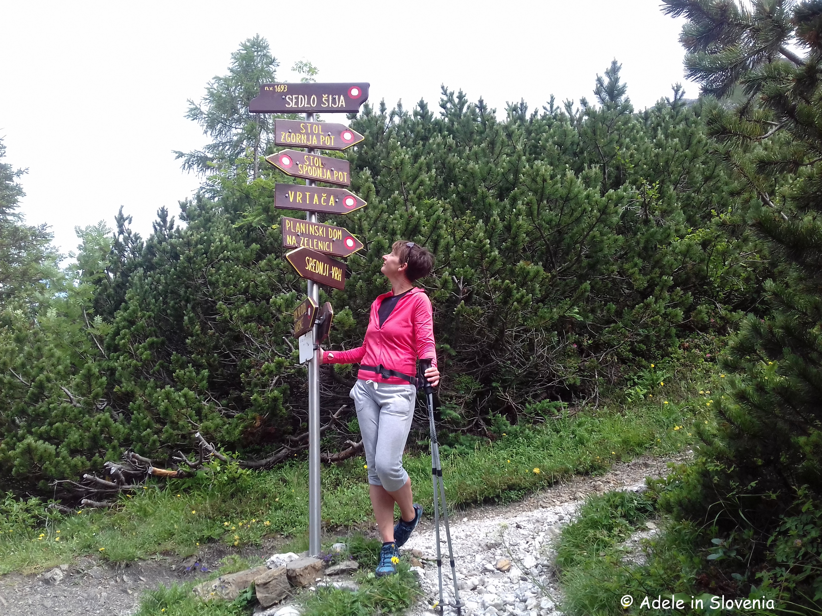
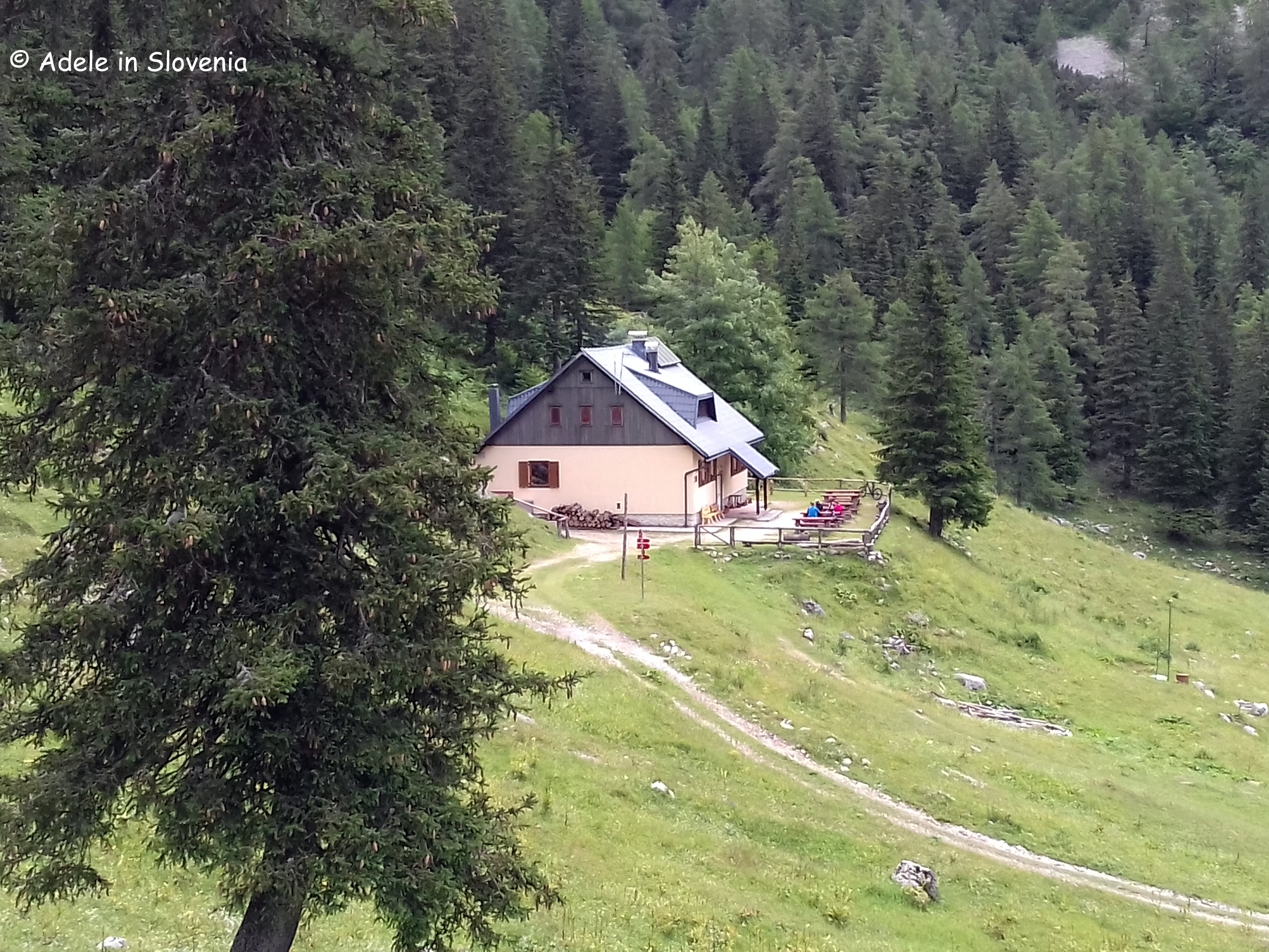
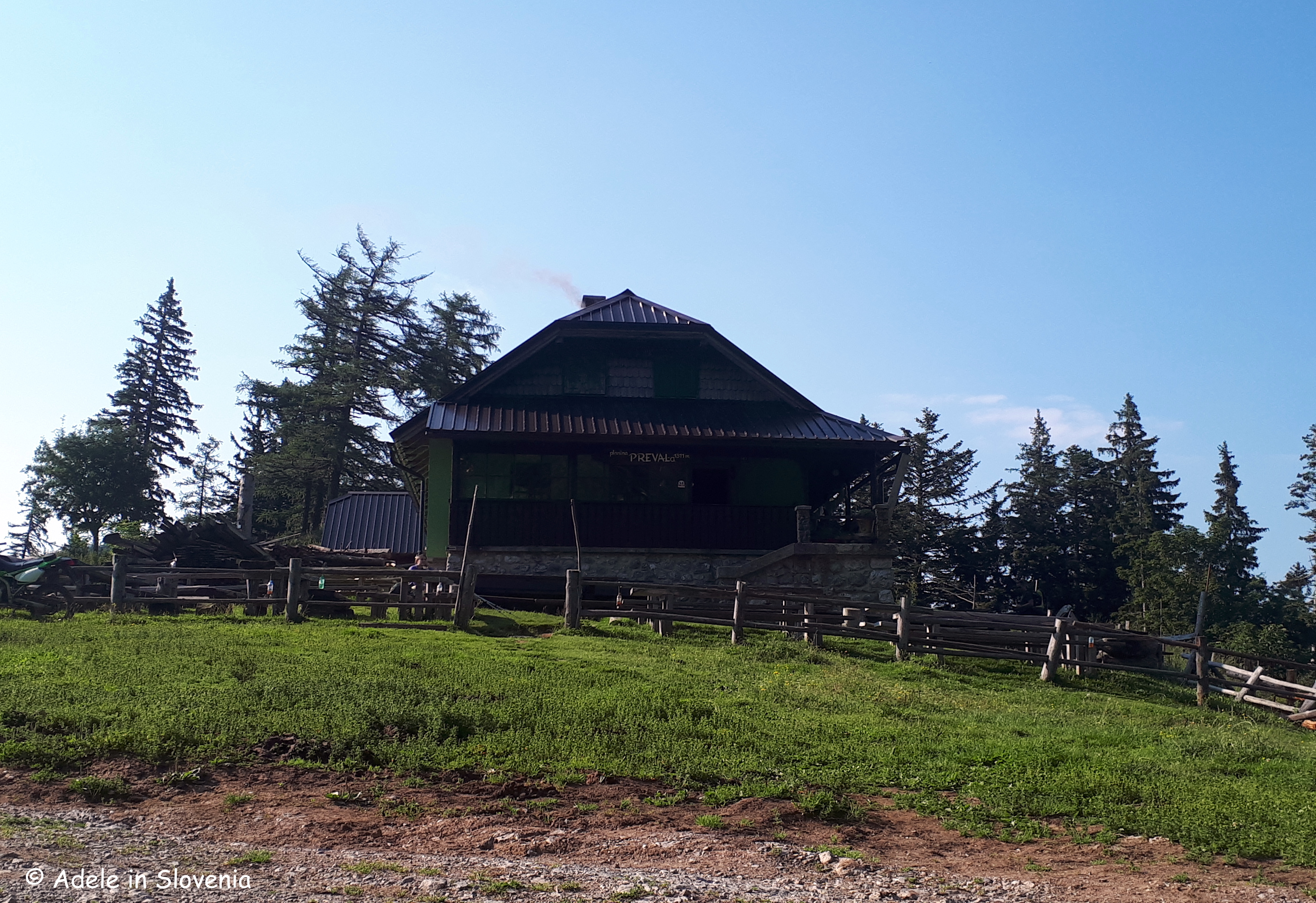
After about an hour to 1hr 15 mins, you reach the Preval mountain pasture and the Koča na Prevalu mountain hut, the first of four (yes, four!) mountain huts that you pass on this trail, where you can stop for refreshments (note: the huts are open daily during summer, but out of season some are closed whilst others open at weekends only) and enjoy the views before continuing on your way.

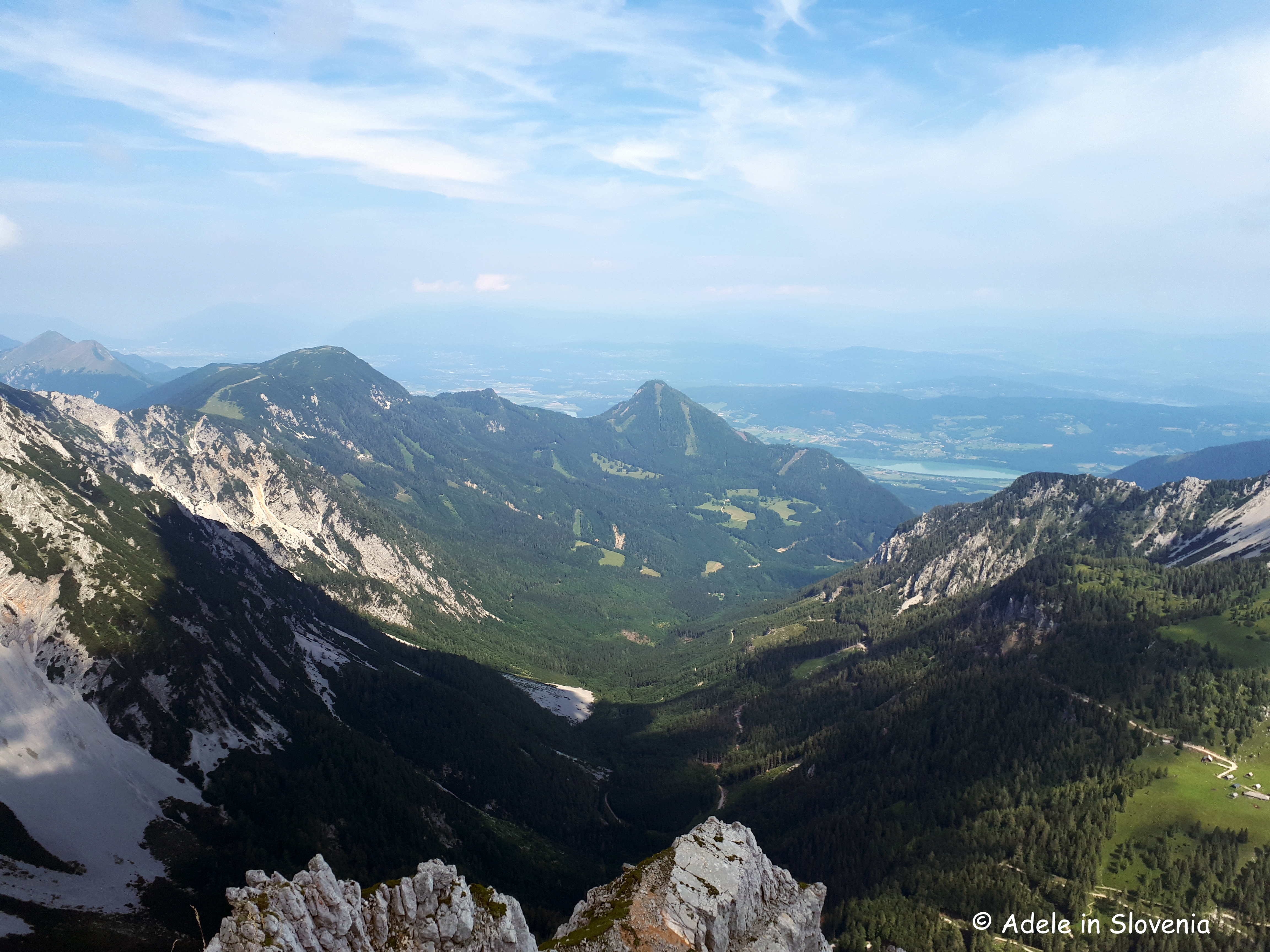
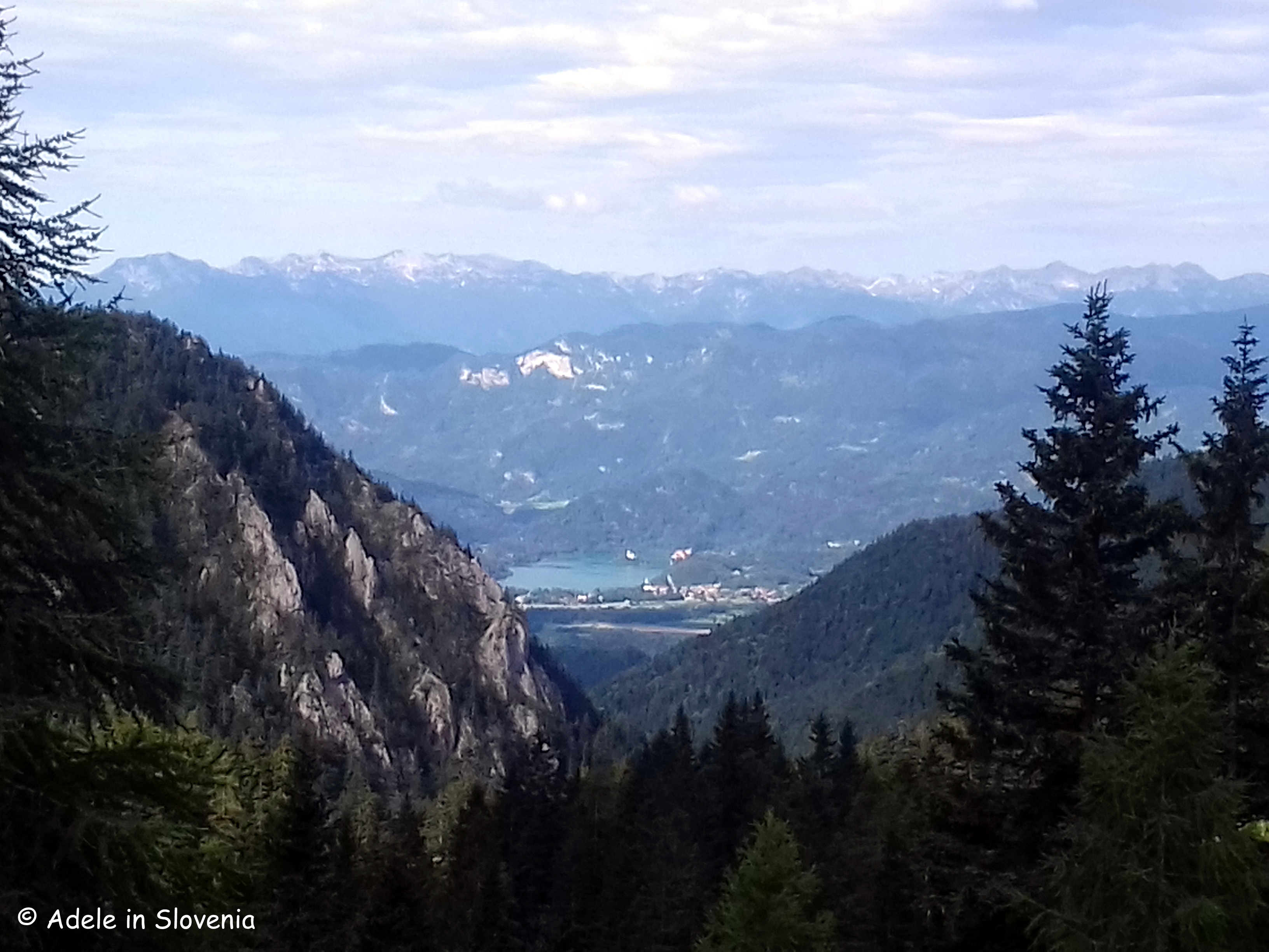
Now follow the road for about 10 minutes, which provides a mini-break from the steep path, before the path branches off to the right and begins to climb up again on the path ‘cez Roza’. But, it’s worth it, as you are soon rewarded with wonderful views of the Radovljica Plains, the Jelovica plateau, Lake Bled, and the Julian Alps.

There are still a couple of mini ‘hurdles’ to overcome, in the form of gullies to be crossed, but here and there, iron rods are provided to assist, and eventually the path levels out to become sheer enjoyment.

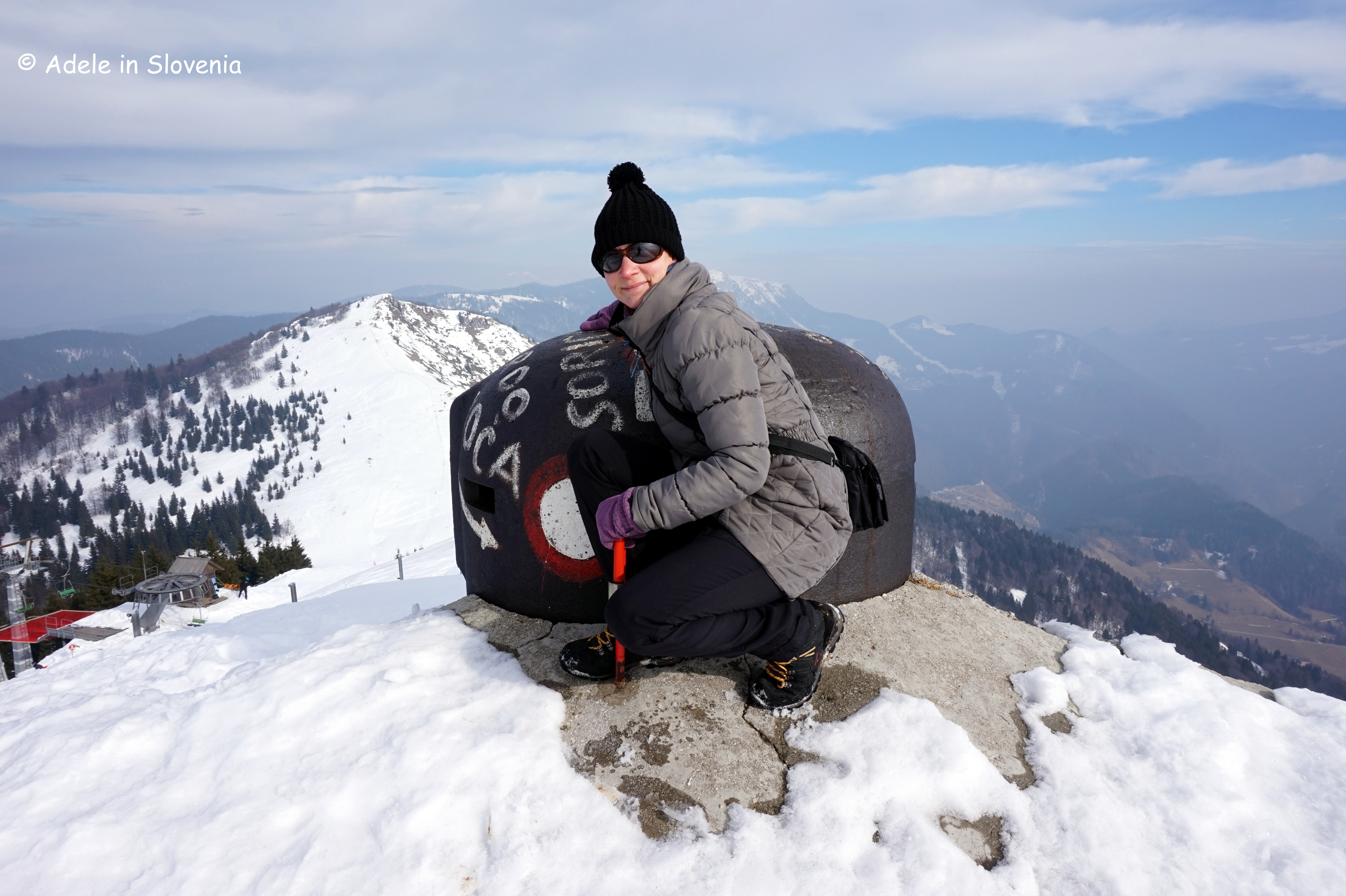
Shortly before the end of the path, you reach an abandoned manganese mine shaft with an information board, and the views open up further across the valley.

Click here for more information about the other themed hiking trails in the Radol’ca, and here for the Radol’ca hiking and biking map.
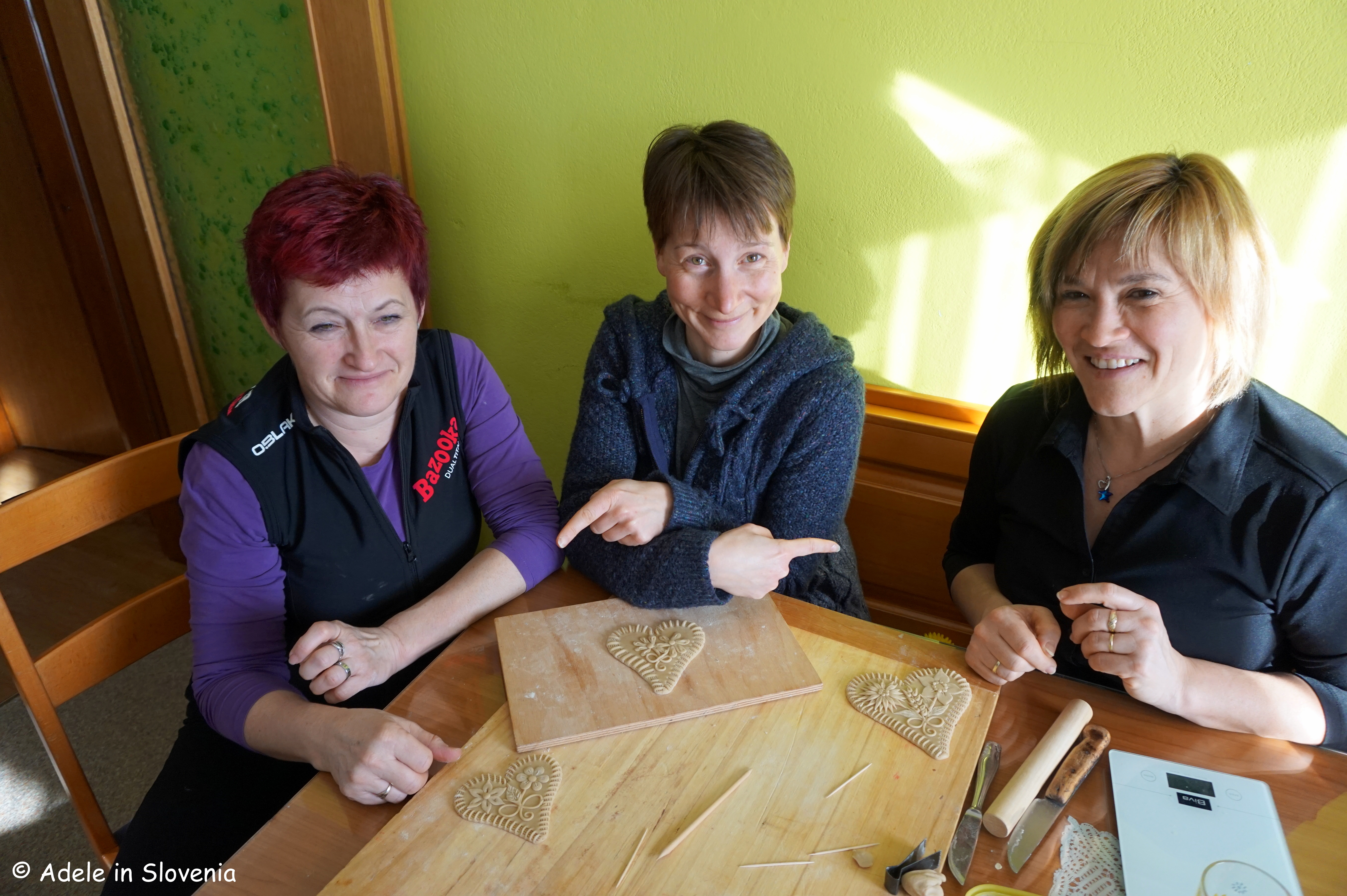
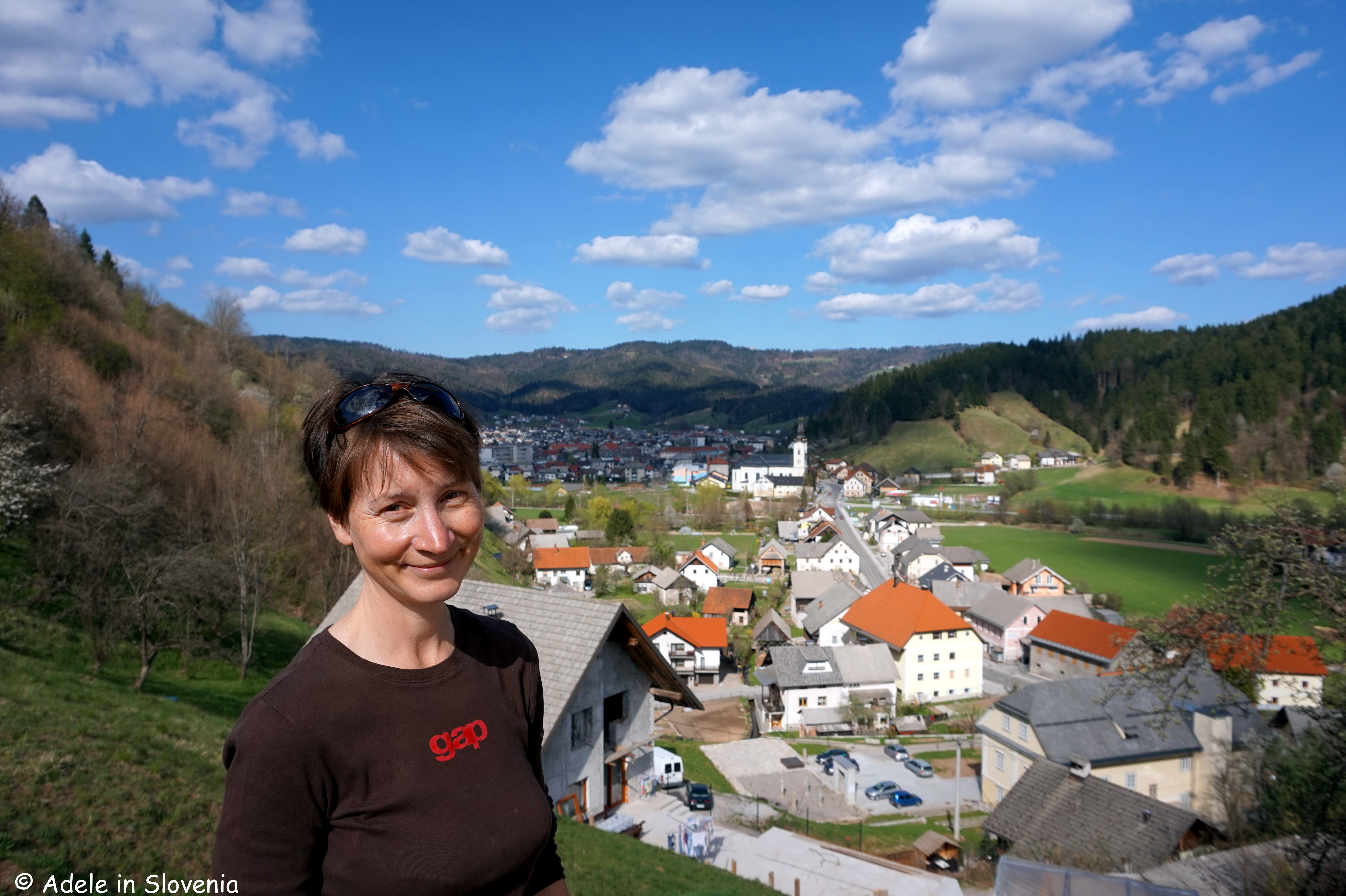
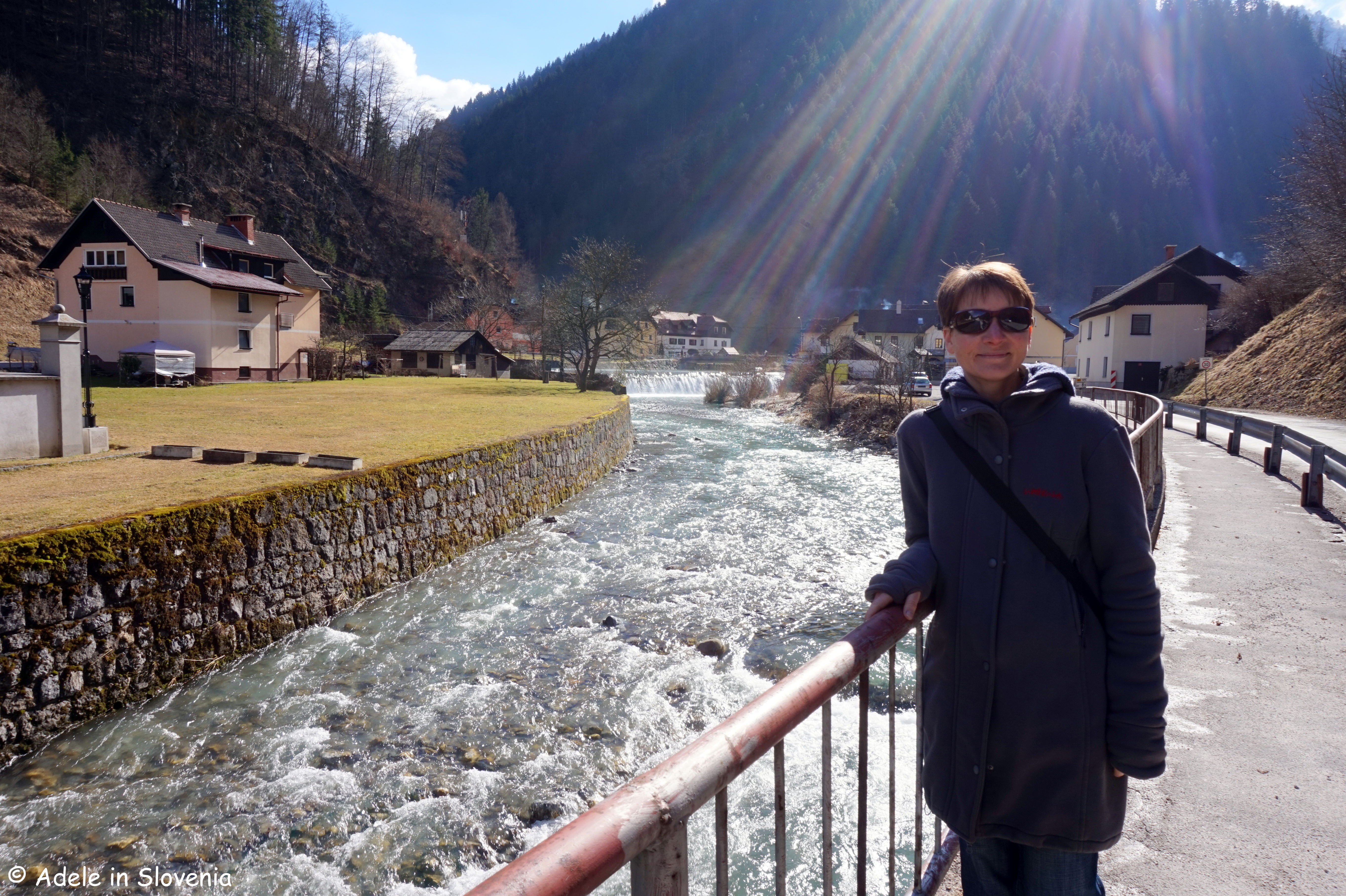
© Adele in Slovenia

Hop-On Hop-Off in Triglav National Park: Bohinj to Pokljuka

Triglav National Park, Slovenia’s only national park, extends over an area of 880km2 and covers almost the entire area of the Julian Alps in Slovenia.

Whilst many visitors to Slovenia, particularly those who visit to hike in the Julian Alps, are familiar with areas such as the ever-popular 7 Triglav Lakes Valley, and Slovenia’s highest mountain, Triglav, another area that is well worth a visit is the oustandingly beautiful Pokljuka Plateau, which during summer you can visit for FREE courtesy of the Hop-On Hop-Off Bohinj to Pokljuka bus.

The Pokljuka plateau is a paradise for lovers of the great outdoors, and offers activities year-round: hiking and cycling in summer, downhill and cross-country skiing, biathlon, snowshoeing and hiking in winter. The forested Karst plateau is around 20km in length and at an elevation of 1,100-1,400 metres.

Since parking charges have this year been introduced for the first time on Pokljuka, taking the Hop-On Hop-Off bus makes even more sense from both a financial and environmental perspective. The FREE bus runs three times per day from the Lower and Upper Bohinj valleys to the Triglav Pokljuka Sports Centre at Rudne polje on Pokljuka. Click here for the timetable.

Since Pokljuka is also a popular destination for cyclists – road cyclists enjoy the challenge of the long road that winds its way up to the plateau from either Bled or Bohinj, whilst mountain bike enthusiasts enjoy the gravel roads that criss-cross the plateau, the buses are also equipped with bike brackets and each bus can accommodate up to six bikes.

Personally, I love hiking on Pokljuka, both in summer and winter, though summer is, and always will be, my favourite time of year! There are walks to suit all levels – from easier, shorter walks to Pokljuka’s many mountain pastures, to more challenging hikes to its peaks.

If you are seeking a walk for all the family, I highly recommend walking from Rudne polje to the picturesque Uskovnica mountain pasture with its numerous small wooden chalets and interesting hummocks.

The route is well-marked and it only takes about 45-50 minutes to reach the pasture and the Koča na Uskovnici mountain hut.

The way there is pretty much all downhill, of course that does mean a bit of uphill on the return trip, but after a stop at the hut for some delicious blueberry strudel or one of the other homemade dishes, you will be raring to go! During summer on Pokljuka you can also buy cheese at one of the working dairies or mountain pastures.

En-route to the pasture you reach an ‘energy field‘, which attracts people from far and wide who come to sit on the various energy points that are believed to be beneficial for various ailments. There is an information board (in Slovene only) giving details of which point is for which ailment and how long should be spent at each point. I must admit to being rather cynical about such things, but if the number of people (and even dogs!) there every time I visit is anything to go by, I’m in the minority! So, why not go and try it out, and let me know the result(s)!

Uskovnica has one of the cutest little wooden chapels around. Here I am with parents on their recent visit!

Those looking for more challenging hikes are spoilt for choice. As you can see below, from Uskovnica, as well as from Rudno polje, there is a wide choice of paths to hike.

Among the most popular are the Zajamniki mountain pasture, Debela peč, the highest point of the Pokljuka plateau at 2,014m, and the peak of Viševnik, 2,050m.

After our walk we returned to the biathlon centre where we enjoyed a(nother!) drink at the hotel, ensuring we timed it right to catch the Hop-On Hop-Off bus back to the valley.

Even when the Hop-On Hop-Off bus ends its run for the season, from wherever you are staying in the Bohinj area you are never more than a 30-45 minutes drive from Pokljuka, and you can visit year-round.

Click here for more information and some interesting facts about Pokljuka.

© Adele in Slovenia

Summit Stol and Take a Seat Atop the Karavanke!

If I crane my neck, I can see Stol, the highest mountain in the Karavanke range, from my desk. Thus, it’s an ever-present feature in my life and, accordingly so, I can’t resist hiking to its top at least a couple of times per year, and yesterday it was time for the first hike to the summit this year!

The word ‘stol’ in Slovenian means ‘chair’, since when viewed from its western side (not the side I can see from here!), its summit forms a kind of ‘back’ for the flatter slightly lower summit which is home to the Prešernova koča mountain hut.

At 2,236 metres, Stol, along with the other mountains in the Karavanke range, forms a natural border between Slovenia and Austria, hence, on a clear day, there are always stunning views to be had in all directions.

Though quite a large percentage of those who hike to the summit of Stol do so by driving the 5km forest road to the Valvasorjev dom mountain hut and from there setting off on foot, I always opt to do the entire hike from the valley, as otherwise it just feels a bit like cheating to me!

After parking at the Završnica reservoir, I set off on the first part of the trail to the Valvasorjev dom hut (cca. 50 mins) from where, as you can see below, there are numerous paths leading in various directions.

Regular readers will know that I have a penchant for circular walks, and this time was no exception! I took the shorter, steeper Žirovniška pot (Žirovnica path) up, and the longer, less steep Zabreška pot (Zabreznica path) down, which is always my preferred route.

If you are feeling somewhat gallant, you might opt to not walk past the pile of logs without putting one in your rucksack or on your shoulder – the staff at the Prešernova koca mountain hut will be very grateful for your assistance in keeping the stove burning! Whether or not I was gallant enough to carry one up or not, I will leave you to decide!

It was somewhat overcast for the majority of the hike up, the story of this ‘summer’, but in actual fact a bit of cloud cover was welcome on the long, steep hike up, and on reaching the top, the clouds majestically began to part to reveal blue skies and warming sunshine, and, for a change, it wasn’t blowing a gale up there, as can so often be the case!

Before the final ascent to the top, the path leads up a steep stony gully, from where there is a real bird’s eye view of the Upper Sava Valley and the Julian Alps in the background. The path is distinct and well-marked throughout.

As you reach the summit, you will notice that the typical red and white Slovenian markers change to red and white with a green outer circle, denoting that the path is on the border with Austria – always a kind of exciting feeling, even after 11 years here!

It took me just over 3hrs 15 minutes to reach the summit. And, as is the tradition, don’t forget to sign the visitors’ book as you take your ‘seat’ at the top of the Karavanke!

Once at the top, among the magnificent sights, you can see Lake Bled on one side, whilst on the other Lake Worthersee in Klagenfurt.

You won’t be alone, since even if there aren’t many other hikers (on Sunday, there were!), there are always some brazen birds that don’t seem in the slightest bit scared of humans as they sit in wait for some tasty tit bits!

After descending from the summit, there was time for a quick bit of sustenance at the Prešernova koca mountain hut, where there is simple, but tasty mountain-type food and refreshments on offer, a(nother) visitors’ book to sign, and then it was time to begin the descent – more about which you can read in my next blog about the myriad of mountain pastures beneath Stol, coming soon…!

Click here for the Visit Žirovnica website where there is more information about this and other hiking trails in the Žirovnica area.

© Adele in Slovenia

Srednji Vrh: Seeking the Sun and a Stream in the Karavanke!

This ‘summer’ – not that it can really be called that thus far – hasn’t been kind to us outdoor types. This time last year we were basking in 35 degrees, whilst a week ago we had temperatures half that, and since the start of June there have only been a couple of days when there hasn’t been rain somewhere in Slovenia.

Thus, trying to find days with clear blue skies for hiking and getting some good snaps for my blog have been few and far between. Fed up with waiting, I just went anyway, and, though not as gloriously sunny as I would have liked, I managed to get in a good hike in the Karavanke mountains to Srednji vrh and the Dom pri izviru Završnice (mountain hut at the source of the Završnica stream) – and even stayed dry too!

Despite the less sunny photos, I hope you, nonetheless, enjoy this glimpse into just one of the many fantastic hikes in the Karavanke mountains in the Žirovnica area. Join me on my trip to see the source of the Završnica stream and Srednji vrh!

I started my hike from the Završnica valley. How far you go by car is a matter of choice – some choose to drive as far as possible along the valley, whilst I prefer to leave the car and set off on foot along the gravel road. You will want to stop and admire the reservoir (seen below on a sunnier day!), but if you have transport, then do continue along the valley further before parking, as its a long walk from here.

From here the road gets much rougher and it’s best to set off on foot. The area, with its many mountain pastures, is also popular for mountain biking.

The road rises gradually to reach the Tinčkova koca hut, which isn’t actually an official mountain hut, rather a private hut, but somehow the name has stuck!

The Dom pri izviru Završnice hut. which was recently renovated and has new beds and furniture, is situated at an altitude of 1425m above the Smokuč mountain pasture (Smokuška planina) and on the backside of the Zelenica ski piste (sadly, no longer operational).

The hut is open from 1st June to 1st October, and at other times at weekends, weather permitting, and by prior arrangement for groups. From the hut there are numerous options for continuing to explore the peaks of the Karavanke including Vrtača, Begunščica and Stol.

I always find the springs of rivers and streams fascinating. Where on earth does all the water come from? At the source of the Završnica stream, there is barely a trickle of water to be seen – and that despite the abundance of snow and rain this year – yet just a little further down the valley, it turns into a gushing stream.

The beauty of hiking in the Karavanke, particularly in the ‘summer’ (ahem!), is the lack of crowds. I hiked for close to 5 hours and only met around a dozen people in that time – bliss for those who really want to get away from it all.

As I like to make my hikes circular, where possible, I continued from the hut up the ski slope before turning left and heading on the slopes beneath Vrtača. In this area there is a lot of loose rock and scree, so you need to keep your wits about you. As you get higher, you are rewarded with a glimpse of Lake Bled in the distance.

Where the path branches off right to ascend the summit of Vrtača, I took the left fork marked for Stol. On reaching a junction I then descend to the Šija saddle, from where there is certainly no lack of choice of where to go next!

I chose the path to Srednji vrh (1796m), which is just a further 15 minute climb from the saddle. At the top there is a visitors’ book, a solitary bench and fab views!

I then descended back down towards the hut, which is less than half-an-hour from the Šija saddle before returning on the same road.

Click here for more information and this and other hikes in the Žirovnica area.

© Adele in Slovenia

Car-Free and Carefree in Bohinj and Triglav National Park

This summer you can take advantage of the new shuttle system in Bohinj, which enables visitors to leave their cars and cares behind and enjoy the beauty of Triglav National Park.

By parking in the one of the designated car parks and taking a bus, not only does it remove the stress of looking for somewhere to park, but it’s more environmentally-friendly and easy on the wallet too – in fact it’s FREE – so what’s not to like?!

I went to try it out for myself last Friday and it really is as easy as pie. So join me on my journey to Bohinj!

First, park your car in the large FREE car park at Camp Danica in Bohinjska Bistrica.

Next, take a FREE ticket from the machine and display it on your dashboard.

Then just hop aboard one of the FREE buses that run every 15 minutes from 9am to 8pm on Fridays, Saturdays, Sundays and public holidays from Camp Danica to Bohinj lake during July and August, and every 30 minutes in June and September.

The buses have various liveries, some easier to spot than others, but all offer the same FREE journey to/from the camp and the lake.

All that is left is to sit back and enjoy the short, scenic ride! You alight the bus just metres from the lake and the Monument to Four Brave Men – which commemorates the first four men who climbed to the summit of Slovenia’s highest mountain, Mount Triglav (2,864m) in 1778.

The rest of the day is yours to enjoy at your leisure, or to be as active as you like in the knowledge that you can easily and quickly get back to your car at day’s end when you have had your fill. Though, does, or can, one ever really have a fill of somewhere so beautiful?!

Walk or hike to your heart’s content, laze by the lake, do water sports in and on the lake, cycle, visit local attractions, soak up the views…

If, however, you are like me, you might like to consider taking a bus one way and walking the other – you get to see more and burn off a few of the calories ingested in ice-cream, too!

Walking on the traffic-free Bohinj Cycle Route from the lake alongside the Sava River back to the bus stop at Camp Danica (or vice versa) takes around 1.5 hours, though allow more as you will want to stop for photos and soak up (more of) the beauty along the way and at the rest areas.

This is just one of this year’s new additions in the Bohinj area. There are also additional car parks as well as buses running from Senožeta to the Blato mountain pasture, a favourite starting place for hikes in the Seven Triglav Lakes Valley, as well as the Hop-On Hop-Off bus to the Pokljuka plateau.

If you are staying in the Bohinj area for at least two nights, you can also avail of the Summer Mobility Card, which provides visitors with free parking, free bus rides and a whole host of other special offers and discounts.

Click here for more about this and what else to see and do in Bohinj, Triglav National Park and the Julian Alps.

© Adele in Slovenia

The Forgotten Village on Ajdna – A Fascinating Archeological Site and a Great Hike Too!

Ajdna is the name of a tooth-shaped peak that lies beneath Mt. Stol, the highest mountain in the Karavanke range. A hike to Ajdna is fascinating, interesting and, if you take the steep way up, also a little challenging – but don’t worry, there’s an easier route up there as well!

The site was first discovered by the field archaeologist Andrej Valič, who climbed to Ajdna with hunters in the 1970s. He identified the remains of an ancient village and archaeological excavations began in 1977. What they uncovered was, or rather is, truly fascinating. Below is an artist’s impression of the village on Ajdna.

Ajdna provided locals with an excellent refuge from the troubles taking place down below in the valley, though one can only imagine what conditions must have been like that led people to flee to somewhere so inaccessible and, particularly in winter one would imagine, inhospitable. Mind you, they certainly found a place of peace and with stunning views!

Ajdna was settled during the crisis times of the collapse of the Western-Roman Empire in 476 AD. Extensive, expensive and exceptionally complex conservation work was carried out and today there are well-preserved buildings and remains of buildings that are thought to date back to the late Antiquity, though some evidence shows that it may even have been inhabited far earlier.

It is estimated that Ajdna was destroyed at the end of the 6th or beginning of the 7th century. The desecration of the church points to the destruction most likely being the result of it being pillaged and set alight by attackers of other religions.

There are several ways to reach Ajdna, depending on which direction you are coming from and also depending on how far you want to walk. I took the path that leads from the reservoir in the Završnica valley. It first follows the path towards the Valvasor mountain hut, where, about 15 minutes before reaching the hut, you turn left onto a gravel road. From here its along the road for approximately 15-20 minutes until the junction with the turn off marked for Ajdna. The path at first goes downhill, through the forest, until reaching the base of the peak. From here there is a choice of the harder, climbing path (15 mins) or the easier path (20 mins). It is well marked throughout.

I chose the harder path up and the easier path down. The path up, though not technically difficult, does require sturdy footwear, a steady hand, concentration and no fear of heights as it leads directly up the rock face – but it is well-equipped with steel cable and rungs. For those not so keen on such ascents, or those with small children, take the slightly longer and easier path to the right. Whichever way you reach Ajdna, you will be richly rewarded for your efforts!

All the information boards at Ajdna are in both Slovenian and English (I should know, I translated them as part of the exhibition catalogue!), so you can read more about the finds and the history of the site.

In addition, to complement a visit to Ajdna, you can visit the Ajdna Museum Room in Čop’s Birth House (Čopova hisa) in Žirovnica, where you can learn more about the site and see exhibits of the many fascinating finds including tools, earthenware, jewellery and weapons.

The house is also the seat of Tourism Žirovnica, thus you can also find out more about what to see and do in the area and/or click here for more information.

© Adele in Slovenia

Visit Žirovnica – Visit Tito’s Village (Titova vas)

Tito’s Village (Titova vas) was a secret World War II partisan camp that was hidden deep in the forest in a remote, hidden and relatively inaccessible location beneath the peak of Smokuški vrh, in the municipality of Žirovnica. The camp had its own newspaper, a choir, butchery and everything needed for everyday life at that time.

For a longer walk, you can start from the reservoir in Žirovnica where there is an information board about the trail to Titova vas and from where it is a pleasant cca. 45 min walk along the valley road which rises gently to the trailhead. If you would prefer a medium-length walk then you can start a little further along the valley at the recreation area by the Zavrh bar, or for a short walk begin at the trailhead itself further along the valley.

Do keep your eyes out for errant kangaroos, though!

From the trailhead it is just approx. 20 mins on foot to reach Tito’s Village.

The camp provided partisans with shelter from the German occupators. Considering its location, in close proximity to German strongholds in nearby Žirovnica, Bled, Koroška Bela, Javornik, Jesenice, Lesce, Radovljica, Brezje, Poljče and Begunje, the existence of the camp from 21 November 1944 – 31 January 1945 – though only 2 months – was considered long for those times.

The well-marked path leads uphill through the forest crossing small bridges and wooden footbridges over a small stream.

One get’s a real sense of how well-hidden the camp was and though today, thanks to the well-arranged trail, it’s a pleasant walk and fun to explore the area. One can only imagine what it must have been like to survive a winter here, although at least a fresh supply of water presumably wasn’t an issue.

On reaching the small camp there is a visitors’ book, information boards (in Slovene only) and a memorial stone.

The walk to Tito’s Village is  interesting, educational and enjoyable, and, combined with the other sights of interest in the Završnica valley, is well worth a visit.

See the Visit Žirovnica website to find out more and this and other hiking trails in the Žirovnica area.

© Adele in Slovenia

Winter Activities in the Završnica Valley

Winter has now really shown its teeth and the recent couple of heavy snowfalls rapidly brought an end to the unusually mild and green January. So, those that love winter, and with it winters sports, are now in their element enjoying all manners of snow-based activities.

As there is also plenty of snow this year in the valley, not just in the mountains, you don’t have to go far from home (or from your holiday home!) to find cross-country skiing trails, sledging tracks and winter walking and hiking trails – all of this, and more, can be found in the Završnica Recreation Park in the Završnica valley.

For lovers of sledging the 5km road that begins near the reservoir in the valley and leads to the Valvasorjev dom mountain hut is a paradise, and this year almost the entire length of the road has been prepared as a sledging track. Of course, you do first have to drag your sledge uphill…

There is also a small sledging track and a 1.5km circular cross-country ski trail opposite the Zavrh bar just a few hundred metres further along the valley from the reservoir. Here you don’t have to drag your sledge too far to enjoy the rewards!

So you can have multiple attempts – however you choose to get down!

If you prefer your winter sports on ‘two legs’, then you can hike the cca. 1 hour path up to the Valvasorjev dom mountain hut – twice the winner of the title of Slovenia’s Best Mountain Hut – where you can be sure of a warm welcome and delicious home-cooked food; soups, stews, strudel etc.

I would, however, advise having a pair of lightweight crampons in your rucksack for the descent, as the lower parts of the path can tend to get very icy at this time of year.

Or you could opt for a shorter, easier walk around the reservoir and along the trim trail to the Zavrh bar.

Once you reach the Zavrh bar, you can cross the bridge, turn left and continue on the right side of the stream, or turn left to follow the trim trail back to the reservoir.

So, don’t delay, get out there and enjoy it today – while the snow lasts!

Click here to find out more about the Završnica Recreation Park (in Slovene only) or here for the Visit Žirovnica website where you can find more information about all the other facilities and attractions in the Žirovnica area.

© Adele in Slovenia


Experience Prešeren’s Day Along the Žirovnica Path of Cultural Heritage

Despite only living to the tender age of 49, the legacy of France Prešeren (1800-1849), Slovenia’s most famous poet, remains as strong today as ever. In fact, Prešeren was, or rather is, so important to Slovenian culture, that a national holiday is dedicated to him annually on 8th FebruaryPrešeren’s Day. 

Find out more about the life and times of Prešeren, as well as that of some of Slovenia’s other great literary writers, along the Walk along the Žirovnica Path of Cultural Heritage.

Although you can visit the attractions along the path year-round, it is a particularly special experience to do so on Prešeren’s Day, when you can join hundreds of others visitors, locals and those from further afield, to walk the path, find out more about life in Prešeren’s time, and feel a part of Slovenia’s cultural heritage.

The 10km circular path leads through the villages beneath Mt. Stol – the highest peak in the Karavanke range – taking in Prešeren’s birth house in the village of Vrba, where there is a car park and information board about the path.

Opposite the car park there is a bust statue of the great man.

In addition to visiting Prešeren’s birth house, you can continue to the birth houses of Prešeren’s friend, the linguist and literary historian Matija Čop in Žirovnica, the writer Fran Saleški Finžgar in Doslovče, and the writer and priest Janez Jalen in Rodine. All the houses offer a unique insight into life in bygone days and you can see exhibits including an original black kitchen.

For many a particular highlight is a visit to the apiary of Slovenia’s greatest beekeeper and the pioneer of modern apiculture, Anton Janša (1734-1773)in Breznica. It’s easy to find, just follow the brown signs marked with a bee!

The apiary was carefully reconstructed in 2017 and this year will be the focal point of this year’s first ever World Bee Day, which will take place in Breznica on 20th May.

At the time of writing, there’s no snow here in the valley, but that could, of course, change by 8th February! Either way, there’s never a shortage of people joining the walk on 8th February, and there is also a rich accompanying programme on the day for all – regardless of whether you take part in the organised walk or not. It includes free entrance to all the birth houses, stalls along the way offering local food and drink, a honey market in Vrba and small farmer’s market in Rodine, entrance to exhibitions, and more! Find the full programme here (in Slovene only) – http://visitzirovnica.si/pohod-po-poti-kulturne-dediscine-zirovnica-8-februar/

But don’t worry – if you can’t make it on 8th February, you can visit the birth houses and walk, all or some of, the trail independently or, to get the most out of it, on a guided tour. The best time to do so is every fourth Saturday in the month from March to October when guided visits to all four houses are available between 10am and 5pm. For a really special experience on this day you can visit the houses by taking a ride on a traditional horse and cart which begins at the car park in Vrba at set times.

The Visit Zirovnica website has more information about this and all the other attractions in the area.

Come and find out more about why France Prešeren is Slovenia’s equivalent to Shakespeare!

© Adele in Slovenia

Highlights of My Škofja Loka Year 2017

As 2017 draws to a close, so does another chapter in my exploration of another area of Slovenia – Škofja Loka, which I have explored the length and breadth of during the past year. As is customary for many at time of year, it’s a time for reflection on what we have achieved, and time to look forward to the next year and the challenges ahead.

So, here’s a look back at just some of the highlights of my adventures in 2017 exploring Škofja Loka and the Selca and Poljane valleys, which I hope will also serve as inspiration for those of you planning a visit to the area in the future.

I began, as every visitor to Škofja Loka should, with a visit to the old town and a walk up to the beautiful Loka Castle.

I tried my hand at making Loka honey breads at the DUO Arts & Crafts Centre under the watchful guise of the master carver Petra Plestenjak Podlogar – https://adeleinslovenia.com/2017/01/13/loka-honey-breads-and-handicrafts-at-the-duo-arts-crafts-centre/

One of the main events of the year in Škofja Loka is the Festival of History (Historial), which takes place annually in June – https://adeleinslovenia.com/2017/06/25/highlights-of-the-skofja-loka-historial-2017/

I had the honour of being shown around the Capuchin monastery by 80-year-old Father Bernard as part of my discovery of the UNESCO-listed Skofja Loka Passion Play – https://adeleinslovenia.com/2017/04/04/the-unesco-listed-skofja-loka-passion-play/

Photo: Tomaž Sedej

And I thoroughly enjoyed getting active, such as cycling around the town on part of the Loka Cycle Trail with a great guide, Matej Hartman – https://adeleinslovenia.com/2017/06/11/active-and-historic-loka-the-skofja-loka-cycle-trail/

Then it was time to start exploring further into the area’s two valleys – the Poljane valley (Poljanska dolina) and the Selca valley (Selska dolina).

I had a snowy adventure at the Soriška planina ski resort and explored Sorica – one of Slovenia’s most picturesque mountain villages  – https://adeleinslovenia.com/2017/02/20/sorica-super-skiing-and-slovenias-most-beautiful-mountain-village/

Showed off my creative side (ahem!) making Dražgoše honey breads in the sunny hilltop village of Dražgoše – https://adeleinslovenia.com/2017/03/07/delightful-drazgose-the-home-of-drazgose-honey-breads-and-serious-sunshine/

I was won-over by scenic, tranquil Žiri, known for its bobbin lacemaking and shoemaking traditions as well as its unspoilt nature – https://adeleinslovenia.com/2017/04/17/discovering-the-most-ziri-things/

As well as by Železniki, known for it’s iron-forging and bobbin lacemaking traditions – https://adeleinslovenia.com/2017/07/09/zelezniki-a-step-back-in-time-and-tradition-lacemaking-days/

And I hiked some of the area’s peaks such as Blegoš – https://adeleinslovenia.com/2017/07/23/hike-blegos-and-dine-at-pr-andrejon-a-winning-combination/

Explored (some of) the bunkers of the Rupnik Line on my ‘Recce of the Rupnik Line’ – https://adeleinslovenia.com/2017/08/06/a-recce-of-the-rupnik-line/

Too numerous are the highlights to include them all here, but they are all there on my blog, and will remain so, for those interested in finding out (even) more about the area.

2018 will bring a new chapter in the Adele in Slovenia story, a new destination to be explored in-depth, albeit one I am already very familiar with, but one I can’t wait to get even more familiar with! Watch this space for more details very soon, and I hope you will continue to join my own my journey.

Happy New Year!

© Adele in Slovenia